'Stay home': Brevard prepares as Hurricane Ian's rainfall, flooding and winds approach
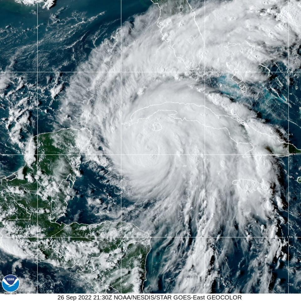
With Hurricane Ian forecast to dump up to a foot of precipitation in some areas of waterlogged Brevard County, officials warn of flooding dangers exacerbated by saturated soils from heavy recent rainfall.
“Last week, we had those torrential downpours — and our streets didn’t handle that volume very well. The roads were flooded," Cocoa Beach Mayor Ben Malik said during a Tuesday morning special meeting sparked by Ian's looming threats.
"The PD had to get a car out on A1A that was submerged," Malik said.
"So just stay home. Do everybody a favor, and don’t get yourself in a situation where you’re going to get your vehicle underwater," he said.
More: Hurricane Ian sandbags: Where to get them across the Space Coast as the storm approaches
More: Hurricane threat from Ian prompts preparations for flooding, power outages in Brevard
The National Weather Service has declared a flood watch for all of East-Central Florida, including Brevard, until 2 a.m. Friday.
Ian may dump 5 to 10 inches of rainfall across the Space Coast, with some neighborhoods reaching up to 12 inches — and heavier amounts possible in northern Brevard, said Derrick Weitlich, a meteorologist at the NWS Melbourne station.
"What we're looking at right now is the potential for flooding rainfall. As Ian makes landfall, it's expected to slow down. So it's going to be with us for a while as we get through mid- to late week, as Ian continues to move across the state," Weitlich said Tuesday morning.
"Don't focus too much on the center of those track positions," he said, referring to Ian's forecast cone of uncertainty.
Ian's deluge could generate extensive street flooding in Brevard, the NWS flood watch summary warns.
"Heavy rainfall may produce flooding along creeks and rivers and in urban, poor drainage and low-lying areas, especially in locations that have recently experienced higher rainfall totals," the summary said.
In addition, a tropical storm warning was declared for Brevard at 5:30 a.m. Tuesday. This means tropical storm-force winds were expected within the county within the next 36 hours.
Tropical-storm-force winds range from 39 to 73 mph. Hurricane-force winds range from 74 mph upward.
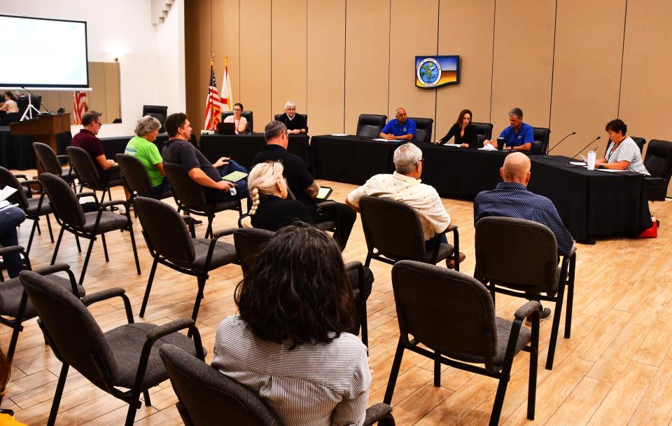
Tuesday morning, the Cocoa Beach City Commission declared a state of emergency ahead of Ian's arrival, citing "the potential for damage to public buildings, public communications systems, public streets and roads, public drainage systems, and to commercial and residential buildings city-wide."
“It is turning to the right, to the (east). So every millimeter it goes, it’s a little more energy this way," Fire Chief Ryan Duckworth said of Ian's path.
Cocoa Beach municipal officials have prepared for Ian by fueling portable generators and fleet vehicles, checking and cleaning utility lift stations, organizing chainsaws and front-end loaders, and stocking up on supplies for firefighters and police officers.
Police Chief Scott Rosenfeld said he would decide Tuesday whether to activate his entire department on rotating 12-hour shifts during Ian. This will be the first major storm to structurally test the city's new three-story police headquarters on South Orlando Avenue, which was dedicated in December.
“The most important thing is, if we do move to where it’s an evacuation and we get into the heart of the storm, police and fire don’t respond. So we say that over and over: We’re hunkering down just like you are," he said.
"So when you get reckless and careless, you put the public safety at risk," he said.
Rick Neale is the South Brevard Watchdog Reporter at FLORIDA TODAY (for more of his stories, click here.) Contact Neale at 321-242-3638 or rneale@floridatoday.com. Twitter: @RickNeale1
Support local journalism. Subscribe today.
This article originally appeared on Florida Today: 'Stay home': Brevard braces for Hurricane Ian's rainfall, flooding, winds

