When will the storm end? What Southern California residents need to know
Southern California residents are going to have to get used to the rain for now, weather officials say.
Many parts of Los Angeles County have seen more than ten inches of rain since the atmospheric river storm arrived on Sunday, including Topanga (10.80 inches); Stunt Ranch (10.75 inches); Bel Air (10.59 inches); Sepulveda Canyon at Mulholland Drive (10.45 inches) and Woodland Hills (10.40 inches)
Live updates: ‘Worst’ of the storm moves into Southern California
Up to 14 inches of rain could fall in mountain and foothill communities by the time the storm is over, the National Weather Service said.
Evacuation warnings and orders are in place throughout SoCal, and a state of emergency has been declared for eight counties from Santa Barbara to San Diego.
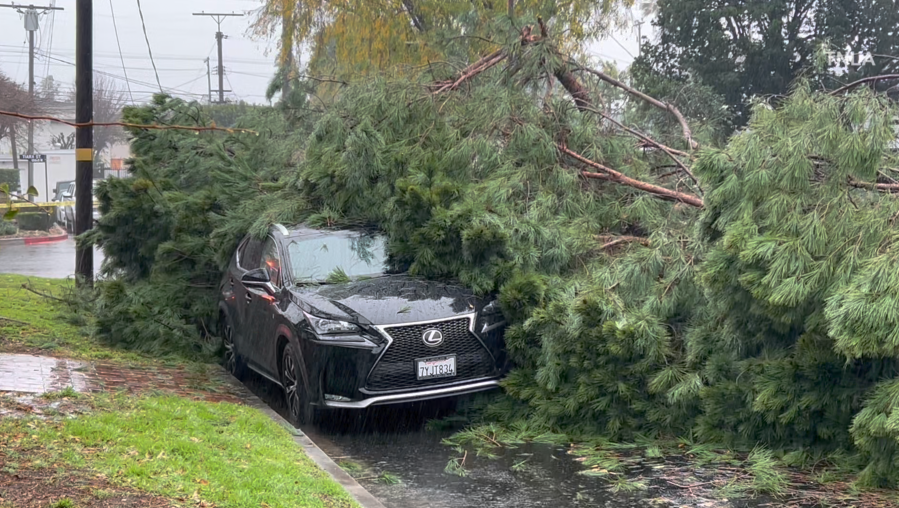
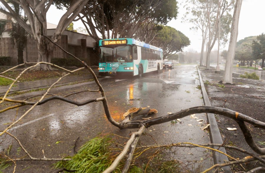
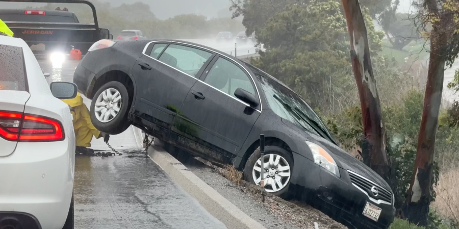
The storm has sent trees crashing onto power lines and cars in addition to triggering life-threatening landslides and flash flooding.
As of Monday morning, SoCal – particularly L.A. and Orange counties – had not “even come close to seeing the worst of the storm,” according to KTLA 5 meteorologist Henry DiCarlo.
“[Rain] is just funneling in through parts of L.A. and Orange counties,” DiCarlo said. “These are the areas that will see the highest rainfall totals…and see the most risk for flooding and issues.”
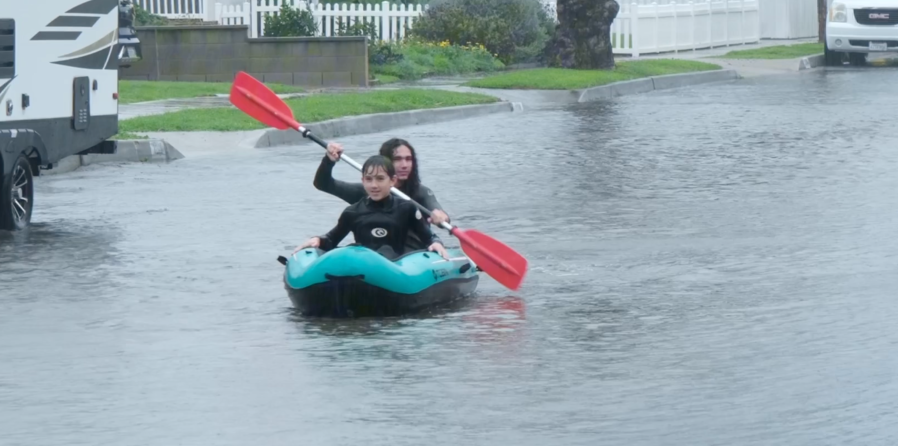
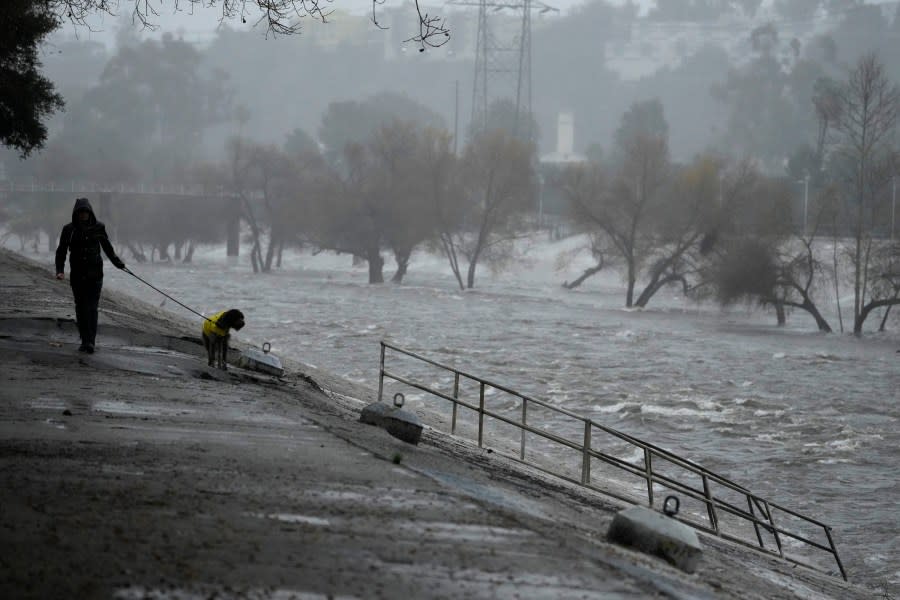
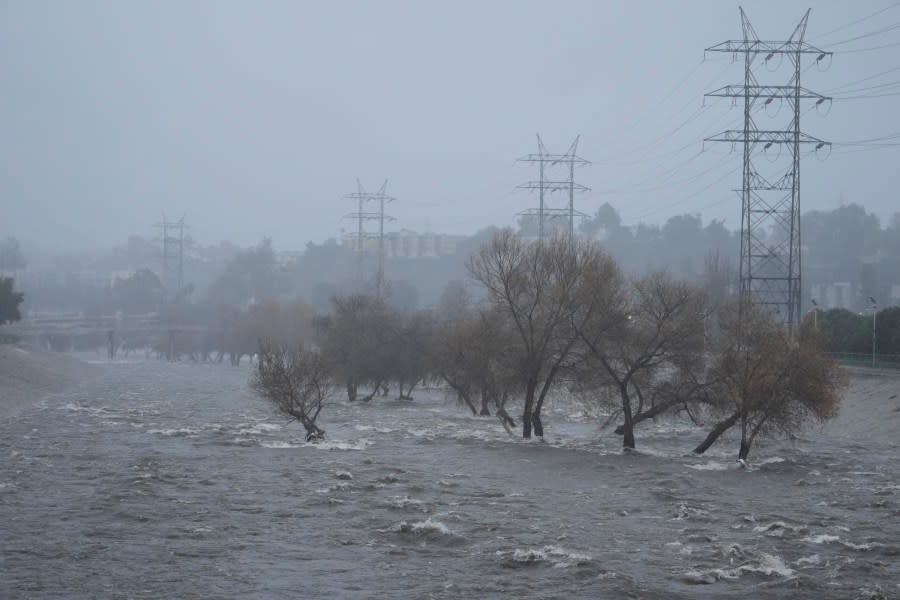
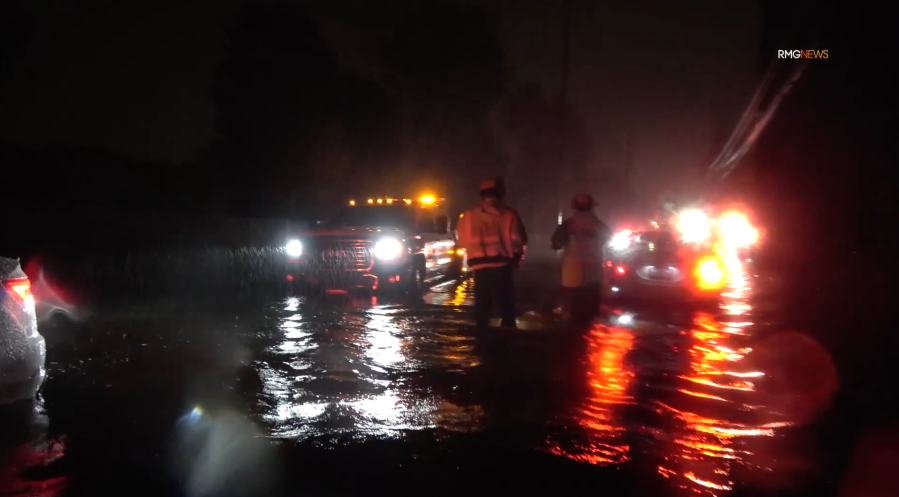
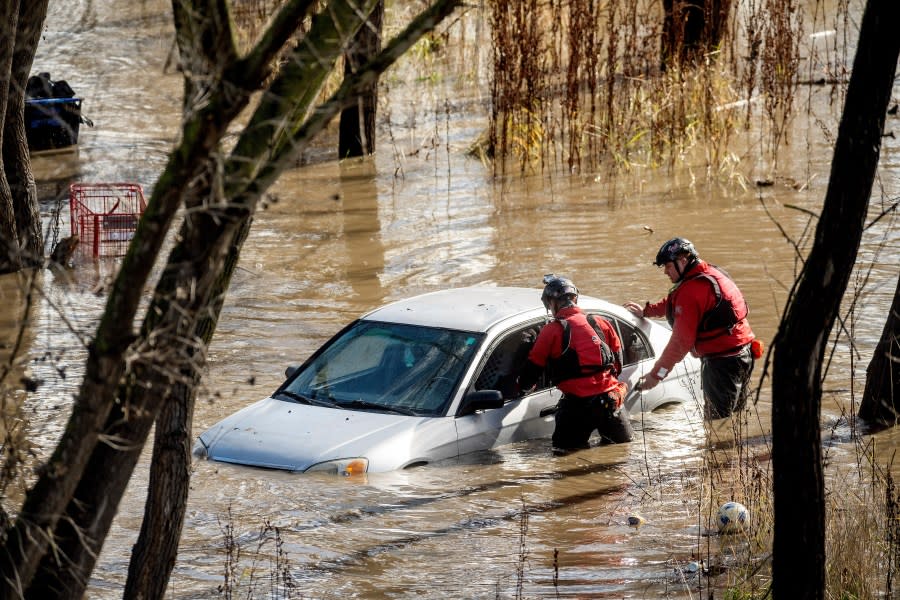
Brothers in Ventura County go kayaking on their flooded street. Feb. 4, 2024 (TNLA) A man walks his dog on the edge of the Los Angeles River, carrying stormwater downstream Sunday, Feb. 4, 2024, in Los Angeles. The second of back-to-back atmospheric rivers battered California, flooding roadways and knocking out power to hundreds of thousands and prompting a rare warning for hurricane-force winds as the state braced for what could be days of heavy rains. (AP Photo/Damian Dovarganes) The Los Angeles River carries increased stormwater flow due to the atmospheric rivers affecting Northern California, which are expected to bring heavy rain and potential flooding to the Los Angeles area, Sunday, Feb. 4, 2024. (AP Photo/Damian Dovarganes) L.A. Fire crews seen helping a woman stranded in flood waters along a Tarzana street on Feb. 4, 2024. (RMG News) Search and rescue workers investigate a car surrounded by floodwater as heavy rains caused the Guadalupe River to swell, Sunday, Feb. 4, 2024, in San Jose, Calif. The vehicle was uninhabited. (AP Photo/Noah Berger) Amid heavy rains, a massive tree came toppling down over two cars, taking out power lines with it on Feb. 4, 2024. (TNLA) Vehicles pass downed branches during a rainstorm, Feb. 4, 2024, in Goleta, Calif. Officials warned the second of back-to-back atmospheric rivers will cause possible life-threatening conditions. (AP Photo/Ethan Swope) Emergency crews attend to a vehicle that went off the road. Feb. 4, 2023. (TNLA)
Western portions of San Bernardino and Riverside counties could also see intense rain, DiCarlo continued, adding that regions further north, such as Ventura and Santa Barbara counties, have been “quiet” but a stronger cell could move in at any time.
‘Be prepared, fool!’ Mr. T says of Southern California’s rainstorm
Future forecasts “point to a broad area of cyclonic flow” for the region on Thursday and Friday, meaning that rain might linger in some areas for the entire week, the National Weather Service said.
“During this time, there will be a slight chance of a shower, but these should not produce much in the way of rainfall,” NWS said. “They will mostly be nuisance showers.”
DiCarlo also acknowledged the possibility of showers for some parts of the Southland towards the end of the workweek, but a large chunk of the region should see the rain taper off.
“I’m a little shy and hesitant to say that Thursday and Friday are going to be wet days for us,” he said. “We may get a stray shower, but I think there will be more areas [that are] dry on Thursday and Friday.”
Click here to follow live updates on the storm.
For the latest news, weather, sports, and streaming video, head to KTLA.
