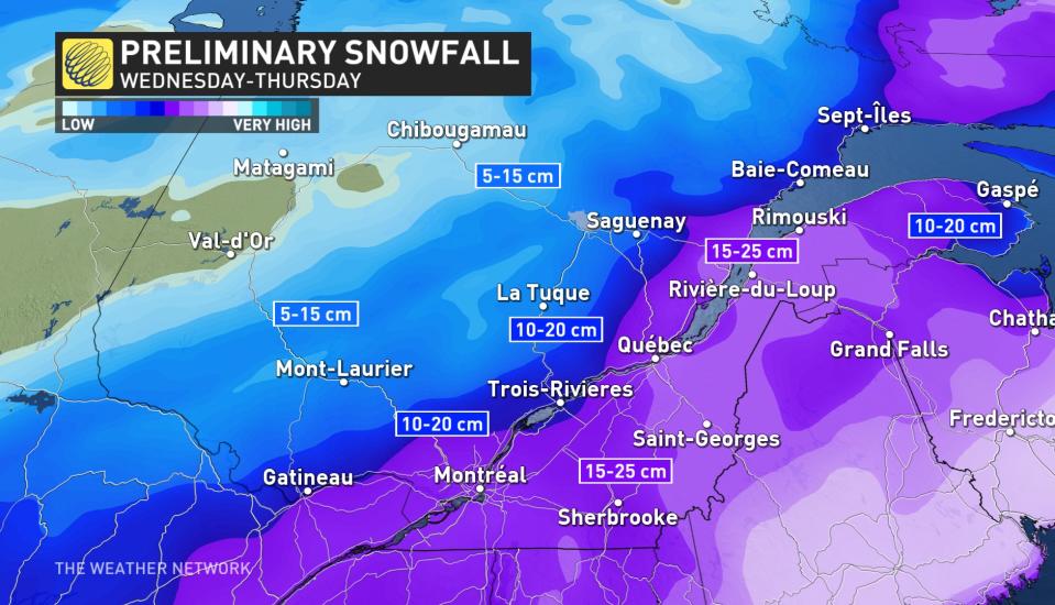
Storm to plow through Quebec with 10-25 cm of snow, blustery winds
Forecasters are closely watching a snowstorm that is building stateside and will target the entire St. Lawrence River Wednesday and Thursday. The same storm that will power through southern Ontario first will then impact Quebec on its way to Atlantic Canada for the end of the week.
SEE ALSO: La Niña fades, so what does that mean for a Canadian spring?
Special weather statements blanket the southern and eastern sections of the province.
Prior to the Texas low entering Canada, the coldest air so far this season descends on southern Quebec, with the Montreal forecast reading a daytime high of -9°C.
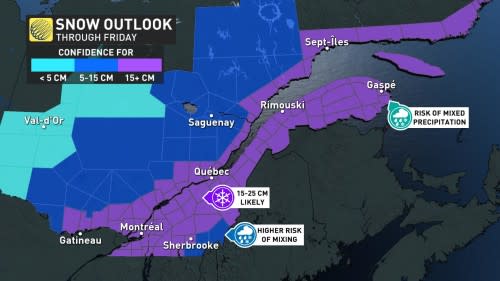
This colder air in place increases confidence in the mid-week system becoming an all-snow event, except for a marginal mixing chance in the extreme southeastern corner of the province.
In the Eastern Townships, the snow may change to rain Thursday morning with a risk of freezing rain during the switch.
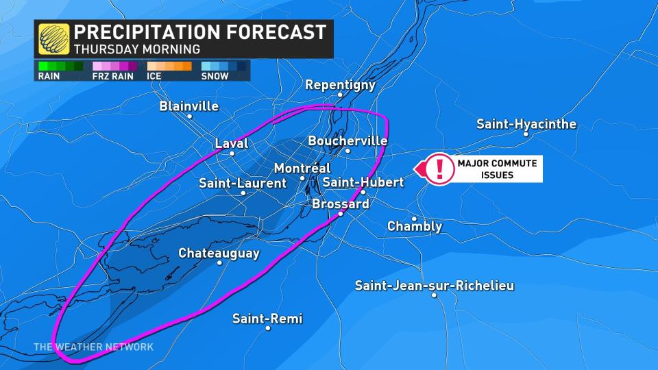
15-25 cm is possible for the hardest-hit regions, including Montreal and Quebec City. Flurries will build into Wednesday evening's commute but conditions are expected to worsen overnight into Thursday morning.
Strong winds will accompany the snow and are expected to create blowing snow. Travel may become difficult due to accumulating snow on roads, along with very low visibilities in blowing snow.
The hazardous weather will improve into the late week.
Temperatures will be colder than seasonal Friday in southern Quebec. A brief warm-up, gusty winds and snow-showers as a clipper tracks north of the province Friday overnight and early Saturday. Temperatures briefly rise above the freezing mark ahead of the cold front, then turn colder.
A more wintry pattern is expected for the final days of January and into early February, with an active influence expected to continue.
Stay tuned to The Weather Network for the latest forecast updates for Quebec.

