Storm with rain, snow and wind heading into Greater Akron Wednesday afternoon
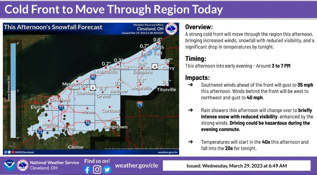
A fast moving storm front heading into the area Wednesday afternoon is expected to bring rain, then snow with little or no accumulation as temperatures drop from around 50 to an overnight low of 25 in the greater Akron area and much of Ohio.
National Weather Service forecasters predict the front will move into the area over a two-hour period starting around 3 p.m. in some areas. Winds will increase, with gusts in the 30-40 mph range as rain arrives and turns to snow as temperatures drop.
Squall-like showers transitioning to snow and reduced visibility is likely in the eastern part of the state, forecasters predict.
Temperatures are expected to rebound back into the 40s, with sunny skies on Thursday.
More rain is forecast Friday, as another front moves into the area with an 80 to 100% chance of rain during the afternoon and into the evening on a breezy Friday. Temperatures near 60 during the day Friday will drop slightly into in the low 50s overnight.
Saturday is forecast to continue breezy with a 70% chance of rain turning to snow overnight as temperatures drop below freezing again.
Sunday is expected to be mostly sunny, with a high around 50.
This article originally appeared on Akron Beacon Journal: Rain, possible snow Wednesday afternoon, evening in Akron area

