Live updates on Oklahoma weather: Tornadoes spotted near Tuttle, Norman, Noble and more
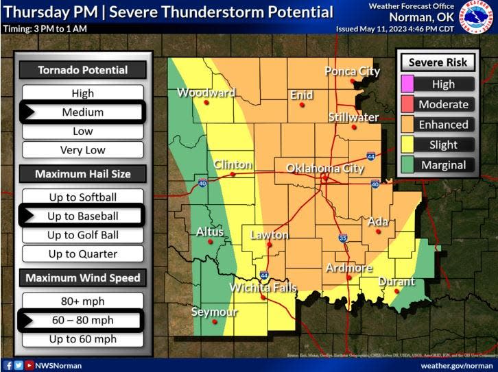
A rapidly strengthening line of storms Thursday evening produced several brief tornados and prompted warnings for two more south and west of the Oklahoma City metropolitan area. Residents should also expect severe storms, rain, high wind gusts and possibility of hail.
The tornado threat will increase over the central Oklahoma OKC metro area, especially the southern parts of the metro area. Stay weather aware and be prepared to seek shelter! #okwx pic.twitter.com/tuey1DysJu
— NWS Norman (@NWSNorman) May 12, 2023
Tornado spotted near Maud, swiftly dissipates
10:26 p.m.
The National Weather Service has advised a storm including a tornado is headed toward Maud and Seminole.
10:14pm - The storm southwest of Maud has intensified and may produce a tornado at any moment!
If you're in Maud, Bowlegs, Lima, and Seminole, take your storm precautions immediately!#okwx https://t.co/MGa84KxtjR— NWS Norman (@NWSNorman) May 12, 2023
-Cheyenne Derksen
Storm damage to buildings in Noble reported
10 p.m.
Tornado damage on Main St in Noble, OK #okwx @OKCFOX @DavidChasanov pic.twitter.com/fBekj5GImF
— Ross Mummah (@RossMummah) May 12, 2023
-Cheyenne Derksen
Power outages worsen across Oklahoma
9:50 p.m.
The latest information from OG&E shows outages have climbed to 12,500, most in Oklahoma City, but about 1,500 in Norman, Noble and Shawnee.
-Jack Money
Tornado warning issued for Seminole, Pottawatomie counties; Cleveland and Oklahoma counties
9:26 p.m.
The National Weather Service in Norman issued a tornado warning at 9:26 p.m. for west-central Seminole County and southwestern Pottawatomie County involving a storm located over Wanette, moving northeast at 25 mph.
Two other warnings were issued about the same time.
One was issued for parts of Cleveland and McClain County, the other for southeastern Oklahoma County and northeastern Cleveland County.
A spotter reports a tornado is causing power flashes just south of Lake Thunderbird on State Highway 9. The storm is headed toward Shawnee, which was recently devastated by a tornado April 19.
-Jack Money
Storm in Noble throwing debris, causing damage
9:23 p.m.
Storm spotters report damage, such as leaning power poles and debris on the ground, in Noble. Some buildings have been damaged as well.
Tornado damage in Noble, OK @NWSNorman #okwx pic.twitter.com/eS6c2JFiFg
— Lexy Elizalde (@JadeoradeWx) May 12, 2023
-Jack Money
Tornado spotted near Noble
9 p.m.
A tornado appears to be on the ground in Noble, spotters report.
Just before 9 p.m., the National Weather Service in Norman issued a tornado warning for parts of Pontotoc, Pottawatomie and McClain County on a storm located near Byars and moving northeast.
-Jack Money
Tornado warning issued near Agawam
9 p.m.
The National Weather Service issued a tornado warning on a severe thunderstorm capable of producing a tornado that was located 4 miles northeast of Agawam.
-Jack Money
Tornado-producing storm heading to Goldsby
8:52 p.m.
The storm that's produced tornadoes east of Cole is approaching Goldsby. Forecasters report debris on radar returns.
Unbelievable tornado minutes ago heading towards Goldsby, OK! #okwx pic.twitter.com/1PEFXQoJJI
— Everett Occhipinti (@WxEverett) May 12, 2023
-Jack Money
Moore, Norman, south OKC residents lose power amid severe storms
8:49 p.m.
Thousands of Oklahoma Gas and Electric customers in Oklahoma City lost power Thursday evening as storms moved through the area. At about 9 p.m., the utility's outage map showed more than 10,500 were without power.
-Cheyenne Derksen
Tornado warning reissued for Norman, south Moore, toward Lake Stanley Draper
8:45 p.m.
Tornado was observed by spotters on the ground east of Cole at about 8:42 p.m. Spotters tracking the storm near Cole have not yet spotted any significant damage, however.
At about the same time, forecasters reissued a tornado warning for a storm that passed over north Norman and south Moore and headed toward Lake Stanley Draper.
The warning reissued on the storm approaching the lake extends into Pottawatomie County.
-Jack Money
Tornado touches down at Cole
8:36 p.m.
Tornado spotters observe a tornado touch down at Cole, a community already devastated by a tornado on April 19 this year.
-Cheyenne Derksen
Tornado developing near I-35 in Norman
8:21 p.m.
Storm spotters have observed a funnel near Franklin Road and 48th Avenue near Norman, which is located near HeyDay and Indian Hills Road.
Slow-mo lightning in the tornadic storm over Norman as seen from OKC! pic.twitter.com/3RZlRoS00c
— Dale Denwalt (@denwalt) May 12, 2023
8:19pm- The storm in north Norman and Moore continues to have the potential to produce a tornado at any moment!
If you're in north Norman or Moore, take cover immediately!#okwx https://t.co/O4Eo7w2jDj— NWS Norman (@NWSNorman) May 12, 2023
-Jack Money
Tornado spotted south of Ninnekah
8:15 p.m.
Tornado spotters have observed a funnel that may have touched down south of Ninnekah about 8:11 p.m.
-Jack Money
Tornado warning issued for Dibble, includes Norman and Cole
8:06 p.m.
The National Weather Service issued a tornado warning for a storm near Dibble about 8 p.m. The center of circulation involved in the warning was southwest of the community. The warning takes in the Norman as well, putting that community under two warnings currently.
Cole, hit by a tornado just weeks ago, also is included in this latest warning.
8:05pm - Another storm capable of producing a tornado is currently near Dibble.
If you're in Cole, Washington, Goldsby, Noble, and Norman, watch this storm closely and be prepared to take cover immediately!#okwx https://t.co/LtwC4dan3e— NWS Norman (@NWSNorman) May 12, 2023
-Jack Money
Storm circulating north of Rush Springs
7:51 p.m.
At about 7:45 p.m., the National Weather Service issued a tornado warning for a storm near Rush Springs.
The center of circulation for the Rush Springs storm appears to be several miles north of the town.
-Jack Money
Tornado spotted near Newcastle
7:43 p.m.
Tornado spotted at 7:42 p.m. near the junction of State Highways 76 and 9, southwest of Newcastle. Briefly, it appeared to be a large, wedge-shaped funnel before it began to lift back to the storm's wall cloud.
Tornado warnings have been issued for areas near Cleveland County, Grady County, and McClain County until 8:15 p.m.
Spotter report of confirmed tornado near Newcastle, OK. Take cover now! pic.twitter.com/5mveNFfNBH
— Jacqui Jeras (@JacquiJerasTV) May 12, 2023
-Jack Money
Moore, Norman under tornado warning; spotters see funnel between Bridge Creek and Newcastle
7:35 p.m.
Authorities sounded sirens in Moore at about 7:30 p.m. as a storm that reportedly produced a tornado as it passed south of Bridge Creek approached the west side of town.
The National Weather Service issued a new tornado warning at about 7:36 p.m. for Norman as spotters saw a storm approaching the community produce a funnel between Bridge Creek and Newcastle.
Tornado Warning including Norman OK, Moore OK and Newcastle OK until 8:15 PM CDT pic.twitter.com/SVGz5LqKDv
— NWS Tornado (@NWStornado) May 12, 2023
-Jack Money
Thunderstorm, tornado warnings issued
7:26 p.m.
The National Weather Service has issued a severe thunderstorm warning for western Oklahoma County and northeastern Canadian County. Residents should expect 60 mph wind gusts and quarter-size hail.
-Cheyenne Derksen
Brief tornado spotted south of Tuttle
7:15 p.m.
The first warning came out about 7 p.m., when spotters saw power flashes south of Tuttle under a strongly-circulating storm that meteorologists tornado warned.
Within minutes, additional tornado warnings were issued on storms near Bridge Creek and Ninnekah.
No damages have been reported, so far.
-Jack Money
This article originally appeared on Oklahoman: Oklahoma tornado live updates: Storms spotted across state

