Storm train to continue rolling through Northwest into November
The unusually warm and dry start to the fall season has come to a screeching halt in the Northwest, and AccuWeather meteorologists say that the ongoing wet and cool pattern will continue for some time.
Persistent rain and mountain snow have been a mainstay in the Northwest over the past week, and more is expected this weekend as a significant storm system from the Pacific Ocean is forecast to crash ashore.
A large storm will reach the Pacific Northwest on Sunday and produce steady and heavy rainfall, according to AccuWeather Meteorologist Andrew Johnson-Levine.
 |
The precipitation is needed with much of the West in some level of drought.
"All of Washington and over 99% of Oregon are experiencing at least 'abnormally dry' conditions according to the United States Drought Monitor," said Johnson-Levine.
Rain is forecast in northwestern Washington on Sunday, including Seattle, with the heaviest rain likely to fall on the Olympic Peninsula. Snow will fall in the mountains although impacts should be limited.
"Some mountain snow is likely, but the most heavily traveled passes should remain above freezing," explained Johnson-Levine.
This will mean rain is likely in many of the mountain passes until colder air arrives early next week, but any hikers or campers should still be prepared for wet and cold conditions.
As the storm train continues into early November, the high country in Washington, Oregon and British Columbia, Canada, could receive 5-10 feet (1.5-3 meters) of snow until the parade of storms subsides, according to AccuWeather Senior Meteorologist Alex Sosnowski.
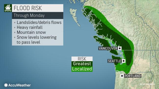
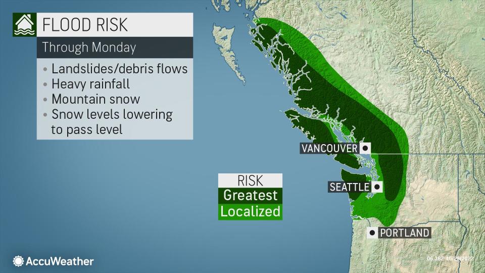
Despite the current drought, repeated rounds of heavy rain will begin to raise the flood risk.
"With the anticipated amount of rainfall, there will likely be significant rises on some of the rivers in the region," cautioned AccuWeather Senior Meteorologist Adam Douty.
 |
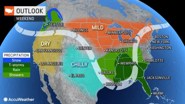
Precipitation is likely to continue in Washington on Monday. After that, southern Canada and Washington may begin to get a break as the rain and snow begin to shift southward. Much of Oregon and Northern California are likely to bear the brunt of the precipitation beginning on Tuesday.
More than 40% of California is in the throes of extreme drought, so rain and mountain snow are desperately needed in the Golden State.
A significant dip in the jet stream is likely to allow the rain and snow to push into Central California by midweek. This jet stream dip will also contribute to below-normal temperatures. As a result, the first significant snow of the season will be possible in the Sierra Nevada.
After Wednesday, there is some question as to the trajectory of the moisture. One scenario is for the rain and mountain snow to move eastward into the central Rockies.
In another scenario, the jet stream would dip even farther to the south. This could allow drenching rain and heavy mountain snow to reach Southern California before eventually moving into Arizona and New Mexico. This could potentially bring beneficial rainfall to Los Angeles and San Diego.
While both possibilities are still on the table, AccuWeather meteorologists are becoming more confident that precipitation is looking increasingly likely to reach Southern California. That said, there could be a large swath of precipitation stretching from California eastward through Nevada and Utah by Wednesday. The exact position of the jet stream will also determine whether California begins to dry out Thursday, or if rain and high-elevation snow could extend linger through Thursday and possibly even Friday.
 |
This past North American monsoon season helped to alleviate the drought in much of Arizona and New Mexico during the summer, but the entire region would still benefit from more precipitation.
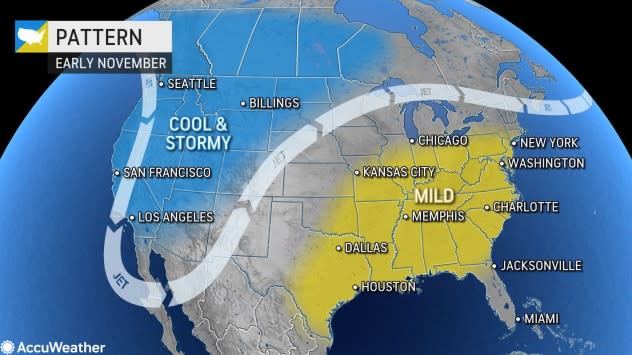
AccuWeather's team of long-range meteorologists expects the ongoing cool and stormy pattern in the Northwest to last into the beginning of November. However, there are some indications that the jet stream will push northward during the first full week of November. If this occurs, the parade of storms will cease in the region.
The West is just beginning its traditional wet season, so there is the potential for much more rain and snow over the next few months. As long as heavy precipitation does not all come at once, the long-term benefits should outweigh any potential flooding, forecasters say.
Want next-level safety, ad-free? Unlock advanced, hyperlocal severe weather alerts when you subscribe to Premium+ on the AccuWeather app. AccuWeather Alerts™ are prompted by our expert meteorologists who monitor and analyze dangerous weather risks 24/7 to keep you and your family safer.


