Downpours ahead in Charlotte as Hurricane Idalia approaches landfall in Florida
As Hurricane Idalia approaches the U.S., severe weather is expected in the Charlotte area over the next couple of days, according to a hazardous weather alert from the National Weather Service.
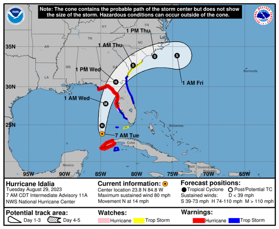
The storm strengthened into a category 1 hurricane Tuesday morning, with wind speeds reaching 80 miles per hour, NBC News reported. It is forecast to make landfall on the Florida Gulf Coast Wednesday morning, according to the NWS.
Showers and thunderstorms are expected to develop in the Charlotte area Tuesday afternoon and last into the evening, according to the NWS. Mecklenburg, Union, Iredell, Catawba, Lincoln, Cabarrus and Cleveland are among the counties that will be affected.
“Rounds of heavy-rain producing showers and thunderstorms are expected today and tonight,” the alert says. “The threat of localized flash flooding along streams and nuisance flooding of poor drainage areas will continue.
“Any thunderstorm will be capable of producing cloud-to-ground lightning and gusty winds.”
Up to three quarters of an inch of rain in the area is possible.
Storms will continue into Wednesday, with lower wind speeds and up to a half inch of rain expected, according to the NWS.
Rain chances are expected to last until Thursday afternoon, according to the latest NWS forecast.