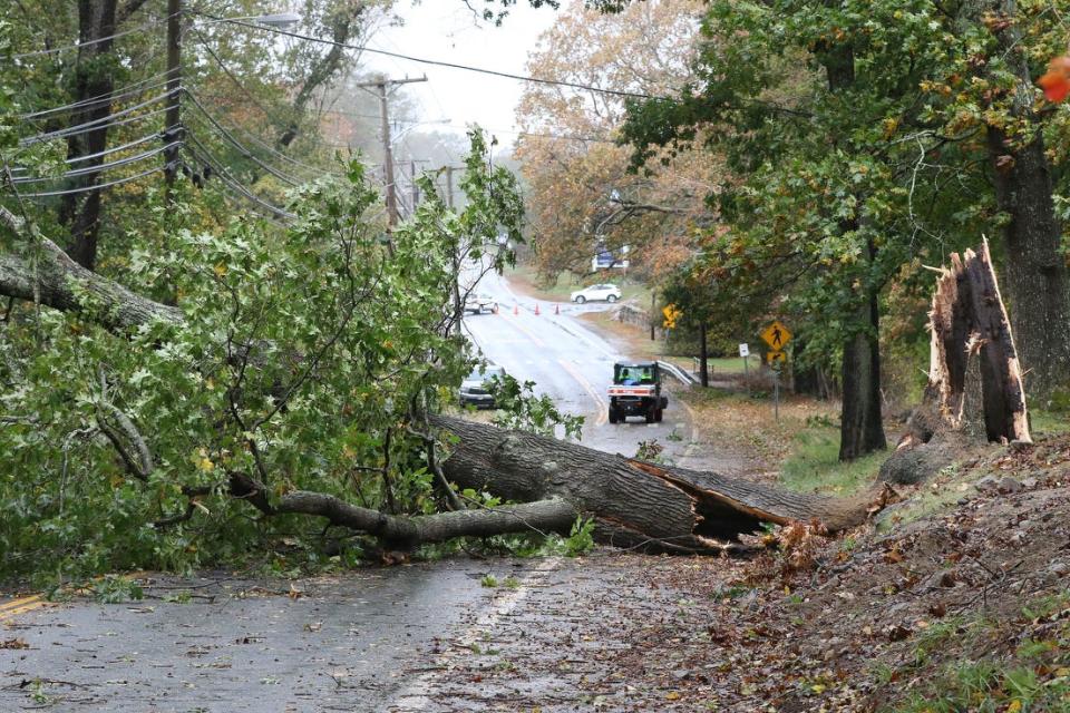
As storms track further inland, they'll cause more wind damage in RI. Here's where.
PROVIDENCE — Millions more homes and businesses along the eastern half of the country will be threatened by wind damage in the coming decades as hurricanes track farther north and inland, according to new research released Monday.
They include thousands of properties in Rhode Island, where the average annual cost of damage caused by extreme winds is projected to rise from $10.2 million today to $15.6 million in 2053.
With a 53% increase, Rhode Island is among the states that would see the largest changes in average annualized losses over the next three decades, researchers with the nonprofit First Street Foundation found. And Newport, overlooking the Atlantic Ocean, is one of the cities that would see the biggest jumps in losses.
If there’s a single takeaway from the study for the Northeast, it’s that property owners should start thinking about protecting their buildings from a threat they probably wouldn’t have thought about before, said Ed Kearns, chief data officer for First Street.
“Be prepared,” he said. “The likelihood that storms are coming your way in the future is increasing.”
RI Weather:First RI snowstorm of year to arrive just as February ends. What to know
More:A $138 million relocation plan for Warren's flood-prone neighborhood
Millions more properties would be susceptible to damage as storms track further inland
The study by First Street, a New York-based organization that assesses climate threats, analyzed tracks of historical hurricanes as well as tens of thousands of storms simulated by a computer model to assess the risk of wind damage to individual properties across the nation.
It found that in 30 years, 13.4 million properties would be susceptible to damage that are not today. Annual losses over that time period would edge up from $18.5 billion to nearly $20 billion.
First Street has released previous studies looking at flood, wildfire and extreme heat threats to home and business owners and has created a free, publicly-accessible website that allows users to look up data by street address. The new research on wind damage has been incorporated into the website riskfactor.com.
As with the foundation’s earlier work, the study on wind damage is designed to inform property owners of their risk and also offer insight into what they can do to protect their homes and businesses. It aims to fill in a gap in what the federal government has done, Kearns said.
The Federal Emergency Management Agency has looked at wind damage in its National Risk Index, but the agency only gives a broad county-by-county score. Moreover, just as it has done with its flood maps across the country, FEMA has only looked at historical data to assess wind risk. The agency has not accounted for climate change.
The American Society of Civil Engineers, which sets widely-used design standards for building construction, considers wind damage in its online hazard tool that generates information on individual properties. While it’s updated periodically, it doesn’t include future projections.
A Rhode Island-specific smartphone app called StormTools calculates flood damage only. While the app and an accompanying website factor in future sea level rise projections, it does not account for changes in hurricane activity, said Malcolm Spaulding, emeritus professor of ocean engineering at the University of Rhode Island who co-directed development of the project.
“We just said we’re not certain enough of it,” he said.
More:With seas rising, study will ask — is Providence's hurricane barrier up to the task?
Wind damage is concentrated in Florida but expected to spread north
While there is debate about the extent of the impacts of climate change on tropical storms, recent studies indicate that hurricane activity is changing. Scientists have found that storms worldwide are growing stronger, and a greater incidence of hurricanes in the Atlantic Ocean are reaching category three and higher.
The First Street study incorporates that research, said Kearns. The foundation calculated the costs of wind damage from a variety of different storms and then averaged those costs on an annual basis.
The researchers analyzed more than 50,000 computer-generated storm tracks to determine wind direction and speed and the likelihood of gusts that are the main driver of damage to roofs, windows and walls. The model factored in surface roughness — the presence of trees and other features that could block the wind – and calculated the costs of damage.
The bulk of the damage from storm winds would still be concentrated in Florida, the state most exposed to hurricane risk. But states in the northeastern part of the country — not just Rhode Island but also Massachusetts, New York and Connecticut — would see more damage as climate change influences the paths that storms follow.
Newport is vulnerable primarily because of its location, along the southern coast of Rhode Island between the mouths of Narragansett Bay and the Sakonnet River. The so-called City by the Sea could also see more damage because of the concentration there of older buildings, many dating to Colonial times.
But increases in annual losses wouldn’t be confined to Newport. Westerly, Warwick, South Kingstown and other communities would also see more losses, though on a smaller scale than in Newport, according to the study.
“Compared to the historic location and severity of tropical cyclones, this next generation of hurricane strength will bring unavoidable financial impacts and devastation that have not yet been priced into the market,” Matthew Eby, founder and CEO of First Street, said in a statement.
Simple roof improvements can reduce risk
The findings on wind damage aren’t a surprise to Grover Fugate, the former longtime director of the Rhode Island Coastal Resources Management Council.
Fugate, who now works as a consultant to builders and others on climate protection, said he got a sense of the problem when the coastal council commissioned a report that found that winds alone would cause widespread damage in Misquamicut in the event of a 100-year storm, an event that has a one-percent chance of happening in any year.
Because Rhode Island is so small, he says it’s not just coastal areas that are at risk.
“Any hurricane will impact the entire state,” Fugate said.
One of the builders Fugate has worked with is Dave Caldwell, vice president of the firm Caldwell & Johnson. Caldwell, whose company specializes in sustainable construction, said the biggest source of damage from winds is to roofs. If roof shingles are blown off in a storm and the underlying sheathing isn’t sealed, rain can get inside a house and cause extensive water damage.
It’s a problem in older houses that don’t have the same layers of protection that are being used more in new construction. For anyone who’s re-roofing their house, he recommends they have their contractor use extra nails to make sure the sheathing is secure and tape off the seams or install a waterproof membrane.
The additional costs are small and the benefits are worth it, he said.
“Take that extra step,” he said. “It’s what we should be doing without question.”
This article originally appeared on The Providence Journal: Climate change in Rhode Island means stronger hurricanes and more wind damage

