Strong low threatens 100 km/h winds, soaking rains on the East Coast
Atlantic Canada will be in for wet and windy ride over the next day or two. An intense low is set to bring soaking rains and blustery winds, and snowfall for some, through Thursday. Winds could reach or even exceed 100 km/h in many areas, bringing the potential for localized power outages. The rainfall won't be abnormally excessive for the region, but may be enough to lead to ponding on the roads and localized flooding in low-lying areas.
SEE ALSO: Triple-dip La Niña and polar vortex to deliver a frigid start to winter
There are rainfall and wind warnings, and the odd snowfall alert, along with special weather statements in place across Atlantic Canada.

Even though the centre of the low is more than 1,000 kilometres away, scraping by Hudson Bay through Thursday morning, a conveyor belt of damaging winds is sweeping ahead of the unravelling cold front.
The upper-level winds ahead of a powerful cold front will sweep across the Maritimes through Thursday morning.
Although the strongest winds will remain just aloft, the intensifying low-level jet could mix down wind gusts over 100 km/h. It's often a tricky forecasting setup to determine how much wind will mix down to the surface.

Winds of this magnitude are capable of spotty power outages, but they'll also usher in well-above-normal temperatures that will spill into the double digits early Thursday.
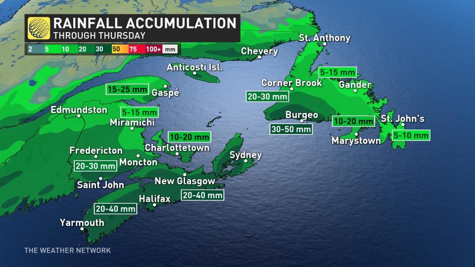
There's ample forcing associated with the upper trough, so heavy rainfall will spread across the area, bringing more than 30 mm of precipitation. Winds will dissipate across the Maritimes while the frontal system crosses Newfoundland Thursday evening.
This won't be the end of the stormy weather, either, as another late-fall-like storm will track north of the region this weekend. This will bring another round of rain, spreading from west to east across the region late Saturday through Sunday.
Double-digit temperatures will once again surge across much of the Maritimes Saturday before they fall on Sunday. Another round of unsettled weather expected mid- or late next week.
Stay tuned to The Weather Network for the latest forecast updates for Atlantic Canada.

