Strong storms, heavy rain possible this weekend across Middle Tennessee

NASHVILLE, Tenn. (WKRN) – With a weekend fully planned for holiday shopping and events, the weather will have an impact on your plans. We will be under a Storm Tracker Weather Alert on Saturday for an isolated severe storm risk, along with heavy rain. The timeframe of concern will be from 2 p.m. Saturday to 2 a.m. Sunday. After this timeframe, a strong cold front moves in for colder temperatures on Sunday.
This storm system will come on the two-year anniversary of the deadly December 10-11, 2021 tornado outbreak. Read more about this here.
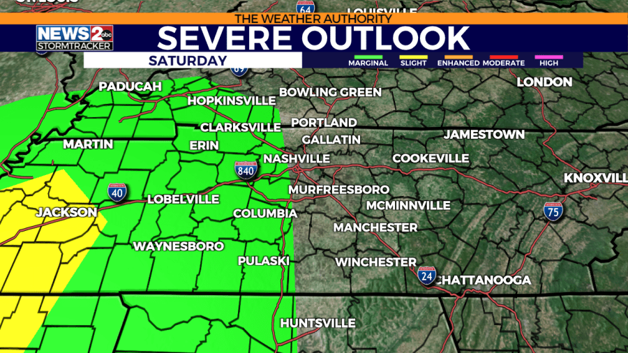
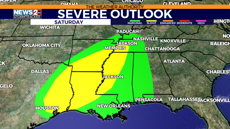
Severe outlook & threats
Locations west of Interstate 65 in Middle Tennessee are under a Marginal Risk (level 1/5) for a few severe storms on Saturday evening and night. The Slight Risk (level 2/5) is from Jackson, TN back to parts of Arkansas, Louisiana, Mississippi, and Texas.
FORECAST: Middle Tennessee & Southern Kentucky Weather
WKRN Severe Weather Outlook local: Valid 6 AM Saturday 12/9 - 6 AM Sunday 12/10. WKRN Severe Weather Outlook regional: Valid 6 AM Saturday 12/9 - 6 AM Sunday 12/10.
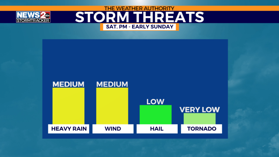
The two primary storm concerns will be very gusty winds as the storms move toward I-65 (and even wind gusts throughout the day before storms arrive), and heavy rain. Lightning will be impressive with the storms we see. The risk for hail and tornadoes are extremely low. These two threats (especially tornadoes) will be higher in parts of Arkansas, Louisiana, Mississippi, and Texas where greater moisture and instability will occur.
RADAR | Track weather across TN live
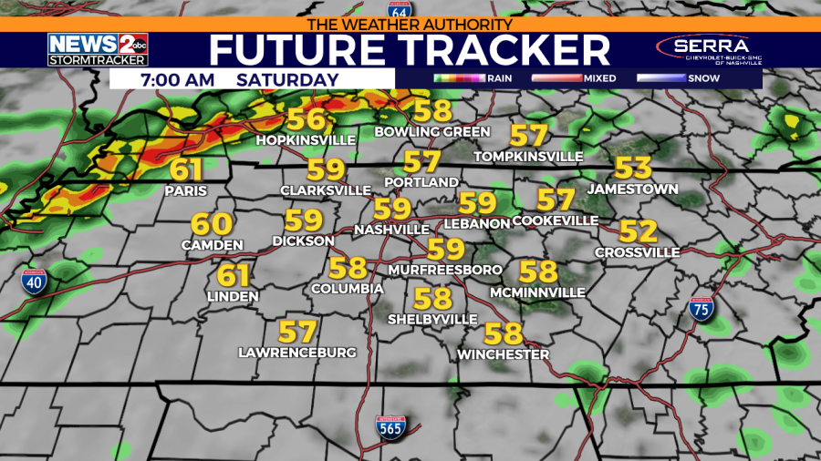
Storm timing with Future Tracker
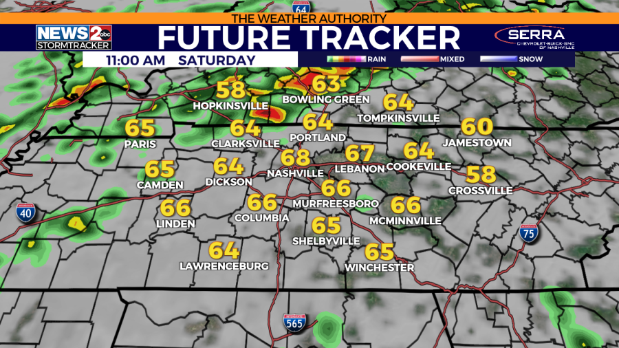
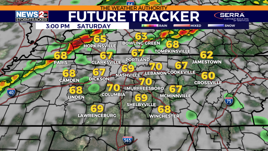
Saturday morning, most areas are dry. However, sections of southwest Southern Kentucky and northwest Middle Tennessee could see some rain and storms from one wave of ongoing rain & storms. This should not be severe, but brings heavy rain and lightning. As midday/afternoon approaches, the south wind increases and temperatures are nearing 70 degrees despite a mainly cloudy sky.
WKRN Future Tracker: Valid 7 AM Saturday 12/9. WKRN Future Tracker: Valid 11 AM Saturday 12/9. WKRN Future Tracker: Valid 3 PM Saturday 12/9.
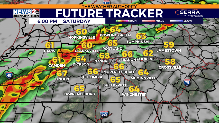
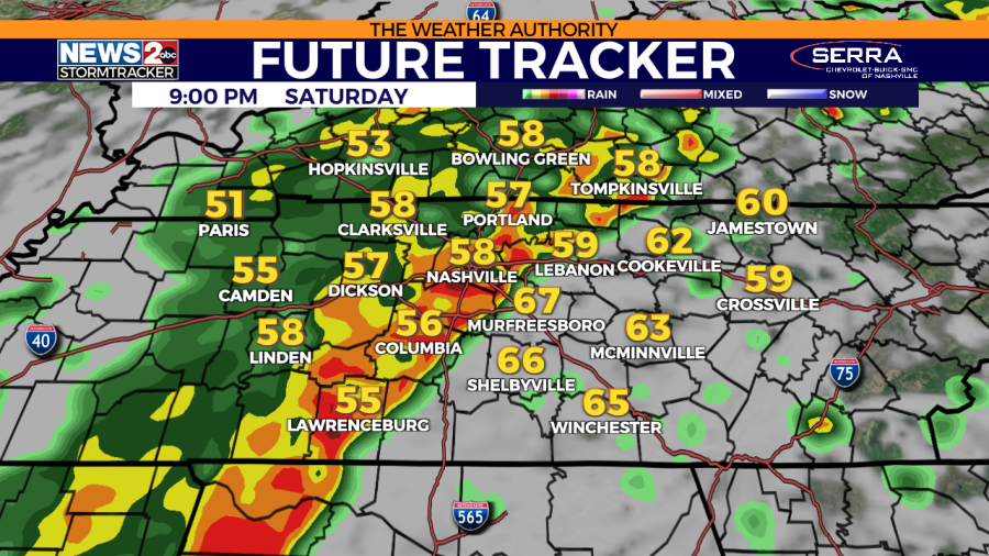
Late Saturday afternoon into Saturday night, a line of storms will increase near the Tennessee River and march east toward Middle Tennessee. Initially, the storms will be the strongest and potentially severe west of I-65. As the night progresses (especially overnight), the storm intensity decreases and transitions to general thunderstorms.
ALERTS | Weather advisories in Middle Tennessee
WKRN Future Tracker: Valid 6 PM Saturday 12/9. WKRN Future Tracker: Valid 9 PM Saturday 12/9. WKRN Future Tracker: Valid 12 AM Sunday 12/10.
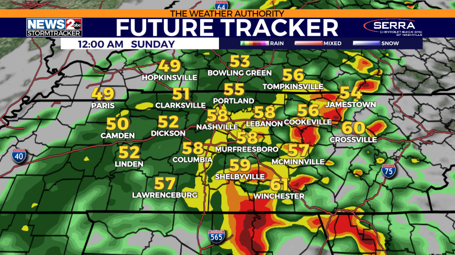
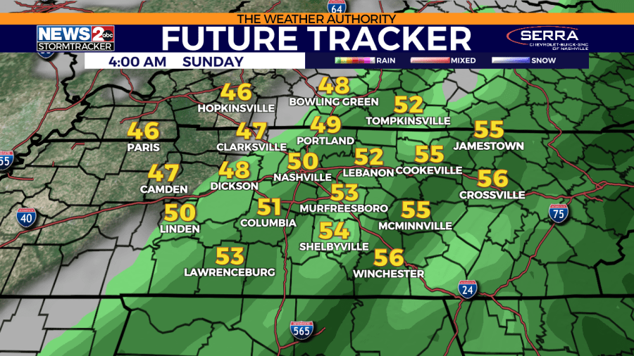
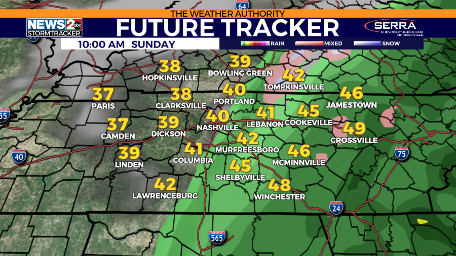
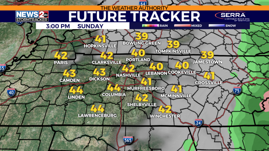
On Sunday, any early morning storms will transition to general rain showers as a cold front moves in. On the tail end of the rain for our Cumberland Plateau area, there could be light wintry mix with the rain. However, temperatures will stay above freezing at the surface, making it all liquid upon ground contact. A cold day will be on tap for us, highs staying in the 40s.
WKRN Future Tracker: Valid 4 AM Sunday 12/10. WKRN Future Tracker: Valid 10 AM Sunday 12/10. WKRN Future Tracker: Valid 3 PM Sunday 12/10. WKRN Future Tracker: Valid 6 PM Sunday 12/10.
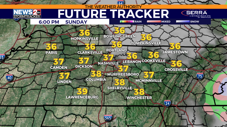
We could receive a good amount of rain with this weather system. Forecast models are indicating 1-2 inches (highest totals possibly in parts of Southern KY/northwest Middle TN).
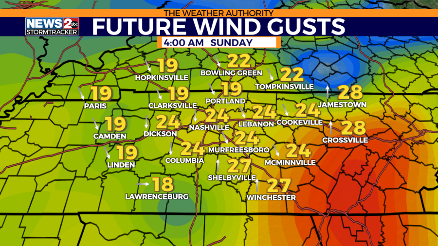
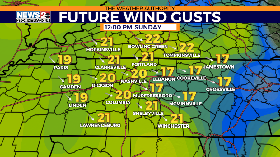
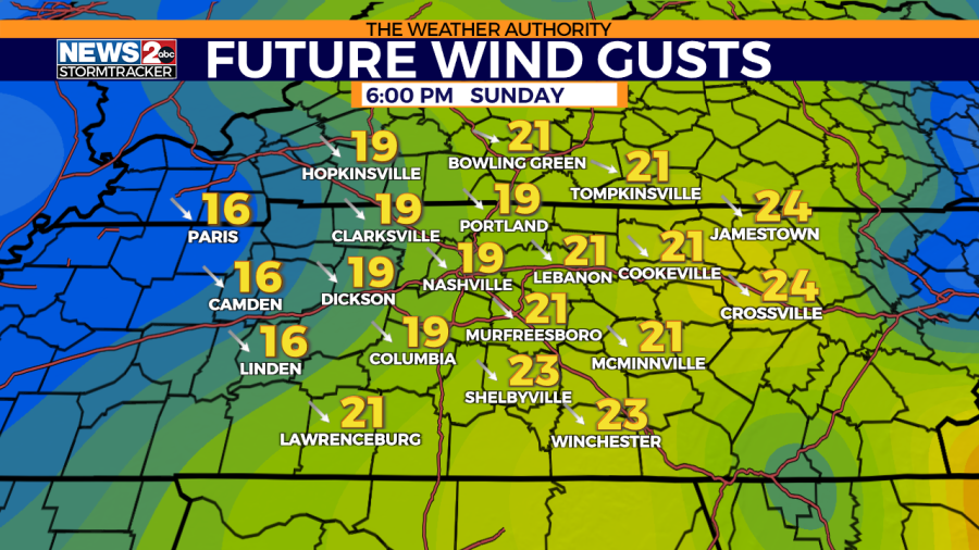
Wind gusts
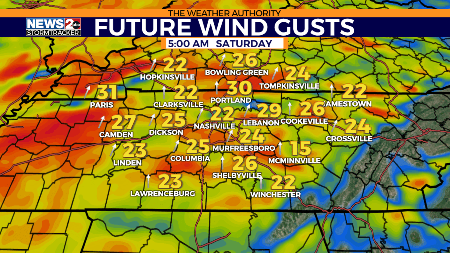
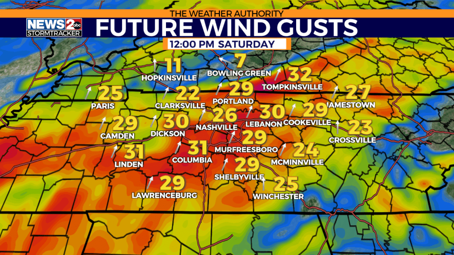
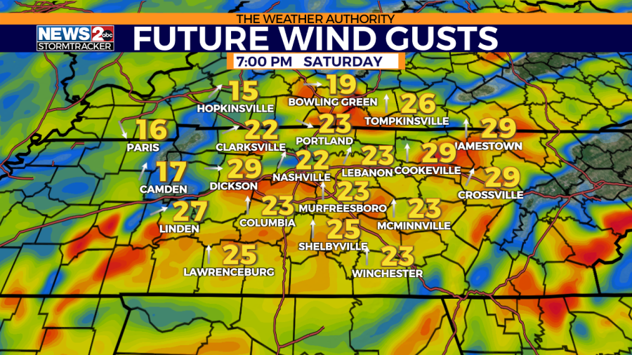
Before, during, and after the storms, there will be an incredible amount of wind energy. Check out the wind gusts from Saturday to Sunday. A south wind gust Saturday, changing to a northwest gust by Sunday.
WKRN Future Tracker Wind Gusts: Valid 5 AM Saturday 12/9. WKRN Future Tracker Wind Gusts: Valid 12 PM Saturday 12/9. WKRN Future Tracker Wind Gusts: Valid 7 PM Saturday 12/9. WKRN Future Tracker Wind Gusts: Valid 4 AM Sunday 12/10. WKRN Future Tracker Wind Gusts: Valid 12 PM Sunday 12/10. WKRN Future Tracker Wind Gusts: Valid 6 PM Sunday 12/10.
Don’t forget to take the power and reliability of the WKRN Weather Authority with you at all times by downloading the News 2 Storm Tracker app.
For the latest news, weather, sports, and streaming video, head to WKRN News 2.

