Strong storms, severe weather could clear out Bradenton beaches full of spring breakers
Strong storms are forecast to start moving into Manatee County on Tuesday evening and bring rain chances through the week as Anna Maria Island beaches are packed for spring break.
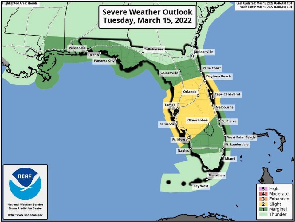
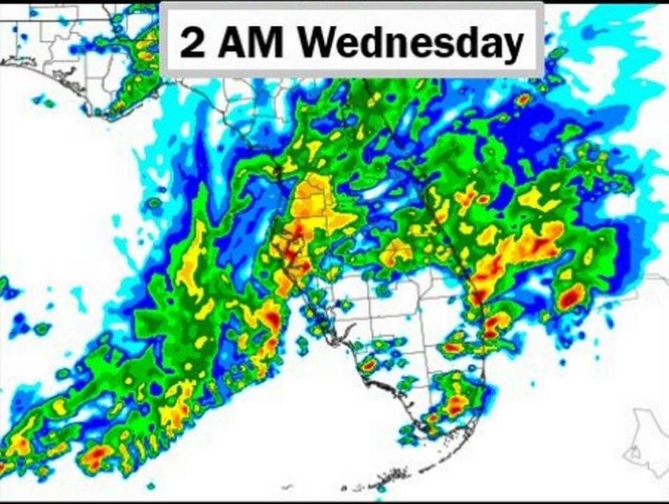
Overnight Tuesday, a large amount of rainfall is expected in the area, the National Weather Service predicts, and isolated thunderstorms and tornadoes are possible from 8 p.m. until 2 a.m.
The main threats are “strong gusty winds, isolated tornadoes, locally heavy rains, and frequent deadly lightning strikes,” the weather service warned.
Wednesday morning’s forecast brings more rain lightning, thunderstorms and 20 mph gusts of wind.
As a result, Wednesday night temperatures could drop as low as 64 degrees, with Thursday night being even cooler with a low of 62 degrees.
A break from the cooler weather and chance of rainfall is not likely until the weekend.
Bradenton weather forecast
Tonight: A chance of showers and thunderstorms before 8 pm, then showers likely and possibly a thunderstorm between 8 p.m. and 2 a.m., then a chance of showers and thunderstorms after 2 a.m. Mostly cloudy, with a low around 67. East southeast wind 5-7 mph. The chance of precipitation is 60%. New rainfall amounts between three quarters and one inch possible.
Wednesday: A 50% chance of showers and thunderstorms. Partly sunny, with a high near 78. Breezy, with a south wind of 6-15 mph, with gusts as high as 20 mph. New rainfall amounts between a quarter and half of an inch possible.
Wednesday Night: Partly cloudy, with a low around 64. West southwest wind 5-8 mph.
Thursday: Sunny, with a high near 78. Calm wind becoming west 5-7 mph in the afternoon.
Thursday Night: Partly cloudy, with a low around 62. Light and variable wind.
Friday: A 20% chance of showers and thunderstorms after 2 pm. Mostly sunny, with a high near 82. Light and variable wind becoming south southwest 6 to 11 mph in the morning.
Friday Night: A 20% chance of showers and thunderstorms before 2 am. Partly cloudy, with a low around 68. South southwest wind 5-7 mph.
Saturday: A 20% chance of showers and thunderstorms after 2 pm. Mostly sunny, with a high near 80. South southwest wind 5-9 mph becoming west in the afternoon.
Saturday Night: A 10% chance of showers and thunderstorms before 8 pm. Mostly cloudy, with a low around 64.
Sunday: Mostly sunny, with a high near 81.
Sunday Night: Mostly clear, with a low around 62.
Monday: Sunny, with a high near 84.