Strong thunderstorms rolling into Kansas City area with heavy rain, gusty winds, lightning
Strong, widespread thunderstorms were rumbling into the Kansas City area Wednesday morning, possibly impacting the morning commute with low visibility and ponding of water on the roads, according to the National Weather Service.
Heavy rains and lightning are expected from the storms as they roll through, along with gusty winds of 30 to 50 mph. There could be some areas that see wind gusts of 60 mph.

Drivers out and about on Interstate 35, 29 and 49 can expect their morning commute and errands to be affected by the storms, the weather service said.
“Thunderstorms moving into the KC Metro now,” the weather service said about 6:20 a.m. on X, formerly known as Twitter. “Expect a wet commute with periods of heavy rain and gusty winds.”
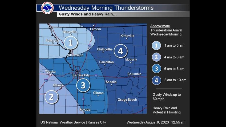
Widespread severe weather is not expected. There could be some flooding, especially in areas that have seen the most rain over the last week, the weather service said.
Strong to severe thunderstorms are expected to redevelop Wednesday afternoon and evening. The strongest storms are expected to be south and east of the Kansas City metro area, mainly south of Interstate 70.
Gusty winds, large hail and heavy rains with possible flooding are the primary hazards.
Weather watches and warnings
A live data feed from the National Weather Service containing official weather warnings, watches, and advisory statements. Tap warning areas for more details. Sources: NOAA, National Weather Service, NOAA GeoPlatform and Esri.

