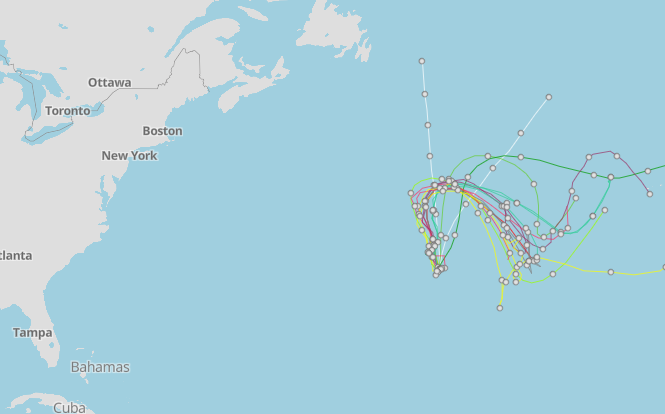
National Hurricane Center tracking Subtropical Storm Don. See spaghetti models
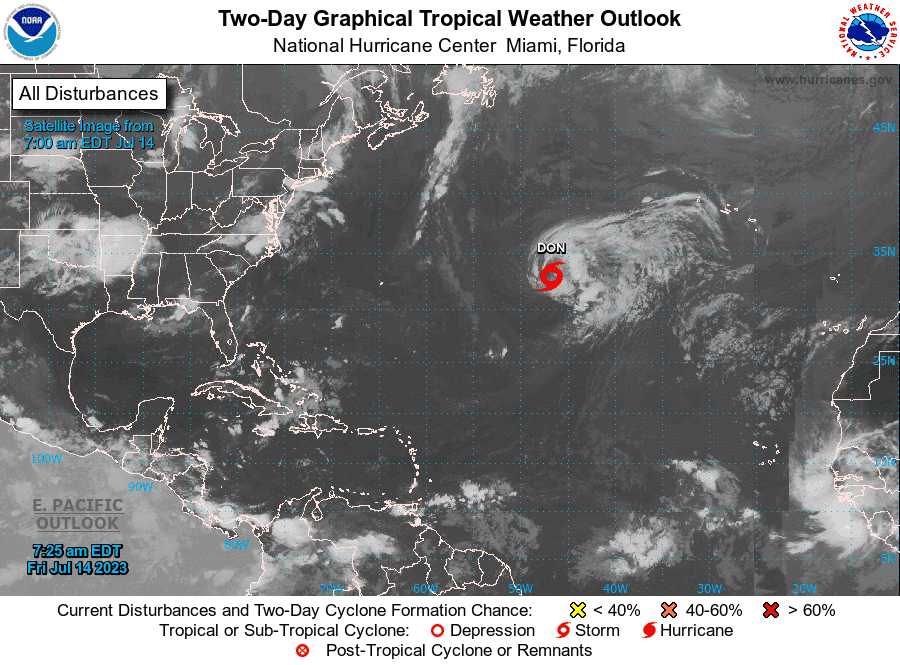
Subtropical Storm Don formed in the Central Atlantic Friday morning, becoming the fifth storm of the 2023 Atlantic hurricane season.
Don isn't expected to hang around long as it moves into cooler waters to the north, according to the latest advisory from the National Hurricane Center.
In the eastern Pacific, Hurricane Calvin has strengthened into a major hurricane, with maximum sustained winds of 120 mph.
The Category 3 storm could grow stronger, before it starts weakening Saturday and into next week as it moves toward Hawaii.
The storm could potentially affect Hawaii as a tropical storm or post-tropical cyclone by the middle of next week, forecasters said.
Hurricane Calvin: Hurricane Calvin churns toward Hawaii, currently a Category 3 'major' hurricane
By 11 a.m., Don had weakened slightly, with maximum sustained winds dropping from 50 mph to 45 mph.
"Direct impacts to land are not expected; however, interests in the Azores should be mindful of rough surf this weekend," AccuWeather Meteorologist Alex DaSilva said.
There hasn't been a tropical system in the Atlantic basin since Tropical Storm Cindy joined Tropical Storm Bret June 22.
Widespread Saharan dust and winds have helped keep the tropics quiet over the past few weeks.
Here's the latest update from the NHC as of 11 a.m. July 14:
Subtropical Storm Don
Subtropical Storm #Don has formed in central Atlantic. Don is 5th named storm (including January subtropical storm) to form in the Atlantic this #hurricane season. Only 2021 (July 1), 2020 (July 6) & 2005 (July 12) have had earlier 5th named storm formations than 2023. pic.twitter.com/IYvO8pvu8M
— Philip Klotzbach (@philklotzbach) July 14, 2023
Location: 1,170 miles west of the Azores
Maximum wind speed: 45 mph
Direction: north-northwest at 7 mph
What to expect from Subtropical Storm Don

At 11 a.m., the center of Subtropical Storm Don was located 1,170 miles west of the Azores. Exact location: near latitude 33.7 North, longitude 47.3 West.
Don is moving toward the north-northwest near 8 mph, and that general motion should continue through tonight. A turn toward the north is expected Saturday, followed by a turn toward the east bySunday or Monday.
Recent satellite-derived wind data indicate that maximum sustained winds have decreased to near 45 mph, with higher gusts.
Additional gradual weakening is expected during the next few days, and Don could possibly become a post-tropical cyclone or remnant low at any time.
Winds of 40 mph extend outward up to 205 miles, from the center.
The estimated minimum central pressure is 1004 mb.
Will Subtropical Storm Don grow stronger?
Don's maximum winds are forecast to gradually diminish over the next few days given a less favorable environment. There is a chance that Don could become a post-tropical cyclone at some point during the next few days.
However, by early next week, Don will be heading back south toward relatively warmer waters, and may be able to get better organized and regain some strength. The National Hurricane Center's long-range forecast calls for restrengthening in about six days.
What's the difference between a subtropical storm and a tropical storm?
Tropical systems have the potential to quickly grow into hurricanes, while extratropical or subtropical storms do not, according to the National Weather Service.
A subtropical storm typically has a large, cloud free center of circulation, with very heavy thunderstorms in a band removed at least 100 miles from the center.
Tropical vs subtropical storms: What's the difference between tropical and subtropical storms?
The difference between a subtropical storm and a tropical storm is not that important as far as the winds they can generate, but tropical storms generate more rain.
If the subtropical storm remains over warm water for several days, it may eventually become a tropical storm.
Forecasters warn that, for people on the ground, there is little difference between a tropical and subtropical storm. Both bring high winds, dangerous surf and potential flooding.
What else is out there and where are they?
Tropical wave 1: A tropical wave in the eastern Atlantic is located west-northwest of Cabo Verde. It's moving west at 17 to 23 mph. Exact location: along 36W, south of 19N.
Tropical wave 2: A tropical wave in the central Atlantic is located east of the British Virgin Islands. It's moving west at 17 to 23 mph. Exact location: along 54W, south of 18N.
Tropical wave 3: A tropical wave in the central Caribbean Sea is located between the Bahamas and Cuba. It's moving west at 11 to 17 mph. Exact location: along 77W, south of 22N.
Spaghetti models: With no Florida hurricane threat in sight, let's examine accuracy of NHC, tracking models
Who is likely to be impacted?
It's too early at this time to determine if there will be any impact to the U.S. from the tropical waves.
Forecasters urge all residents to continue monitoring the tropics and to always be prepared.
Weather watches and warnings issued in Florida
If you can't see any local weather warnings here, you'll need to open this story in a web browser.
When is the Atlantic hurricane season?
The Atlantic hurricane season runs from June 1 through Nov. 30.
When is the peak of hurricane season?

The peak of the season is Sept. 10, with the most activity happening between mid-August and mid-October, according to the Hurricane Center.
Tropical forecast over the next seven days
Excessive rainfall forecast
What's out there?
Systems currently being monitored by the National Hurricane Center.

What's next?
We will continue to update our tropical weather coverage daily. Download your local site's app to ensure you're always connected to the news. And look at our special subscription offers here.
This article originally appeared on Palm Beach Post: Subtropical Storm Don forms in Atlantic. No impact to land

