Subtropical Storm Nicole could usher in significant rain and cold to NJ
Subtropical Storm Nicole is strengthening on its way to the southeast Florida coast, and New Jersey meteorologists are watching its path carefully. By Friday, the remnants of Nicole may spread over New Jersey and bring a soggy, soaking start to the weekend, according to the National Weather Service.
Nicole could reach the strength of a low-grade hurricane by Wednesday or Wednesday night as it hits Florida, after which it is likely to weaken and drift north, said Alex Dodd, a meteorologist at the Mount Holly Station of the National Weather Service.
The weather service said the storm is not likely to bring strong winds or coastal flooding to New Jersey; rather, the remnants of the storm bring a damp start to the weekend.
"As a cold front comes in later in the week and helps to draw that (subtropical) system northward, we're just going to see… a combination of rain with the (cold) front and rain with the tropical moisture associated with whatever's left of Nicole," Dodd said.

Though the forecast is still early to accurately predict, Dodd said the rain is likely to be heaviest Friday afternoon or evening and last into Saturday.
That rain could help reduce drought conditions in parts of the state that remain abnormally dry: portions of Cape May, Sussex, Passaic, Bergen and Morris counties remain in a moderate drought, according to the U.S. Drought Monitor.
Yet, Nicole's forecast could change in the next four to five days, Dodd said.
"We don't have a lot of confidence (yet) in the rainfall amounts that could come through," he said.
Steve DiMartino, the forecaster behind NY NJ PA Weather, said the amount of rain that will fall Friday and Saturday is dependent on the speed of a cold front headed for New Jersey.
That collision of storms could bring heavy downpours, gusty winds, isolated thunderstorms and the possibility for some flash floods to New Jersey, DiMartino said.
However, there is a chance the cold front could gain speed and push the remainder of Nicole out to sea, he said.
"Probably, I wouldn't be driving around Friday… If we had plans Friday evening or Saturday morning, I'd probably change them," DiMartino said.
One big change forecasters generally agree on: The unseasonal warmth of the last week is about to come to an abrupt end.
"This cold front will be the coldest air of the season that we've seen so far," he said. "We're talking about high temperatures by Sunday in the 40s, so a bit of a whiplash in that respect."
That cold may stick around too. The National Weather Service's 8 to 14 day outlook calls for a high probability of below normal temperatures across most of the country.
Are you tired of the warm weather so far this month? If so, you're in luck! There's about a 60% chance of below normal temperatures in our region by the middle of the month. 🌡️📉 #PAwx #NJwx #DEwx #MDwx pic.twitter.com/Nm4HvW7sZt
— NWS Mount Holly (@NWS_MountHolly) November 6, 2022
Bergen County
Temperatures will drop Monday night into the lower 40s and return to a more November-like high in the upper 50s on Tuesday, according to the weather service. Overnight temperatures Tuesday into Wednesday will fall to near-freezing temperatures.
The weather pattern will remain sunny and clear through the workweek. On Thursday, temperatures will warm again into the mid-60s during the day.
Friday and Saturday are likely to be rainy, with temperatures in the upper 50s to mid-60s.
Camden County
The workweek will be clear and sunny, but cooler than the previous weekend. Expect daytime temperatures in the upper 50s and overnight lows in the upper 30s, according to the National Weather Service.
Tuesday will be clear and breezy, with wind gusts up to 20 mph.
Thursday will bring a warmer end to the week, with temperatures in the mid- to upper-60s and overnight temperatures around 50.
Friday and Saturday will likely be rainy and warm due to the remnants of subtropical storm Nicole.
Cumberland County
Temperatures will drop Monday night into the lower 40s, but skies will remain clear. Tuesday will be clear and colder than the previous weekend, with high temperatures in the upper 50s and breezy conditions.
Midweek temperatures will remain cool, with highs in the upper 50s and overnight lows in the mid-30s.
Thursday will be warm once again and sunny, with high temperatures during the day in the upper 60s.
Rain will return Friday and Saturday, but temperatures will remain warm as the remnants of subtropical storm Nicole soak portions of New Jersey.
Middlesex County
Minor coastal flooding is possible on Wednesday. The region remains under a hazardous weather outlook, according to the National Weather Service.
Temperatures will drop Monday night into the lower 40s and return to a more seasonal high in the upper 50s on Tuesday. Overnight temperatures Tuesday into Wednesday will fall to near-freezing temperatures, and remain chilly through Thursday.
Warmth returns Thursday, with temperatures in the mid-60s during the day and overnight temperatures in the upper 40s.
Friday and Saturday are likely to be rainy, with highs in the 60s.
Monmouth County
Minor coastal flooding is possible on Wednesday and the region remains under a hazardous weather outlook, according to the National Weather Service.
Tuesday will be cooler than the weekend warm stretch, with temperatures in the middle 50s. Tuesday night will be breezy with gusts as high as 20 mph.
The middle part of the week will be clear and sunny, with temperatures in the 50s during the day and overnight lows in the lower 40s.
Thursday will be warm and sunny, with a daytime high around 65 degrees.
Friday and Saturday are likely to be rainy with temperatures in the mid-60s as the tail end of Nicole moves over New Jersey.
Ocean County
The weekend's warmth ends Monday night when temperatures are expected to drop into the lower 40s. Tuesday will be cooler, with highs in the upper 50s and breezy conditions.
Clear skies will last through the workweek, with daytime temperatures in the 50s and nighttime temperatures in the high 30s.
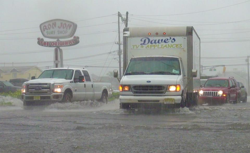
The leftovers of Nicole move into the region Friday and bring a warm rain to the area, which is expected to last through Saturday.
Amanda Oglesby is an Ocean County native who covers Brick, Barnegat and Lacey townships as well as the environment. She has worked for the Press for more than a decade. Reach her at @OglesbyAPP, aoglesby@gannettnj.com or 732-557-5701.
This article originally appeared on Asbury Park Press: Subtropical Storm Nicole could bring rain, sweep winter chill into NJ

