Summit, Portage counties trek closer to connecting popular paths via Freedom Trail
Two significant trails in Summit and Portage counties are being connected, linking two of the area’s largest universities and allowing Portage County to directly connect to the Ohio & Erie Canal Towpath Trail.
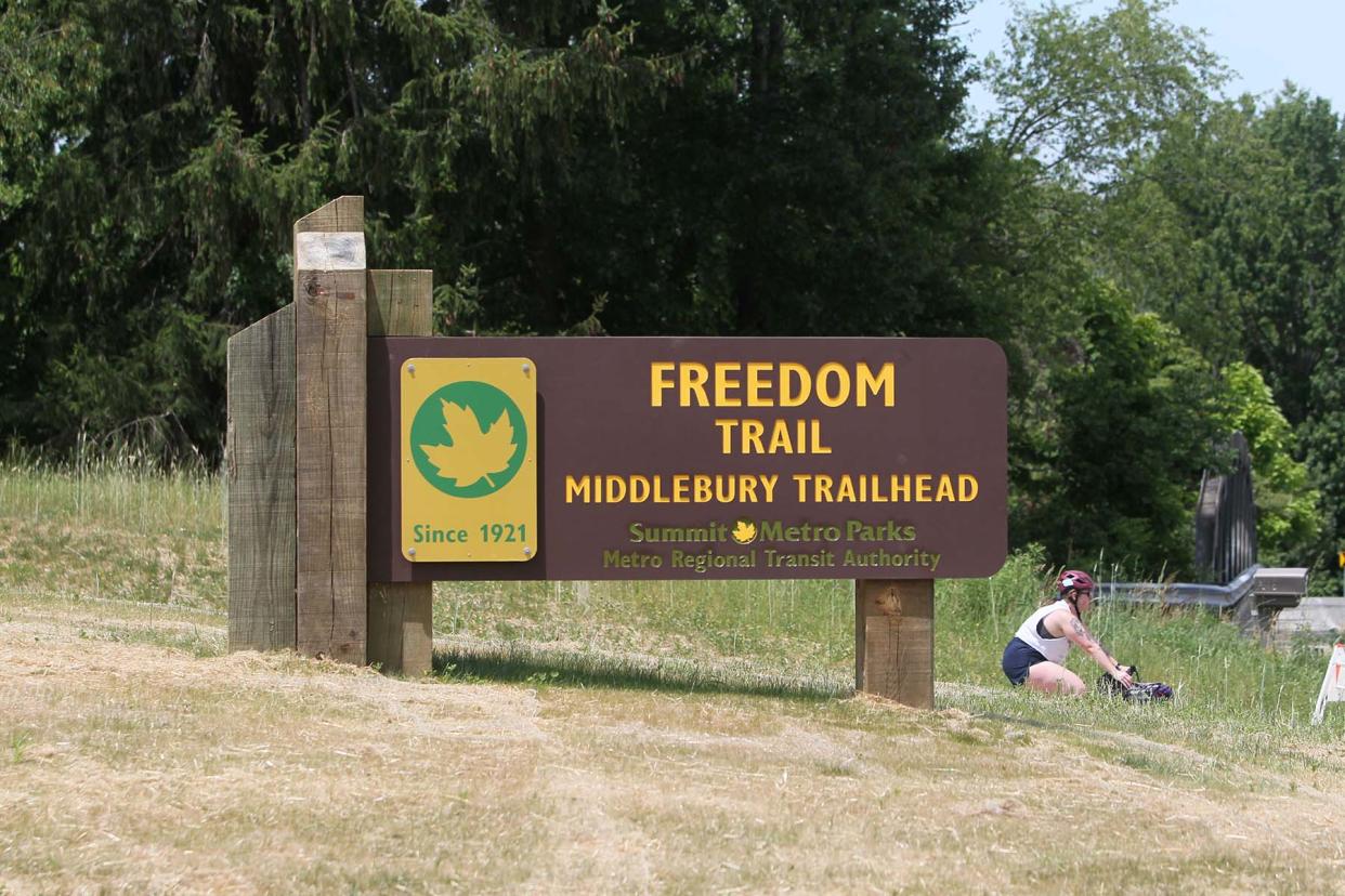
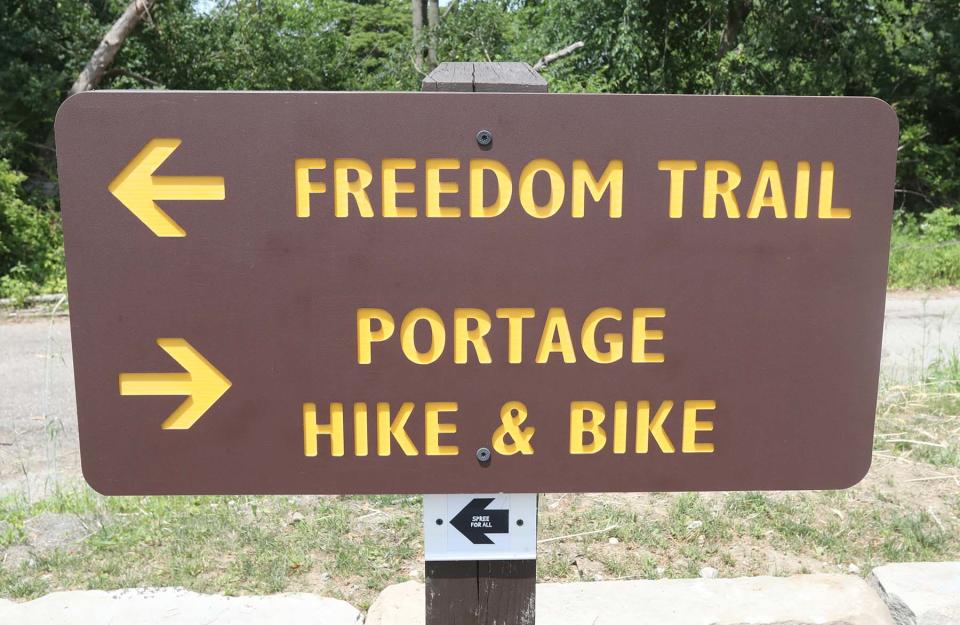
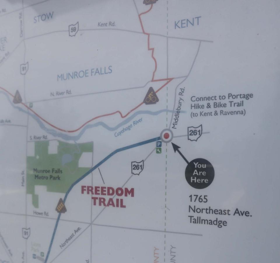
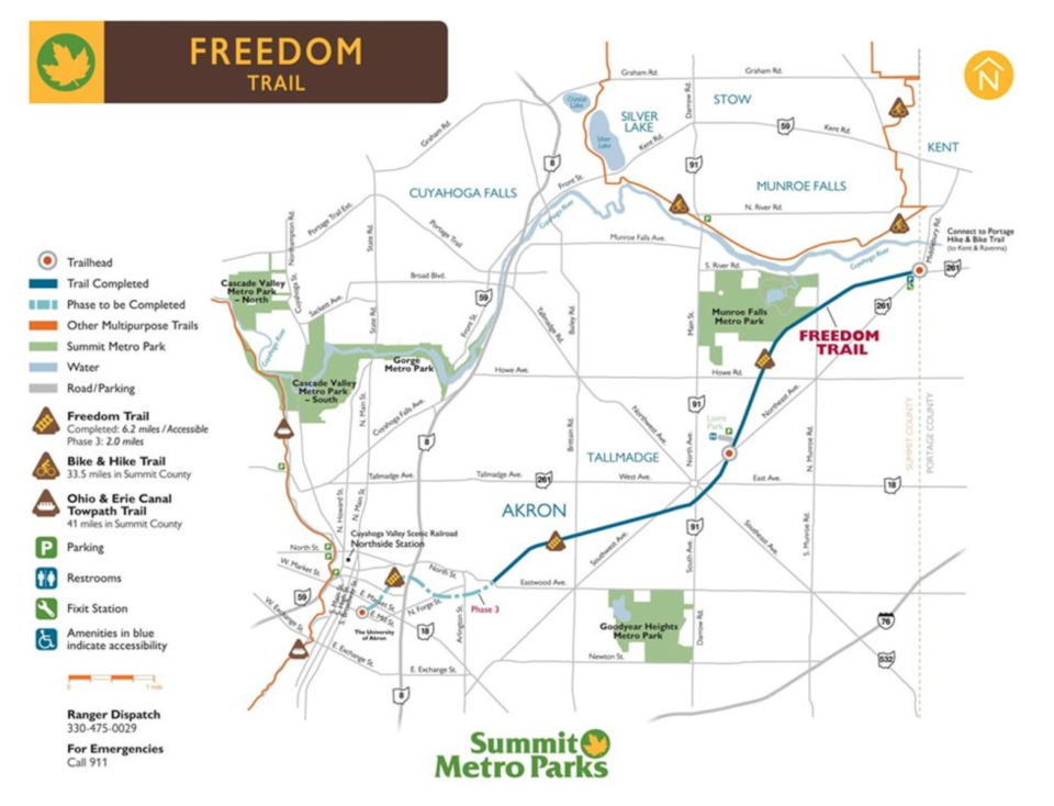
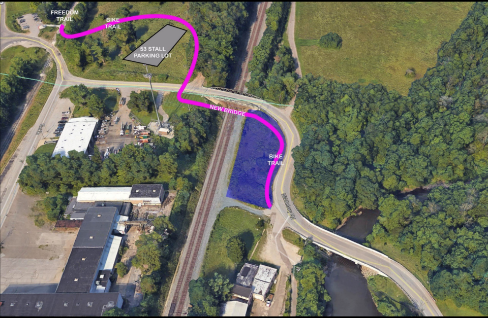
Summit Metro Parks plans to connect Summit County’s Freedom Trail from the trailhead at 1324 Middlebury Road — where Tallmadge, Stow, Brimfield Township and Kent meet, off state Route 261 — to Portage County’s seven-mile Portage Hike and Bike Trail.
Construction on the connection is slated to begin in the summer of 2023 and is expected to last about six months. The work includes a bridge over an existing CSX railroad line and a switchback-style path over the grade change between the two trails.
The Portage section starts west of Peck Road in Ravenna and runs through Ravenna, Ravenna Township and Kent, providing access to Towner’s Woods and Chestnut Hills Park.
“I think there was always a vision that we would connect it to the Portage,” Summit Metro Parks brand manager Lindsay Smith said of the Freedom Trail. “A lot of the challenge with that had been figuring out a safe way to make that connection because with the nature of the area, it just wasn't something where we could just send people across the street. It just wouldn't have been a safe enough connection to make. So the solution they came up with addresses that, and we’re finally to the point where we're able to do that.”
The total cost of the connection project is projected to be $1.75 million. The funding includes a $700,000 grant from the Akron Metropolitan Area Transportation Study. The rest will be funded by Summit Metro Parks, which is still looking for additional grant funding for the project.
The Freedom Trail, which follows an unused railroad corridor, has been an ongoing project for more than a decade.
A rails-to-trails multipurpose trail conversion, the trail begins at the Portage County line and is currently rideable to Union Street in Akron. The bulk of it is located in Tallmadge.
Construction on the Freedom Trail began in 2011, with the first phase being 4.2 miles. The second phase was 2 miles, the third phase was 1.8 miles and the fourth phase will be 1.4 miles. When it’s done, the Freedom Trail will be 9.4 miles long. In total, the project cost is about $3 million over more than a decade.
The third phase is expected to be completed this July. Smith said the third phase has been “mostly done for quite a while” but was held up for more than a year due to a land ownership dispute involving a stretch between East Market and Mill streets.
The entire trail is built on land owned by Akron Metro Regional Transit Authority, with the park district having an agreement with the transit agency to construct the trail. There was a dispute on whether Metro RTA or rail transportation company CSX owned the piece of land. After a study, it was determined Metro RTA owned the land, and the project was able to continue moving forward.
Construction on the fourth and final phase — which will allow riders to cross from Downtown Akron to connect to the Ohio & Erie Canal Towpath Trail near the Spaghetti Warehouse on South Main Street — will start next summer.
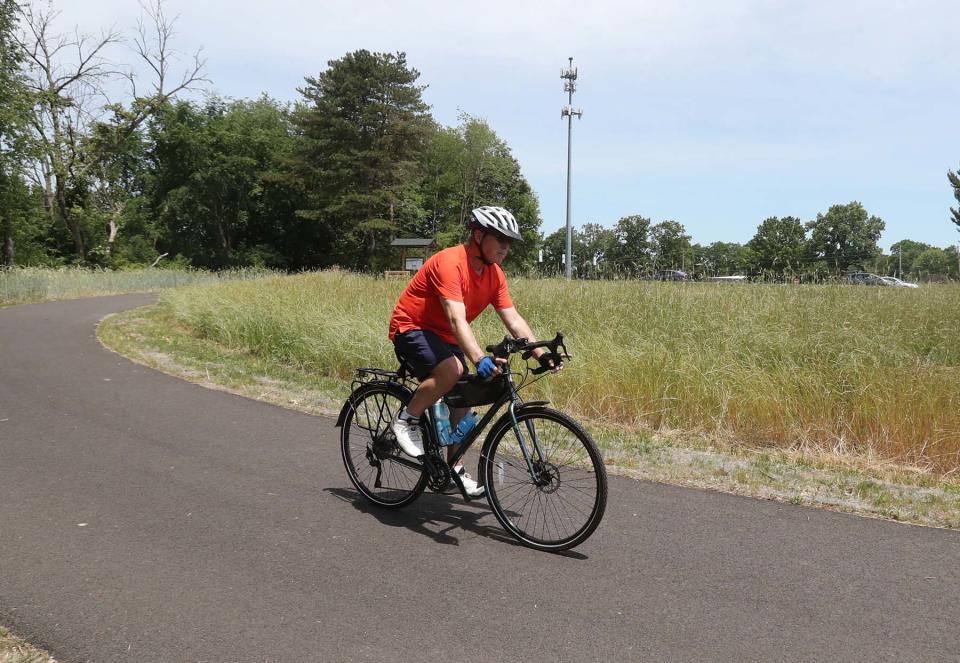
“Phase four will connect the Freedom Trail to the Towpath Trail, which is really exciting because as often as we can, Summit Metro Parks is looking for ways to connect trails because that's what our visitors tell us they really want, so it gives people a lot of options, even when it comes to commuting,” Smith said. “We've had a lot of folks share interest for using trails as an alternative way to get around, and making that connection connects to very major trails in a way that is very useful for our visitors.”
To view project renderings of the connection between the Freedom and Portage trails, or to provide feedback on the project, visit summitmetroparks.org/project-updates.aspx.
Contact Beacon Journal reporter Emily Mills at emills@thebeaconjournal.com and on Twitter @EmilyMills818.
This article originally appeared on Akron Beacon Journal: Summit Metro Parks plans to connect Summit, Portage counties via Freedom Trail

