Sunday storms knock down trees and power lines as the region's 'second' severe weather season arrives; frost possible later this week
Sunday's severe thunderstorms across southern Wisconsin are typical for this time of year when warm, humid summertime air collides with colder air moving in during the transition to fall, a meteorologist says.
While June, July and August are the peak seasons for thunderstorms in southern Wisconsin, September-October is sometimes referred to as the region's second severe weather season as the approach of fall brings clashing air masses that generate storms.
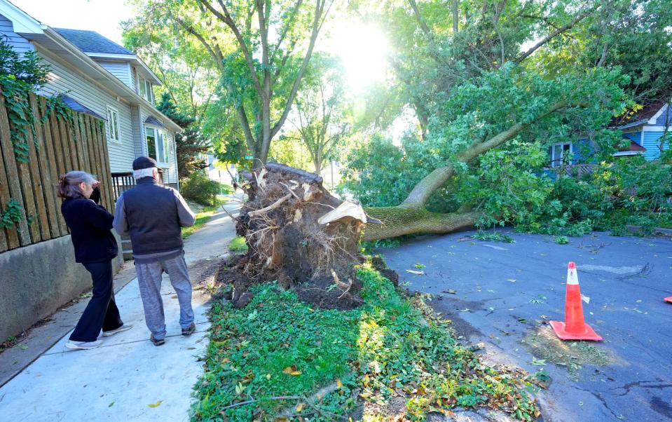
That's precisely what happened on Sunday. The fast-moving storms brought 60 mph wind gusts and knocked down trees and power lines across the region.
"We have the cool air trying to exert its influence and we still have lingering warmth, instability and moisture," said Paul Collar, a meteorologist with the National Weather Service in Sullivan.
"You do get these situations where you have a cold front and you can have strong to severe storms occur as a result as fall tries to take hold," Collar said. "Anytime you are talking about transition seasons, spring and fall, you're setting up the potential for (severe storms) to affect the area."
The transition on Sunday was abrupt.
The high temperature in Milwaukee was 68 degrees when the storms began to move through during the late afternoon.
By midday Monday, it was only 55 degrees in Milwaukee and there was a wind chill making it feel like it was about 50.
Milwaukee public works crews busy
Crews from the city of Milwaukee Department of Public Works answered dozens of calls after the storms moved through, said Brian DeNeve, a spokesman for the department.
Crews were continuing to respond to calls on Monday. "Calls continue to come in for mostly broken branches that we continue to address with forestry crews," DeNeve said.
As of 9:30 a.m. on Monday, city crews had responded to 80 calls for damage to at least 93 trees in the city.
"Most of the damage was broken branches, but we did have 11 trees down requiring immediate removal," DeNeve said.
Another 22 trees were damaged badly enough that they had to be cut down.
Storms knock out power
About 500 We Energies customers remained without power at midmorning on Monday.
Shortly before 6 p.m. Sunday, the storms made their way from northwest to southeast, moving through an area that included Dodge, Columbia, Sheboygan, Fond du Lac, Jefferson, Waukesha, Ozaukee, Washington, Milwaukee and Walworth counties. The storms leveled trees across the region before exiting the area and moving out over Lake Michigan.
As of about 7:40 p.m. Sunday, 24,226 Wisconsin We Energies' customers were out of service, according to the company's outage map.
Alliant Energy and the Wisconsin Electric Cooperative Association were each reporting fewer than 200 outages at midday on Monday.
There were no immediate reports of injuries as a result of the storms.
Frost possible on Tuesday, Wednesday
The storms brought much cooler air into the region and will likely lead to the first frost of the season.
The forecast calls for areas of frost overnight Tuesday night into early Wednesday in Milwaukee and southern Wisconsin. The forecast low for Milwaukee on Tuesday is 36 degrees.
There are also chances for frost overnight Wednesday into early Thursday.
Look for warm air to then move back into the region for the upcoming weekend, with a high temperature of 68 to 70 degrees on Saturday and Sunday.
Storms packed a punch
The storms that moved through on Sunday knocked down trees and power lines throughout the region.
Wind gusts of 60 mph were common across southern Wisconsin.
Here's a look at some storm damage reports compiled by the National Weather Service:
Milwaukee County
6:16 p.m. Numerous reports of downed trees and large limbs snapped in Wauwatosa.
6:24 p.m.: 60 mph wind gust reported in Milwaukee.
6:25 p.m.: Numerous reports of trees down and large limbs snapped in Milwaukee's Bay View neighborhood. Some streets were blocked.
6:30 p.m.: A fallen tree was reported on top of a car on Milwaukee's south side.
Washington County
5:45 p.m.: 911 call center reported numerous trees down and blocking roads across northern and central Washington County.
5:54 p.m.: A trained storm spotter reported a 5-foot diameter tree was uprooted and fell on a house near West Bend.
Waukesha County
6:05 p.m. Report of a large tree snapped near Delafield.
6:10 p.m. Report of a large tree uprooted and blocking a road in Waukesha.
6:20 p.m.: Trained weather spotter reports 60 mph wind gust in New Berlin.
Fond du Lac County
4:50 p.m.: 911 call center reports numerous trees down in Ripon.
5:08 p.m.: 911 call center reports numerous trees down in Fond du Lac.
Jefferson County
6:05 p.m.: National Weather Service office in Sullivan measured a 50 mph wind gust.
6:20 p.m.: 911 call center reported downed trees and power lines across Jefferson County, including Ixonia, Lake Mills, Waterloo and Palmyra.
Lake Michigan
The storms continued out over Lake Michigan. At 7:30 p.m., a buoy 35 miles east of Racine recorded sustained winds of 40 mph and a gust of 56 mph.
Our subscribers make this reporting possible. Please consider supporting local journalism by subscribing to the Journal Sentinel at jsonline.com/deal.
DOWNLOAD THE APP: Get the latest news, sports and more
Contact Joe Taschler at (414) 224-2554 or jtaschler@gannett.com. Follow him on Twitter at @JoeTaschler or Facebook at facebook.com/joe.taschler.1.
This article originally appeared on Milwaukee Journal Sentinel: Sunday storms packed a punch as severe weather hit Wisconsin

