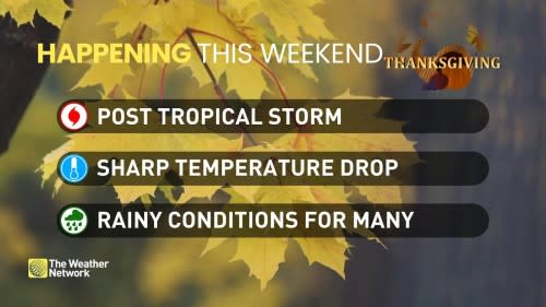
Sunshine, snow, and a post-tropical storm all on deck this Thanksgiving weekend

As the turkeys begin defrosting and Thanksgiving weekend draws closer, the forecast for the long weekend becomes clearer.
Western Canada will be bathed in sunshine and experience close to seasonal temperatures whereas parts of eastern Canada will see drastically cooler temperatures rain, and a potential for snow.
Atlantic Canada can expect to see impacts from post-tropical storm Philippe throughout the weekend.
Visit our Complete Guide to Fall 2023 for an in-depth look at the Fall Forecast, tips to plan for it and much more!
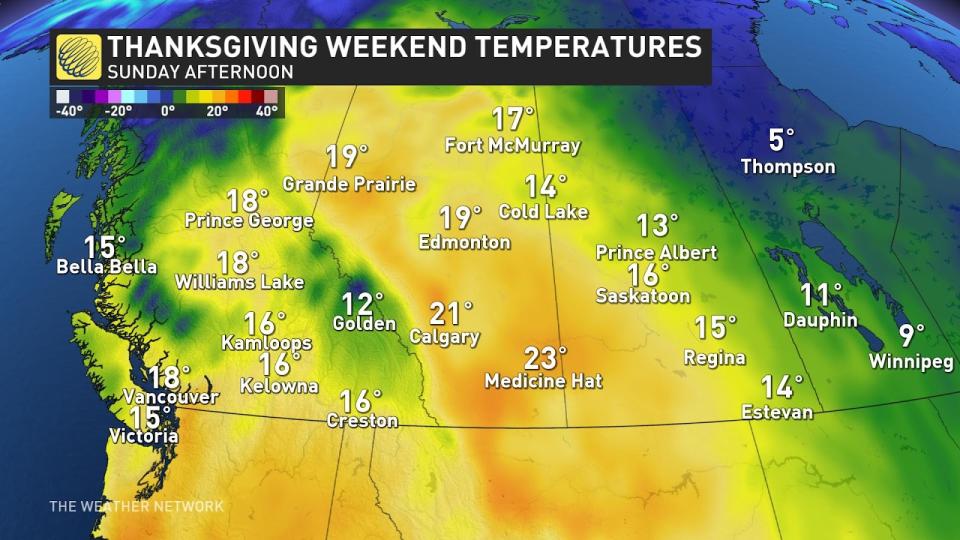
Western Canada
For most of western Canada, a ridge of high pressure will keep everyone warm and dry to start the weekend. An abundance of sunshine and close-to-seasonal temperatures will be felt across British Columbia, Alberta, and Saskatchewan.
Daytime highs are expected to be in the upper teens and low 20s for many areas. A pattern change will begin to unfold on Monday across the southern coast of British Columbia. Vancouver Island and the lower mainland can expect heavy rain through Monday.
SEE ALSO: Polar vortex may bring snow to the Prairies, pattern switch into the weekend
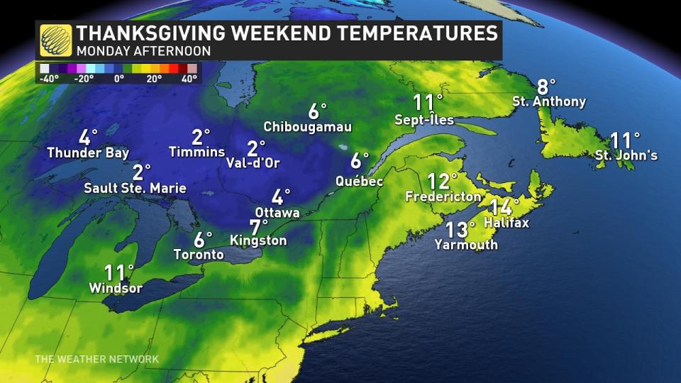
Eastern Canada
Ontario and Quebec will have a lobe of the polar vortex pay a visit over Thanksgiving weekend. This means a piece of the coldest air on the globe will become dislodged from the northern parts of Canada and sink south.

Daytime highs this weekend will be drastically different than what we have seen this past week. Ontario will see the coldest air settle into the region on Sunday and Monday, with daytime highs in Toronto barely reaching double digits and low single digits before wind chill will be felt in the northeastern part of the province.
MUST READ: Polar vortex to replace Canadian heat with chill, snow
Lake effect showers will be possible and snow in northeastern Ontario will be falling. The warm surface will keep much of the snow from accumulating, so stay tuned to The Weather Network for the latest on amounts.
Atlantic Canada
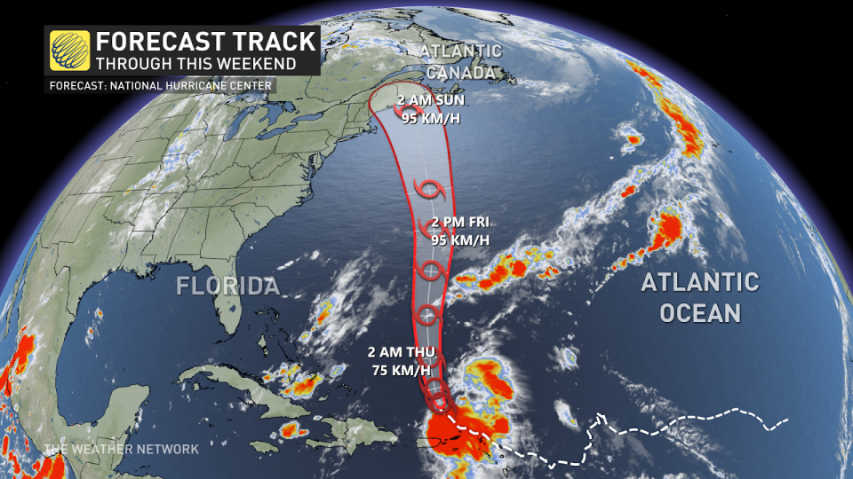
Philippe will move northward toward Atlantic Canada on Thursday and Friday hovering around category one hurricane strength. Once it moves into colder waters, it will be deemed post-tropical and its wind field will expand.
Atlantic Canada will be impacted by post-tropical storm Philippe on Saturday.
Many areas across Nova Scotia Prince Edward Island and New Brunswick will be experiencing 90 km winds Saturday through Sunday.
SEE ALSO: Tropical Storm Philippe could make a Thanksgiving appearance in Atlantic Canada
Stay tuned to The Weather Network for forecast updates across Canada.

