'Super' El Niño is here. What does this mean for our weather? And what happens next?
The current El Niño climate pattern has now attained "historically strong" status, federal scientists announced. They also predict that its counterpart, La Niña, will develop in its place later this year.
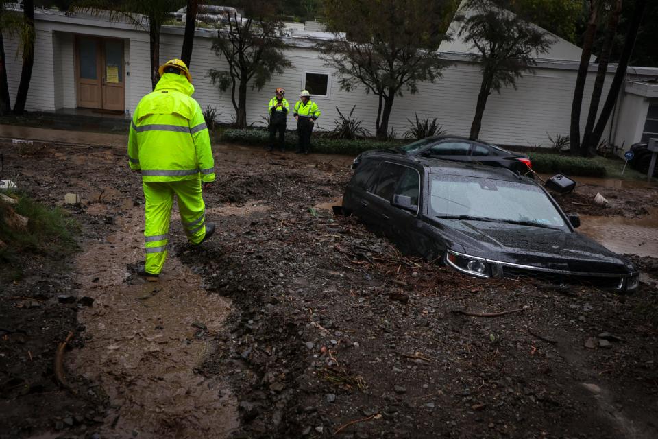
Both climate patterns have dramatic effects on weather and climate in the U.S. and around the world. A typical wintertime impact of strong El Niños is storminess across the southern tier of the U.S., from California to Florida.
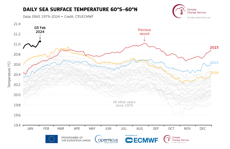
The warmth from the strong El Niño, colloquially called a "super El Niño" coupled with climate change, also helped to boost global temperatures in 2023, as the year ended up as the warmest since accurate weather records began in the late 1800s.
El Niño's US impacts to continue through April
As the transition to La Niña occurs, El Niño will weaken, but its impacts on U.S. weather are expected to persist through April, the Climate Prediction Center said in a statement Thursday. This usually translates into more storminess for the southern tier of the nation, all the way from California to Florida. It also means warmer-than-average temperatures for much of the USA's northern tier.
El Niño also could lead to an increased chance of above-normal tornado activity in central and south Florida over the next couple of months.
Overall, El Niño’s influence on the U.S. is most notable in the late fall through spring, NOAA said.
Record warmth in January
Global climate data from January is starting to roll in, and the streak of record-warm months continued: According to the Copernicus Climate Change Service, "January 2024 was the warmest January on record globally."
"This is the eighth month in a row that is the warmest on record for the respective month of the year," the service added in a statement.
Data from NASA also showed that January saw record-warmth around the world.

Could La Niña mean more hurricanes?
And worryingly for later in the year, once La Niña takes hold, that pattern often helps to boost hurricane activity in the Atlantic Ocean, Colorado State University meteorologist Phil Klotzbach posted on X Thursday.
But he added this caveat: "It should be noted that it's only February, and a lot can change between now and when the Atlantic hurricane season really ramps up (typically in early to mid August)," Klotzbach said.
If La Niña does develop, "it may also have a heavy hand in the weather forecast for the United States next winter," according to AccuWeather meteorologist Brian Lada. "It generally results in a dry and mild winter in the South, a colder winter in the Northeast and frequent storms in the Northwest, although it is still too early to make the call on what next winter will bring."
What is El Niño?
El Niño is a natural climate pattern in which sea surface temperatures in the central and eastern tropical Pacific Ocean are warmer than average. It occurs, on average, every two to seven years.
Its name means "the little boy", or "Christ child" in Spanish. El Niño originally was recognized by fishermen off the coast of South America in the 1600s with the appearance of unusually warm water in the Pacific Ocean around Christmas.
The entire natural climate cycle is officially known as El Niño – Southern Oscillation, called ENSO by scientists. The cycle swings between warmer and cooler seawater in a region along the equator in the tropical Pacific. La Niña is marked by cooler-than-average ocean water in the region.
This article originally appeared on USA TODAY: 'Super' El Niño is here, but La Niña is on the way, forecasters say

