Another day of storm potential on the Prairies as pattern holds on
An unsettled pattern across the eastern Prairies will stay put as we round out the final days of May. This means a daily threat for thunderstorms for the foreseeable future, with the severe risk in southeastern Saskatchewan and southwestern Manitoba.
People in these regions will want to be weather-aware and stay tuned for updates Sunday and Monday.
Visit The Weather Network's wildfire hub to keep up with the latest on the active start to wildfire season across Western Canada.

The robust Rex block that’s bringing quintessentially summery weather to Ontario will continue sparking a risk for severe thunderstorms on the Prairies this weekend.
A series of disturbances running against this stubborn high will combine with a flow of unstable air drifting north from stateside, fuelling a continued risk for potent thunderstorms across the eastern Prairies.
A stormy, summer-like outlook
As the ridge of high pressure remains locked in place over the Great Lakes, any developing systems stateside will continue to feed moisture and heat toward the southern Prairies heading into the weekend.
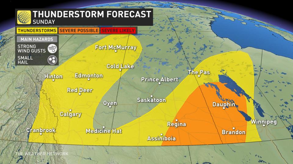
All three Prairie provinces will need to keep their eyes to the sky on Sunday. The initial low-pressure system, which is in no hurry due to the stagnant pattern, will continue to foment a risk for severe thunderstorms in portions of Saskatchewan and Manitoba on Sunday.
Farther west, a sinking front will trigger some active weather in Alberta through the afternoon and evening hours.
Check back with The Weather Network in the coming days as details on the storm threat become clearer, especially if your plans take you outdoors this weekend.

Summer-like heat will keep daytime highs in the upper 20s and low 30s through the long range, especially in southern Manitoba. The combination of heat and an active pattern will keep the risk for storms in the forecast for several days, again primarily focused on southern Saskatchewan and Manitoba.
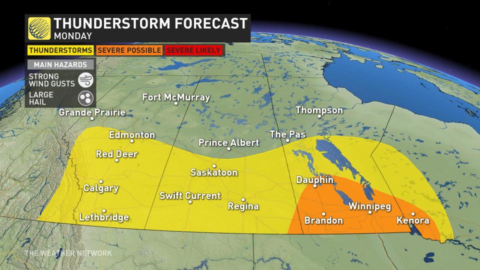
The threat for storms will continue on Monday, as well, with the severe potential shifting east to cover southern Manitoba and parts of northwestern Ontario.
Prepare
Stay alert and monitor the forecast for updates. Have a plan and a place to head indoors if the weather changes.
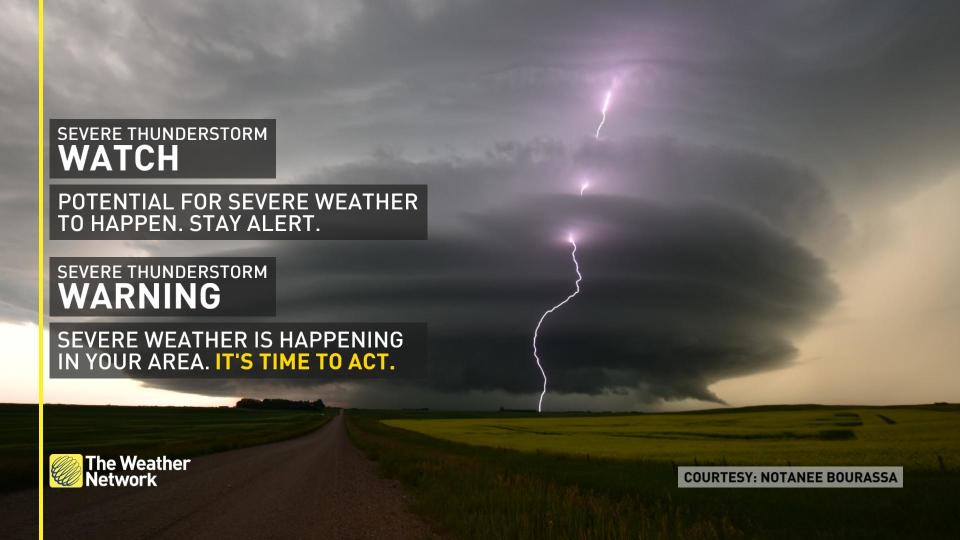
Watches mean conditions are favourable for the development of severe thunderstorms.
Warnings mean they are imminent or occurring in your area.
Thumbnail courtesy of Notanee Bourassa, taken in Chamberlain, Sask.
Stay tuned to The Weather Network for more forecast updates on the Prairies.

