Taking the scenic route step by step along Worcester's East-West Trail
WORCESTER — When I first heard about a 14-mile hiking trail across Worcester, the city that has been my home for nearly three years, I knew I wanted to make an attempt to give it a go at least once.
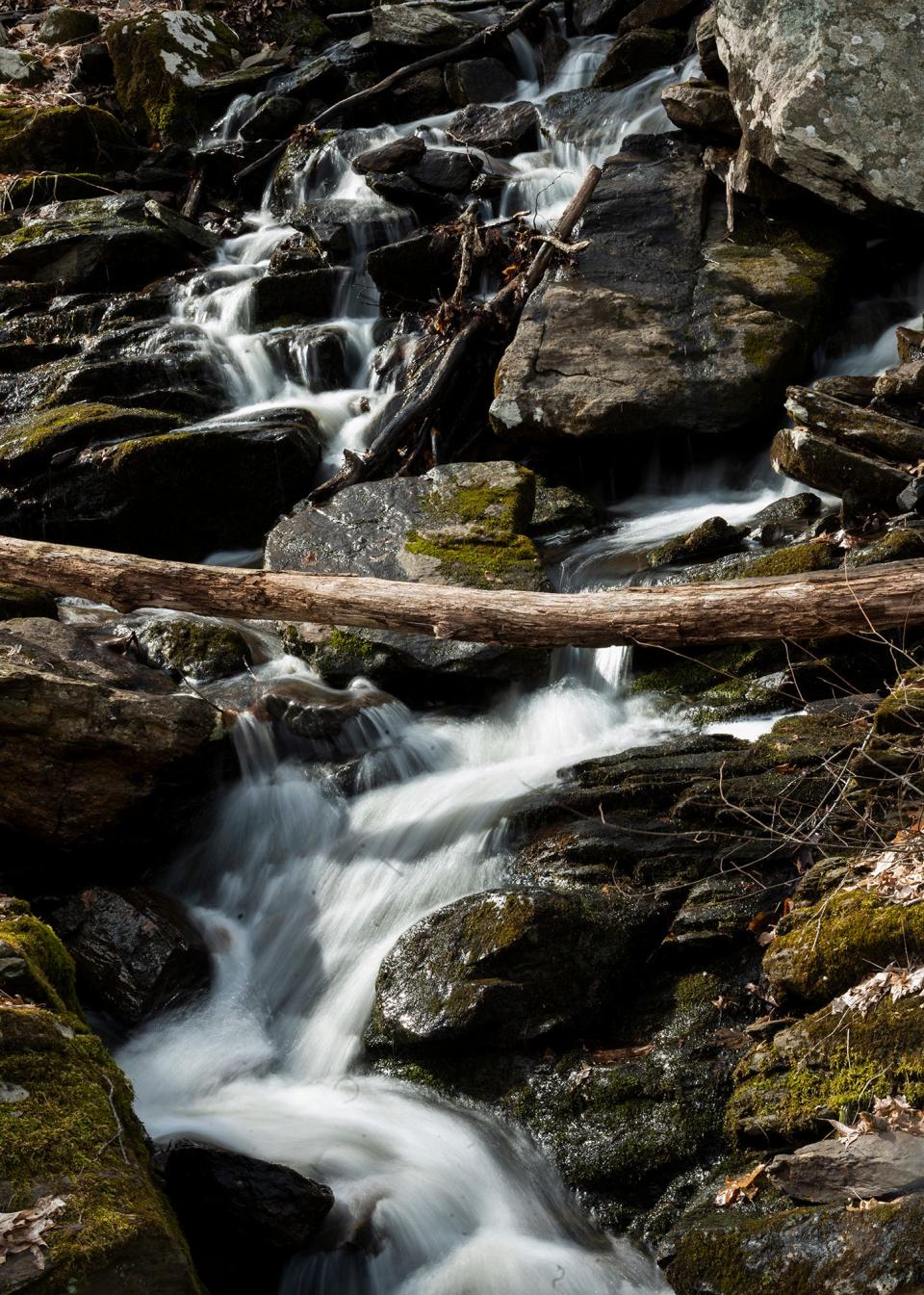
I got most of the way there Thursday, walking more than 12 miles of the East-West Trail before the early sunset got the better of me and I faced the possibility of hiking through the Cascades in the dark.
I've never considered myself much of an outdoors person. I grew up in the Miami-Dade area in Florida and largely stuck to the county's urban destinations to kill time. However, I have been a relentless pacer since I was a child and I have started to hike a bit more to burn some of the excess energy I accumulate over the week.
More: Meet the T&G's lead political reporter, Marco Cartolano
Perhaps out of a desire to break free from a routine dominated by the recently finished municipal election and city politics, I decided to spend a full workday making this trek.
After all, covering several five-hour City Council meetings must count as some form of endurance training.
My legs may be a little sore as I write this story the day after my trek, but I gave myself my own walking tour of much of the city and got to see both its history and its changing face.
According to the trail's website, the concept that birthed the East-West Trail has been discussed by green space advocates since around 2001. In 2015, Rick Miller, former Park Spirit president, and Colin Novick, executive director of the Greater Worcester Land Trust, presented the concept to Park Spirit's board of directors, which voted unanimously to allocate funds.
The following spaces are part of the trail: Coal Mine Brook, Trinity Woods, Green Hill Park, Grant Square Park, Rural Cemetery, Institute Park, Salisbury Park, Newton Hill at Elm Park, Beaver Brook Park, Hadwen Arboretum, Knights of Columbus Park, Columbus Park, Coes Park, John J. Binienda Memorial Beach, Tetasset Ridge, John W. Spillane Field, Boynton Park, Cascades West, Cascades Park and Cascading Water.
The trail is connected through several city streets including residential, commercial and industrial portions of the city.
In 2021, new directional signs and kiosks were added to the trail.
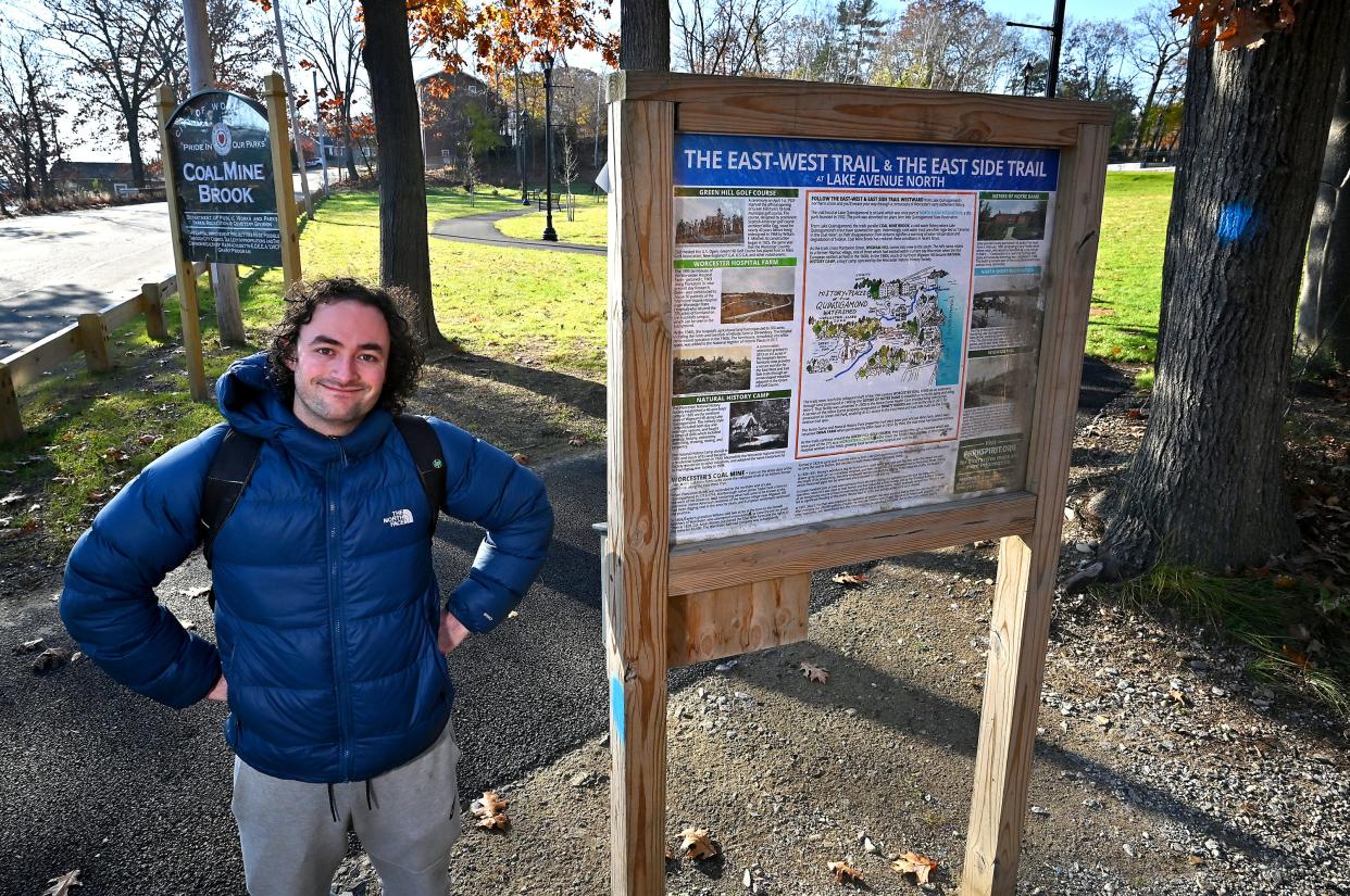
I started my trek at around 9:30 a.m. at the marker in Coal Mine Brook that is the official start of the trail from the eastern portion. I did the trek on my own, carrying a backpack with food, water and other essentials.
After marveling at the pretty stream at Coal Mine Brook, I soon met my first real challenge. Facing a busy Plantation Street, I miraculously made it to the other side of Coal Mine Brook without becoming roadkill.
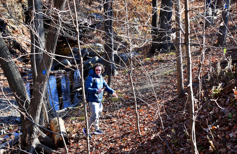
The trail from Coal Mine Brook to Green Hill Park that makes up much of the first leg of the trail has plenty of uphill portions to be a workout, but the fall colors and the quiet were a nice change of pace from downtown, where I live and work.
I had previously hiked at Coal Mine Brook around the summer, but the humidity kept me from making it too far. Thursday had perfect fall weather, sunny but cool enough to spend hours outside. Later on, I was even able to shed my jacket.
When I got out of the woods near Green Hill Park, I came face to face with a more urban portion of the trek as I spent a few minutes puzzling over the markers in the Green Hill neighborhood. I eventually accepted my natural lack of direction and stuck to the map I had downloaded as I walked through the neighborhood and the small Grant Square Park.
As I walked the urban parts of the trek, I learned that I had strong feelings about walking spaces. I never felt more overjoyed to see a sidewalk than after portions through streets that were rougher on my feet.
I made my way through to Lincoln Street and began to approach downtown before I headed to Prescott Street and walked past some WPI buildings and old industrial sites.
As I walked past those industrial sites, I began to recognize buildings that I've covered in stories. I saw the old Washburn-Garfield building, which was the subject of an article I wrote the prior day because it was recently sold.
I saw the logo from Massachusetts Biomedical Initiatives' biomedical center. I covered the center's groundbreaking in 2022 and have written about the growing life sciences industry in Worcester.
As someone who moved to Worcester as a young adult, it can be hard for me to fully appreciate the changes to decades-old buildings and institutions that I only became familiar with after I got an assignment.
Walking through a historical manufacturing sector where a newer life sciences industry is beginning to take root made that change feel all the more real to me.
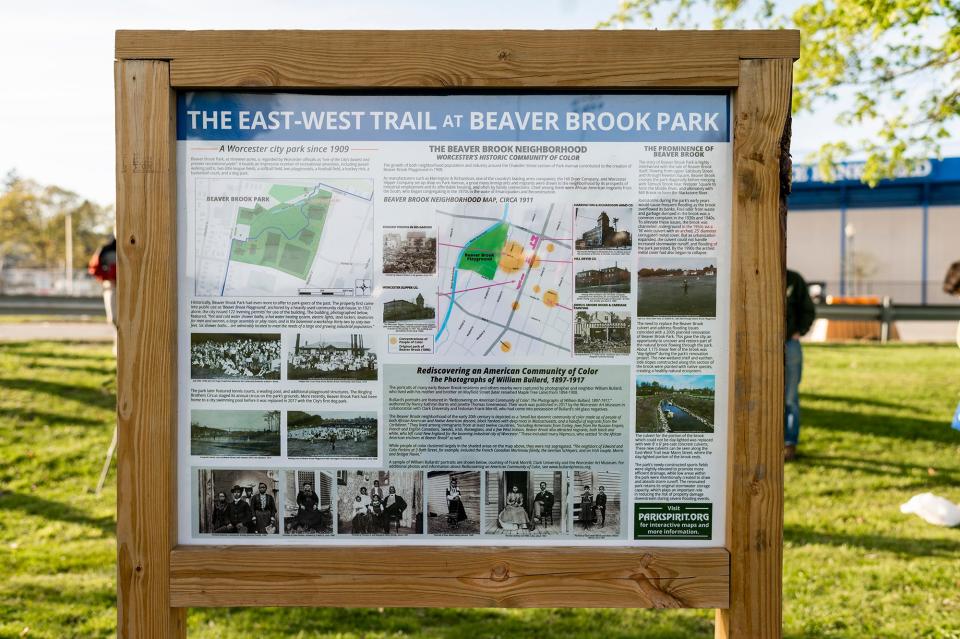
I also felt I was in the physical presence of change when I walked past the construction site for the new Doherty Memorial High School, saw the last campaign yard signs that had not been picked up yet and walked past a field at Beaver Brook Park that still carries a logo from Tim Murray's time as mayor.
I especially felt the impact of change as I walked through a solid portion of Mill Street. It's a street I have come to know all too well these past two years as I drove through it to see a partially collapsed apartment building, confirmed sighting of demolition signs at the former Big D supermarket site and made notes of the street's controversial lane redesign less than a week before my hike.
Whenever I weaved back to the green spaces, I saw much of what Worcester had to offer. I made the uphill climb to Bancroft Tower and Newton Hill, marveled at the beauty of Coes Pond and felt like I was in a horror movie when I got to Tetasset Ridge in the late afternoon and was greeted by bare trees.
Occasionally I lost the path and had to do my best to get back on the trail, but I felt safe when I was in the woods.
However, my trek had to end a little short of my goal as I made a stab at continuing on the path through Boynton Park and was forced to accept I did not have the visibility I needed by 5:20 p.m.
While I don't see myself doing the full 14 miles again in the near future, I intend to finish that last portion when I get the chance.
This article originally appeared on Telegram & Gazette: Worcester East-West Trail shows nature, history along 14-mile route

