Talk About Woodville: Portage River earns its name
The summer-like temperatures in the forecast almost guarantees kayaks and canoes will be pulled out of storage for the first launch of the season this weekend.
I have lived across the road from the Portage for 30-plus years and have seen hundreds of people paddling downriver. I’ve often heard “thunk thunk, scrape scrape, grumble grumble grumble,” the sound of small boats being dragged across the rocks when the river is so shallow one has no choice but to get out and carry, or portage, their boat to deeper water. Hence, the reason for the river’s name.
A shiny new blue sign has been installed at Trail Marker Park on the west side of Cherry Street, along with another sign high up on a pole at the river’s edge. The signs are part of the recently designated Portage River Water Trail, and indicate the park is an access point.
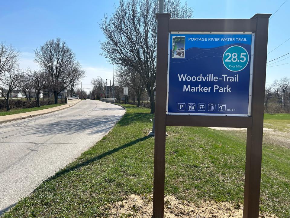
After several years of planning, the Ohio Department of Natural Resources (ODNR) and the Ohio Division of Wildlife announced the designation of the water trail in 2022. It begins at William Henry Harrison Park in Pemberville and ends at Lake Erie Beach in Port Clinton. The water trail is 36 miles long, with Trail Marker Park at the 28.5 mile marker.
Reach the rapids at Opfer-Lentz bridge, and 'you better have your lifejacket on
Jim Taylor lives on the Portage River and has been kayaking for 15 years. He has gone from New Rochester to Oak Harbor, although not all in one day, and enjoys the serenity of the river and all of the wildlife, especially the bald eagles. Taylor’s favorite trips are when the river is high enough to be in his backyard and he’s heading to Elmore.
“Once you reach the rapids at the old Opfer-Lentz bridge, the fun begins and you better have your lifejacket on.” Taylor said. “Immediately after that is the dam, which is followed by rapids before and directly after the turnpike bridge.”
Last year, one of Taylor’s friends was sucked out of his kayak at the rapids when he chose the path to the right. By the time they returned to Taylor’s house, the river had gone down enough that it was no longer in his yard, which Taylor described as creating “a toilet bowl flushing effect on the rapids.”
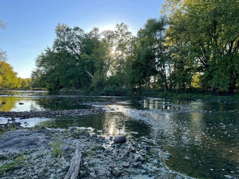
Even though I’ve lived so near the Portage for so long, it was just last year I took my first kayak trip. The wildlife along the river is fascinating with the wide variety of birds, from waterfowl to songbirds, turtles sunning themselves on logs and deer wading across the river. I’ve even seen a fawn pick its way along the riverbank and mink running along the shoreline.
River from Woodville to Elmore is 'a blast'
Woodville resident Brian Spieldenner, who also lives on the river and has worked the last five summers as a river guide for the Portage River Paddling Company in Port Clinton, has kayaked every section of the river from Pemberville to Lake Erie. Like Taylor, his favorite also is the Woodville to Elmore segment.“Everybody smiles when they get out of a kayak,” Spieldenner said. “Even the lady who lost her paddle and had to be towed back to the paddling company. When the river is up a bit, it’s a blast.”
A note of caution, only experienced kayakers should try navigating that section when the river is up and flowing fast.
Copies of the official Portage River Water Trail Map and Guide, published by the ODNR and Division of Wildlife, are available online and at the Woodville Public Library. Water levels can be checked with an app such as Rivercast or online at waterdata.usgs.gov.
And finally, a bit of advice if you’re planning to travel any part of the river between Pemberville and the bridge at Ohio 590 … take a moment to check water levels at the low spots. If you see rocks, you may want to start your trip further downstream. Unless, of course, you enjoy carrying your kayak as a form of exercise. Remember to take sunscreen.
Bridge improvements coming
The Sandusky County Engineer recently inspected bridges throughout the county and has determined the Cherry Street bridge is in need of repair or replacement within the next two years. Weight limit signs have been placed at either end of the bridge.
No schedule has been set yet for work on the bridge, but in the meantime, the weight limits mean larger vehicles will need to travel Main Street to access the south side of the river. This also means the Fourth of July Committee will have to make a few changes to the lineup and start of the parade this year. Details on that will be shared in a future column.
Annual Road Clean-up
The Woodville Buckeyes 4-H Club and Troop Woodmore Boy Scouts will pick up trash along Woodville’s township roads on Sunday. Please slow down if you see these young people cleaning up litter.
Red Cross blood drive
The next Red Cross blood drive will be noon-5 p.m. April 27 at the Woodville Township Fire Station. Appointments can be made at www.redcrossblood.org or by calling 1-800-RED-CROSS.
Contact Rene Dix at 419-307-0914 or via email at rene.dix@email.com.
This article originally appeared on Fremont News-Messenger: Talk About Woodville: New signs mark Portage Rivere Water Trail

