Should taxpayers buy Revolutionary war land slated for warehouses? Monmouth County might
Monmouth County might buy the Upper Freehold farmland tied to the Revolutionary War that is caught in the crosshairs between residents who want the land saved and a developer who owns it and wants to build two warehouses on it.
On Monday, the Monmouth County Board of Recreation Commissioners made a motion to solicit professional services to have the property appraised. This comes after Andrew J. Spears, director of the Monmouth County Park System, wrote the developer to discuss preserving the land for recreation.
Monmouth County Commissioner Ross Licitra, who is the liaison to the county's park system, said county officials are very interested in the property, particularly with the 250th anniversary of the Revolutionary War coming up. Licitra told the Asbury Park Press earlier this month that they are doing "their due diligence," on it.
Seth Gerszberg, one of the principals of Active Acquisitions Upper Freehold (AAESUF), said they're 100% open and interested in any reasonable offer on the land. He said they have been contacted by local township and county officials regarding selling the land. According to county property records, the entity purchased the 60-acre farm for $15 million last year.
The land is in the Upper Freehold's Highway Development Zone, which permits warehouse usage, and to date has not had any historical preservation designation. As the land owner, AAESUF has developer rights to the property.
Greszberg said if they do develop it, they would be responsible stewards of the land and follow any binding mandates from state, county or local officials.
'I'm angry': Residents fight against Revolutionary War site becoming warehouses
In May, the owner submitted plans for two warehouses totaling close to 500,000 square feet and 108 loading bays for review to the township's Planning Board, the Monmouth County Planning Board, the Freehold Soil Conservation District and the state Department of Environmental Protection.
Residents of Upper Freehold and Allentown have been periodically staging protests on Route 524, or Old York Road as it is named locally, in front of the land in question. As of Wednesday 3,150 people have signed a petition against the proposed warehouse.
"This is exciting. I'm hopeful. We still have to stay organized but this is very big news," said Sue Kozel, the former vice chair of the Upper Freehold Historic Farmland Scenic Byway Committee and one of the residents leading the fight to save the land, regarding the news that the county is having the land appraised.
Opinion: Proposed Upper Freehold warehouse destroys NJ history — and our environment
The land is Block 26, lots 1, 2 & 3 on the Upper Freehold tax maps. The developer owns lots 1 and 3. Lot 2 is a 1.7-acre tract owned by private homeowner.
The homeowner has signed legal documents to allow the property to be used in the development, although the Asbury Park Press has not learned if the homeowner has sold the land yet to the developer. There was no change of deed on the land in the county's accessible online property records as of Wednesday nor was the land included in the lots the county will have appraised.
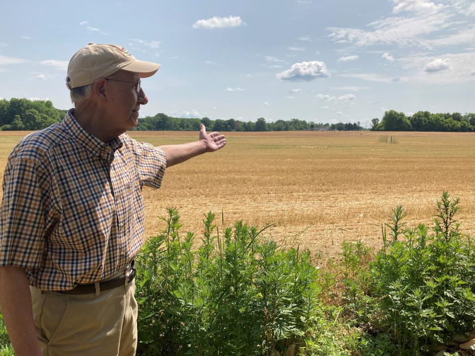
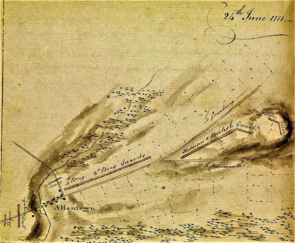
The land was part of a large Revolutionary War encampment of British soldiers that was spread out along Indian Run Creek in June 1778, just days before the Battle of Monmouth Courthouse. The creek runs from Allentown through the property in question in Upper Freehold. Historical maps show the encampment fronting near Old York Road.
More recently the property belonged to Edith Stein before it was purchased by AAEUF. Today portions of the land lie fallow while soy bean plants cover several acres.
'A theme park for flowers': Instagram-worthy sights at Holland Ridge Farms in Cream Ridge
Aside from the historical roots, residents are concerned the development will bring more trucks to town and pollute the Indian Run Creek. The warehouses could add 2,200 trucks and cars to the roadway here, according to the site plan's traffic study. Residents whose backyards back up to the farmland have also expressed concerns about losing their quality of life.
Land in tthe upper reaches of rural Monmouth County and neighboring Mercer County has come under increasing pressure from warehouse developers due to its key location on the Interstate 195 corridor.
Tolani Taylor, Clean Water Action N.J.'s zero emissions and warehouse organizer, wrote the Upper Freehold Township Committee earlier this month, urging it to do what it can to save the land. Taylor argued there are far too many warehouses in New Jersey already, plus abandoned buildings that could be repurposed instead of carving up farmland.
When Jersey Shore native Dan Radel is not reporting the news, you can find him in a college classroom where he is a history professor. Reach him @danielradelapp; 732-643-4072; dradel@gannettnj.com.
This article originally appeared on Asbury Park Press: Monmouth seeks price on Revolutionary War land slated for warehouses

