A new technique could help save the Mississippi River's floodplain forests: raising the forest floor
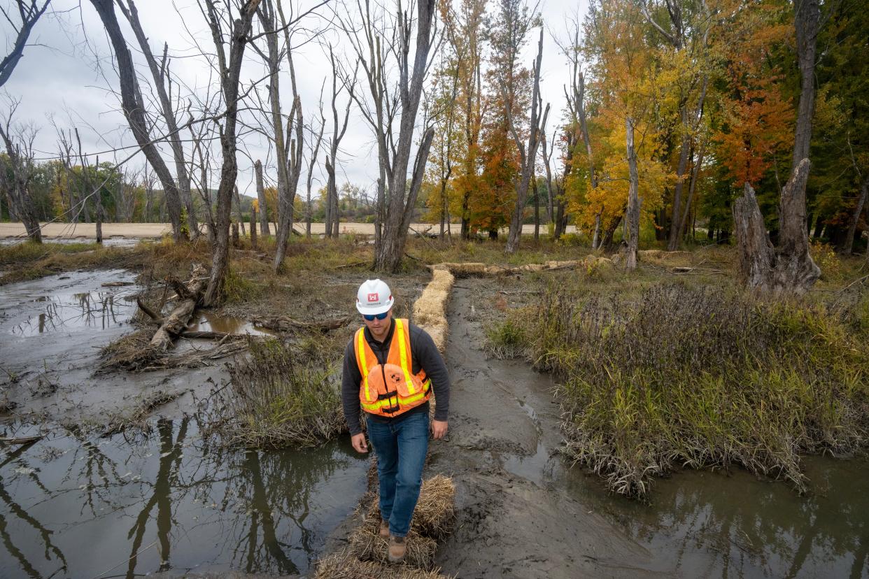
Near the bridge that connects Prairie du Chien with Marquette, Iowa over the Mississippi River, John Henderson walks over a long, man-made island of sand until he reaches its endpoint.
There, he gestures to the scene in front of him: a stand of silver maple trees, growing on a natural island in the slow-flowing backwaters of the river. As if someone had drawn a dividing line between them, the trees to the left are dead — killed by flooding a few years prior — while the others are alive.
Though it may look like nothing's happening, it's actually something of a construction site.
"It's sort of underwhelming," he said. "That's the point."
Henderson, a project manager for the U.S. Army Corps of Engineers' St. Paul District, and his team are gradually filling the area with sediment to raise the level of the ground by a few inches. Then they'll plant new trees on top — ones that can hopefully survive future flood events.
This technique is called thin layer placement, and while it's commonly used on the coasts to combat sea-level rise, this is the first time it's being used on the Mississippi River to restore the river's struggling floodplain forests. The pilot site is small and sits near McGregor Lake, an expansive river backwater between Wisconsin and Iowa.
The newness of the strategy means there are lots of unknowns, and Henderson said he and other Army Corps staff are just trying to learn what they can from the project. Their hope is that it's a less intrusive and more cost-effective way to restore the ecosystem — one that's personally important to many of them.
"Everyone who works on these projects grew up on the river," Henderson said. "We all want to do the best we can for it."
Prolonged flooding is killing off low-lying trees
Floodplain forests play a pivotal role in the river ecosystem – creating wildlife habitat, improving water quality, storing carbon and slowing flooding. The Mississippi River floods every year, and these trees are generally built to withstand that.
But in the last few decades, they've been overwhelmed with high water from long-lasting floods, soaking the trees more than they can stand.
More: What to know about floodplain forests, a struggling ecosystem on the Mississippi River
More: The Mississippi River's floodplain forests are dying. The race is on to bring them back.
That growing problem was cast into sharp relief in 2019, when the upper Mississippi experienced massive flooding that didn't subside for weeks. In La Crosse, the river's flood persisted for the longest duration in recorded history. Thousands of trees were damaged or killed.
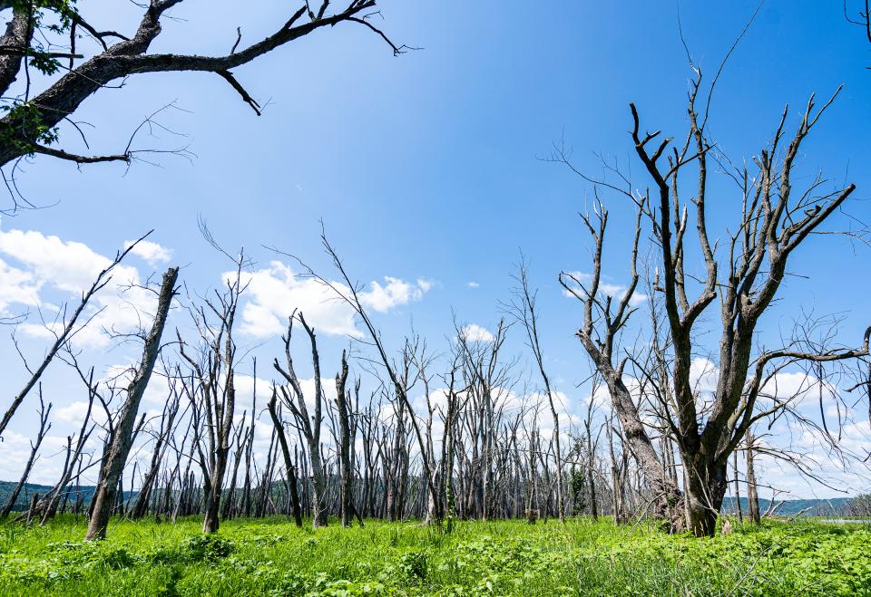
In the case of the silver maples, just a few inches of elevation made all the difference for those that survived versus those that were wiped out by floodwaters, Henderson said.
Although the Army Corps was thinking about using thin layer placement to elevate the trees prior to the 2019 flood, that event made the need for some sort of action crystal-clear, he said.
New technique uses dredged sediment to raise the forest floor
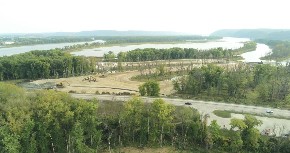
Habitat restoration isn't new for the Army Corps. Decades after it installed the locks and dams on the upper Mississippi River, which essentially converted it into a series of lakes for navigation purposes, the Corps began to construct islands on the river to revive some of the habitat that had been lost as a result of that engineering.
Those islands have been built using sand that the Corps must dredge from the river's main channel to keep it navigable for shipping. But that type of island-building is intensive — and expensive.
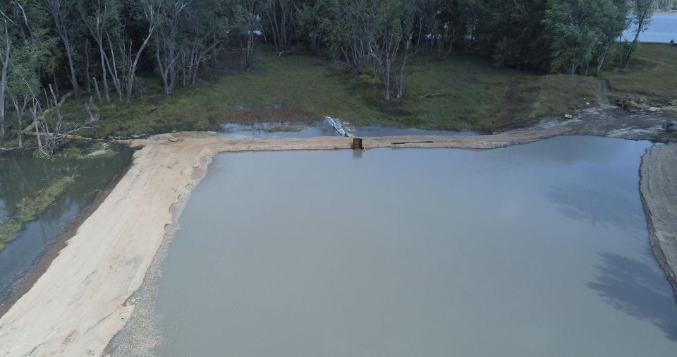
Thin layer placement mimics the natural sedimentation process that creates land. And at the site near Prairie du Chien, the Corps is hoping it'll play double duty.
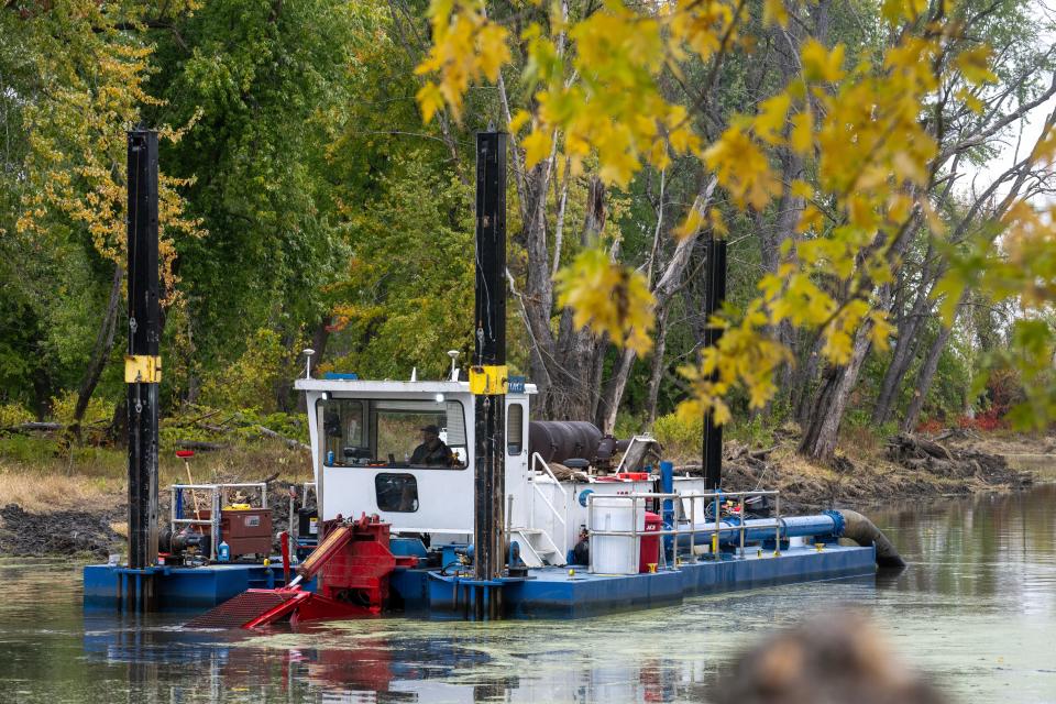
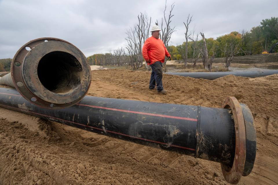
Under the other side of the bridge, a small hydraulic dredge scrapes up sediment from the bottom of the river backwaters. Those backwaters have grown increasingly shallow in recent years as water sweeps sediment downriver, and that shallowness has driven fish who prefer deeper waters out of their habitat. The dredging for this project should restore that depth and make local ice fishers happy, Henderson said.
Once the sediment is pulled up from the river bottom by the dredge, it's piped half a mile back under the bridge to a series of pools leading to the area where the silver maples grow. A few small structures called weirs slow the sediment down so it doesn't move through the pools too quickly — but eventually, it will all end up spilling into a thin layer on top of the existing forest land.
Henderson's team is aiming to let the sediment stack up between six and 18 inches. Once it's ready for planting, which Henderson estimated would occur by 2026, Army Corps foresters will come out and plant silver maples and cottonwoods. Those trees would be expected to have a better chance at surviving heavy floodwaters because they aren't as low-lying.
At that point, the Corps will monitor the trees to determine how well the technique worked. They'll also need to figure out some missing variables, Henderson said, like whether the sediment is as clean as the sand from the main channel they've historically used to build islands.
The thin layer placement is part of a larger habitat restoration of the McGregor Lake area, estimated to cost about $25 million.
Project partners eye a bigger impact
This technique won't do away with the need for those sand islands, Henderson said, because they replace other islands that have been whittled away by erosion.
But it could allow the Corps to improve floodplain forest conditions over a larger area without creating as much of a disturbance.
More: In the winter, the Mississippi River is 'a magical place.' Here's how you can enjoy it.
Take Reno Bottoms, for example — a tranquil wildlife area spanning thousands of acres of Mississippi River backwaters at the junction of Wisconsin, Minnesota and Iowa. The 2019 flood killed off hundreds of trees there.
"We simply could not afford" to build sand islands and plant enough trees to cover that amount of space, Henderson said. Thin layer placement could be a viable alternative.
"The potential benefits of this are huge," he said.
Producing more healthy forests has far-reaching impacts in itself: Those forests provide habitat for migrating birds, suck up pollutants that would otherwise make their way downriver and slow floodwaters.
Madeline Heim is a Report for America corps reporter who writes about environmental issues in the Mississippi River watershed and across Wisconsin. Contact her at (920) 996-7266 or mheim@gannett.com.
Please consider supporting journalism that informs our democracy with a tax-deductible gift to this reporting effort at jsonline.com/RFA or by check made out to The GroundTruth Project with subject line Report for America Milwaukee Journal Sentinel Campaign. Address: The GroundTruth Project, Lockbox Services, 9450 SW Gemini Dr, PMB 46837, Beaverton, Oregon 97008-7105.
This article originally appeared on Milwaukee Journal Sentinel: Army Corps strategy could restore Mississippi River floodplain forests

