Texas Is Staring Down a Major Winter Storm
Driving conditions across Central Texas are likely to be poor through Wednesday because of cold temperatures and wintry precipitation.
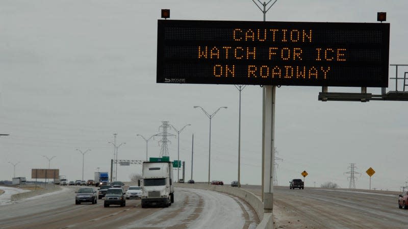
An Arctic cold front is bearing down on the Great Plains and points south, all the way into Central Texas this week. Already, cold temperatures and freezing rain have begun across the state, and the dangerous winter weather is likely to persist through Wednesday, according to Monday morning’s short-range forecast from the National Weather Service.
Much of Central Texas is under a Winter Storm Warning and a larger area is under a Winter Weather Advisory as of Monday afternoon, according to the NWS’s national forecast. More than a quarter-inch of ice is expected to accumulate over the next 48 hours, and up to half an inch of ice is possible in some parts of North and Central Texas, with thermometer lows hovering between 20 and 30 degrees Fahrenheit. Forecasters expect that Oklahoma, Arkansas, southern Missouri, and western Texas will also be impacted by the wintry precipitation.
Read more
These Winning Close-Up Photos Show Life That's Often Overlooked
Remembering Enterprise: The Test Shuttle That Never Flew to Space
Potentially hazardous winter weather is anticipated for a wide swath of the US today through at least mid-week. Check for the latest at https://t.co/VyWINDkBnn and ensure that you and your family are #WeatherReady pic.twitter.com/fMRkCtvHXr
— National Weather Service (@NWS) January 30, 2023
Together, all that cold and ice could turn roads treacherous. Ice and sleet are already impacting major thoroughfares, according to the Texas Department of Transportation, and more disruption is likely. “Sleet and freezing rain accumulations are likely to create widespread hazardous travel conditions for several days in a row, especially on untreated surfaces,” NWS forecasters wrote in Monday’s short-range prediction.
Local weather offices are advising people to avoid driving as much as possible, particularly Monday and Tuesday evening and into Wednesday morning. “Drive carefully if you have to be out!” wrote Dallas-Fort Worth forecasters in a tweet.
Hazardous travel conditions are already being reported this afternoon. More widespread freezing rain/sleet are expected Mon. night into Tues., and Tues. night into Wed. AM, which will worsen travel conditions. Drive carefully if you have to be out! #dfwwx #ctxwx #txwx pic.twitter.com/9Kj3kUecG7
— NWS Fort Worth (@NWSFortWorth) January 30, 2023
Ice accumulation can also trigger power outages, downed power lines, tree damage, and other infrastructure issues.
Though the cold air is set to dissipate on Wednesday, the atmospheric moisture is only predicted to intensify. In the immediate aftermath of winter storms, eastern Texas is forecast to face significant, heavy rains which could bring flash flooding to the area.
Texas has been hit with repeated cold blasts in recent years. Earlier this winter, the state was caught up in the nationwide polar vortex that brought single-digit temperatures and dangerous wind chills to much of the U.S. in December. Almost exactly one year ago, the state experienced an intense cold front that brought temps below 20 degrees Fahrenheit. And in 2021, an even more extreme polar vortex sent Texas and 20+ other states into a deep freeze. Hundreds of people in Texas died and millions across the state lost electricity for days on end as the power grid failed under the pressure of the 2021 freeze.
Though none of these individual events have been definitively linked to climate change, cold blasts and polar vortexes are expected to become more frequent and intense for Texas as climate change progresses. A polar vortex is a phenomenon that occurs when the air circulation patterns that usually keep Arctic air circulating at high latitudes break down, and wayward currents carry that frigid air much farther south. Climate change is likely making those circulation break-downs more frequent and severe, as the Arctic warms.
More from Gizmodo
Sign up for Gizmodo's Newsletter. For the latest news, Facebook, Twitter and Instagram.

