Tens of thousands without power as massive storm hits Western U.S.
Tens of thousands are without power as a weekend storm slams the Pacific Northwest, dumping four-to-seven feet of snow on the Sierra region and leading to road closures in Northern California. The National Weather Service issued a winter storm warning for greater Lake Tahoe through 1 a.m. Tuesday and warned of "widespread whiteout conditions" and strong wind gusts.
CBS News weather producer David Parkinson says the Sierra region can expect another two-to-four feet Monday, and there's a foot coming Monday into Tuesday in the Wasatch Mountains in Utah. He says gusts in Lake Tahoe could top 100 mph on mountain ridge tops.
As of Monday morning, there were more than 56,000 homes and businesses without power in California, 11,000 without power in Oregon and more than 6,000 in Washington, according to PowerOutage.US.
In addition, Parkinson says there wil be "uncharacteristic, even record cold" in the West: Monday's high in Seattle should be just 24 degrees — the coldest high ever there for this date, breaking the old record by 10 degrees. The cold will be felt as far south as Riverside, California, where the high won't hit 50 degrees, which would be another record.
There's a massive cold air outbreak in Canada making its way down to the American West, Parkinson explains, meaning the region will be dealing with the cold through at least Wednesday.
The National Weather Service reported 3.8 inches of snow fell in Seattle Sunday, where the wind chill caused temperatures that felt like they were near zero degrees.
In Northern California, 29 inches of snow fell over a 24-hour period ending Sunday morning, the UC Berkeley Central Sierra Snow Lab tweeted. The National Weather Service in Reno said snow would remain heavy into Monday as the next storm pushes through the region.
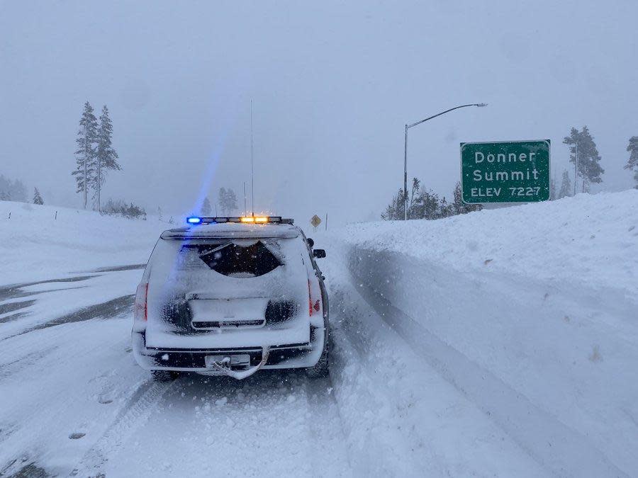
Several mountain roads were shut down Sunday, including a 70-mile stretch of Interstate 80 through the Lake Tahoe region to the Nevada state line. The California Department of Transportation tweeted Sunday that there was "low or zero visibility on I-80."
The National Weather Service in Sacramento warned on Sunday night that "mountain travel will continue to be difficult if not impossible through tomorrow." The best time to travel will be Thursday.
The continuing storms were welcomed in parched California, where the Sierra snowpack had been at dangerously low levels after weeks of dry weather, CBS Sacramento reported. But the state Department of Water Resources reported on Christmas Eve that the snowpack was between 114% and 137% of normal across the range with more snow expected.
Boise, Idaho, named most unaffordable city for homeowners in the U.S.
Cybersecurity experts explains “Log4j” vulnerability, discusses top cyber threats of 2022
The life and legacy of Desmond Tutu, South Africa’s anti-apartheid hero who died at 90

