Widespread ice and snow threat covers Quebec to end the week
Folks across Quebec will face icy and snowy roads beginning Thursday evening as a Colorado low approaches the region from south of the border.
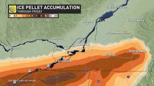
This moisture-laden system will bring a healthy blanket of snow to much of the province, with the threat for freezing rain and ice pellets covering portions of the Eastern Townships.
Prepare for travel issues beginning Thursday evening and lasting through the day Friday.
RELATED: What’s up with this winter so far, Canada? We have the answer
Weather models have shown a colder temperature trend for the duration of this event, which will allow precipitation to fall as snow for a wider area, confining the risk for freezing rain and ice pellets to a smaller section of southern Quebec.
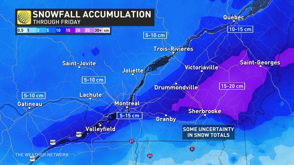
Snow will begin during the evening and pick up in intensity heading into the nighttime hours. Montreal and Gatineau will face the heaviest snow overnight Thursday, with some snow lingering into the morning commute. There is still however some uncertainty with exactly how much snow accumulates in the Montreal area.
DON'T MISS: It may be mild, but the snowiest months are just ahead for these parts of Canada
Widespread snowfall totals of 5-10 cm are expected across much of Quebec through Friday morning, with higher-end totals possible around Gatineau, Quebec City, and Trois Riviere.
Meanwhile, marginal temperatures just above the ground will allow precipitation to fall as ice pellets across portions of southern Quebec south of Montreal and Sherbrooke, with a risk for freezing rain right along the international border.
Conditions will improve through the day Friday as the storm clears the province and heads out to sea.
WATCH: Icicle buildup could mean trouble for your home
Be sure to check back for the latest updates on the weather across Quebec.

