Thunderstorm warnings prompt flash flood worries at national parks in Utah
The thunderstorms that have started wandering into Utah in recent days are raising worries about flash flooding at places like national parks.
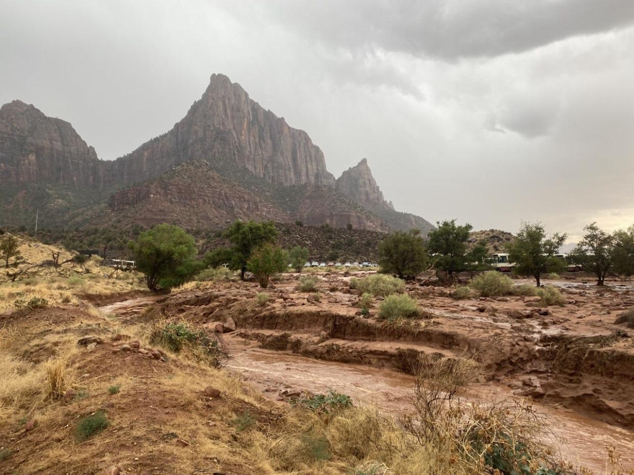
Flash flooding threats were possible in most parts of southwestern Utah on both Tuesday and Wednesday, according to the National Weather Service, with parks from Zion to Bryce Canyon to the Glen Canyon National Recreation Area all likely to see flooding in slot canyons, dry washes and small streams.
"Make sure to check in with local visitor centers or ranger stations before heading out and have a plan if threatening weather approaches," warned the Salt Lake City office of the NWS on social media.
There is an increased risk of flash flooding for southern Utah National Parks and recreation areas. Make sure to check in with local visitor centers or ranger stations before heading out and have a plan if threatening weather approaches. More at: https://t.co/7kgSJIR7mF #utwx pic.twitter.com/9a6poCliNQ
— NWS Salt Lake City (@NWSSaltLakeCity) July 25, 2023
Thunderstorms and flash floods hit isolated areas across the state over the weekend and on Pioneer Day, bringing heavy rain and high winds along with them and prompting a series of warnings and special weather statements to various parts of the state.
The trend was likely to continue in the coming days, although their sporadic, isolated nature can make them difficult to predict until just before they hit.
Flash flooding earlier today in @CapitolReefNPS produced many waterfalls across the park. This one was caught on camera by a park ranger. #utwx pic.twitter.com/bVZOG67pHg
— NWS Salt Lake City (@NWSSaltLakeCity) July 18, 2023
In the meantime, the weather outside the storms' influence remained hot and dry, with most of the region expecting daily high temperatures in the triple digits.
St. George was expected to hit 107 degrees on Tuesday, followed by 108 on Wednesday, with temperatures expected to remain in that range through the weekend. The NWS forecast suggested there was a 15% chance of precipitation for the day, with thunderstorms a distinct possibility, if unlikely to hit any particular area.
In Springdale outside of Zion National Park, the forecasted high for Tuesday was 102, with Wednesday set to reach 104.
Temperatures were even high at higher-elevation locations like Cedar City, with the forecast calling for 94 degrees on Tuesday and 95 on Wednesday.
Temperatures should cool by next week though, with increased moisture likely to make the storms stronger. The Cedar City area forecast showed a 30% chance of precipitation by next Monday, with a 50% chance on Tuesday.
This article originally appeared on St. George Spectrum & Daily News: Flash flood potential rising at national parks in Utah

