Thursday storms cause heavy damage in Killearn Lakes, NWS warns of potential weekend weather
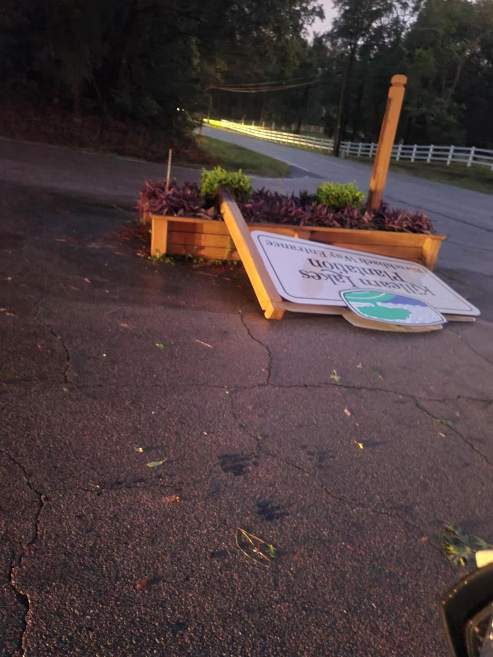
A band of severe storms took down trees and scattered debris across roadways and yards in the Killearn Lakes neighborhood of northern Tallahassee on Thursday evening.
Around 6:15 p.m., the National Weather service issued a tornado warning for the Bradfordville area. Shortly after, a tornado warning was also issued for Thomas County across the Florida-Georgia border. The Bradfordville tornado warning was canceled at 6:40 p.m.
Killearn Lakes residents said that chainsaws could be heard throughout the night as people cleared roadways and driveways.
Debris alongside the roads and heavy damage to houses could be seen on Friday morning throughout the neighborhood.
The NWS was surveying on Friday morning to determine wind gusts and if there was tornadic activity.
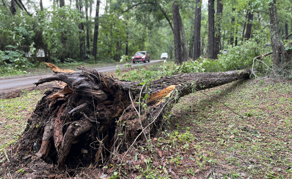
The Thursday storm system, which affected much of the Panhandle and Southwest Georgia, spurred a tornado in Liberty County, causing widespread, major damage to homes in Hosford. Drone video from Fox Weather shows at least one home with its roof torn off and a large area with trees snapped in half.
In the hours after the storm, 76 percent of Liberty County, the state’s least populated county, was without power. The next day almost 1,500 customers were still without power in Liberty and nearby Gadsden County.
Later Friday afternoon, the National Weather Service confirmed tornadoes in
Hosford - estimated peak winds of 125 mph, EF2
Lynn Haven - estimated peak winds of 110 mph, EF1
Thomasville, Ga. - 2 confirmed EF 1 tornadoes. Peak winds of 110mph and 90 mph.
Gadsden County/Havana - 1 confirmed EF 0 tornado. Peak wind of 80 mph.
They determined there was no tornado in Killearn Lakes, but said straight line winds of 80 mph caused much of the damage there.
The NWS warned on Friday morning that more storms over the weekend are possible.
"We know there's a lot of cleanup ongoing from yesterday's severe weather. Unfortunately, a few more rounds of strong to severe storms are expected ... through early Sunday morning," the NWS said in a tweet.
"Scattered storms will develop (Friday) morning near the Big Bend coast and move inland into south central GA early this afternoon. The main threats will be locally damaging wind gusts and some hail. Severe threat ends by early to mid afternoon."
A squall line is forecast to move across North Florida and South Georgia Saturday afternoon. Damaging winds and tornadoes will be possible, as well as locally heavy rainfall.
Then more bad weather could be in store on Sunday.
"A broken line of strong to severe storms may develop along the cold front late Saturday night into early Sunday morning, moving east," NWS Forecasters wrote. "Damaging winds, tornadoes, and large hail would be possible with this round."
If you have storm damage photos from the Tallahassee area and give permission for them to be used by the Tallahassee Democrat, please send them to news@tallahassee.com with your name and location.
4/28: We know there's a lot of cleanup ongoing from yesterday's severe weather. Unfortunately, a few more rounds of strong to severe storms are expected today through early Sunday morning. We break down the forecast in this thread. ⬇️
🧵(1/5) #ALwx #FLwx #GAwx— NWS Tallahassee (@NWSTallahassee) April 28, 2023
This article originally appeared on Tallahassee Democrat: Tallahassee weather: Thursday storms down trees in Killearn Lakes

