Severe thunderstorms bring ping-pong ball-sized hail around the Pittsburgh region
An advancing cold front will bring thunderstorms to our area Thursday afternoon and evening.
>>>TRACK THE RAIN AND STORMS WITH OUR LIVE INTERACTIVE RADAR<<<
UPDATE 6:57 p.m.
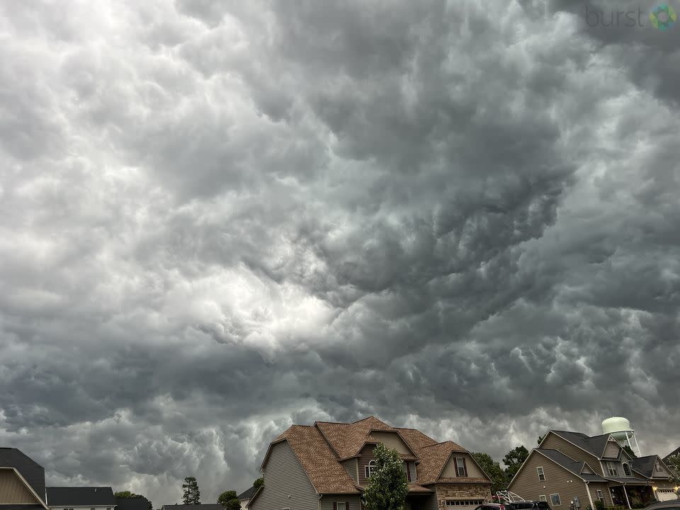
Viewers around the region are sending in their photos from the storms.
Check out the ones we’ve received so far HERE >> PHOTOS: SEVERE THUNDERSTORM WATCH issued ahead of severe storms moving toward Pittsburgh area Thursday evening
UPDATE 6:46 p.m.
The Severe Thunderstorm Watch issued for our region is now only in effect in Greene County.
UPDATE 6:39 p.m.
The Severe Thunderstorm Warning issued for Greene County has been cancelled.
However, the National Weather Service said small hail and gusty winds are still possible with this thunderstorm.
UPDATE 6:35 p.m.
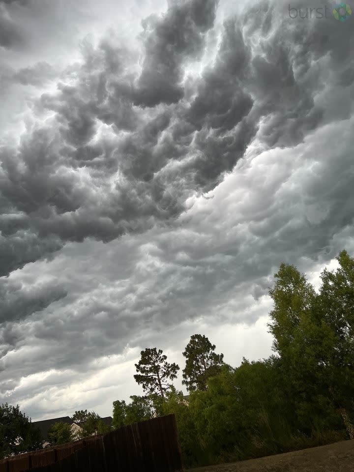
Check out the sky in Sanford right now from one of our viewers!
UPDATE 6:23 p.m.
Damage reports are filtering in from throughout the region.
Are you seeing storm damage and/or severe weather in your area? If it’s safe for you to do so, share your photos and videos with us HERE and we may use them on-air and on our website.
UPDATE 6:15 p.m.
A SEVERE THUNDERSTORM WARNING has been issued for southern Greene County until 7 p.m.
Severe Thunderstorm Warning including Mannington WV, Cameron WV and Mount Morris PA until 7:00 PM EDT pic.twitter.com/Eg3MwVTGrA
— NWS Pittsburgh (@NWSPittsburgh) June 16, 2022
UPDATE 6:10 p.m.
Damage reports are coming in from around our region as storms continue to sweep through.
Social media reports hail of half dollar size at 04:15 p.m. in Venango County. Fire departments are also reporting wind damage with multiple trees down throughout Clintonville in Venango.
Trees snapped or uprooted are being reported in Clarion County.
UPDATE 6:06 p.m.
The Severe Thunderstorm Warning issued for parts of Armstrong, Indiana and Clarion counties has expired.
UPDATE 5:50 p.m.
A SEVERE THUNDERSTORM WARNING has been issued for parts of Washington and Greene counties until 6:30 p.m.
Severe Thunderstorm Warning including Wheeling WV, Moundsville WV and Martins Ferry OH until 6:30 PM EDT pic.twitter.com/7LaoOZgFii
— NWS Pittsburgh (@NWSPittsburgh) June 16, 2022
UPDATE 5:45 p.m.
The Severe Thunderstorm Warning issued for Washington County has expired.
The National Weather Service said “the storm which prompted the warning has weakened below severe limits, and no longer poses an immediate threat to life or property. Therefore, the warning will be allowed to expire.”
UPDATE 5:26 p.m.
A SEVERE THUNDERSTORM WARNING has been issued for parts of Armstrong, Indiana and Clarion counties until 6 p.m.
UPDATE 5:22 p.m.
A SEVERE THUNDERSTORM WARNING has been issued for parts of Washington County until 5:45 p.m.
Severe Thunderstorm Warning including Steubenville OH, Wintersville OH and Mingo Junction OH until 5:45 PM EDT pic.twitter.com/J7IKjV7GsL
— NWS Pittsburgh (@NWSPittsburgh) June 16, 2022
UPDATE 5:01 p.m.
The National Weather Service reports that at 4:59 p.m., a severe thunderstorm was located near New Bethlehem, or near Rimersburg, moving southeast at 45 mph.
UPDATE 4:43 p.m.
Ping pong size hail has been falling in Mercer County. Below is viewer video from Clark.
The National Weather Service just announced that Mercer County was experiencing ping pong size hail. A viewer who lives in the area shared this video with us. If it is safe for you to do so, you can share the weather in your area with us, here: wpxi.tv/341kkt0 Click here for live updates on tonight's severe weather: wpxi.tv/3HqTWLm
Posted by WPXI-TV Pittsburgh on Thursday, June 16, 2022
UPDATE 4:35 p.m.
A SEVERE THUNDERSTORM WARNING has been issued for Armstrong, Butler, Venango and Clarion counties until 5:15 p.m. Large hail and high winds are possible.
UPDATE 4:28 p.m.
The National Weather Service reports that a severe thunderstorm was located near Oil City at 4:23 p.m., moving east at 45 mph.
Update 4:07 p.m.
A SEVERE THUNDERSTORM WARNING has been issued for parts of Butler, Mercer, Venango and Clarion counties until 4:45 p.m.
Severe Thunderstorm Warning including Mercer PA, Knox PA and Stoneboro PA until 4:45 PM EDT. This storm will contain two inch sized hail! pic.twitter.com/XY4tdVtTGP
— NWS Pittsburgh (@NWSPittsburgh) June 16, 2022
The National Weather Service Pittsburgh is reporting ping pong size hail in Mercer County. Check out the video here.
Ping pong size hail reported in Transfer, PA in Mercer County.
— NWS Pittsburgh (@NWSPittsburgh) June 16, 2022
A SEVERE THUNDERSTORM WATCH has been issued for our entire area until 9 p.m. Thursday.
A Severe Thunderstorm watch has been issued for the counties shaded on the map. A Watch means conditions are favorable for strong thunderstorms that could bring damaging wind or large hail. Have a plan in place in the event of severe weather. pic.twitter.com/Hzxx3HNSnD
— Scott Harbaugh (@WPXIScott) June 16, 2022
Our Severe Weather Team 11 meteorologists will continue to update the timeline during the day:
Noon - 3 p.m.
Isolated storms will likely pop up.
Any storm that pops could turn severe.
3-8 p.m.
Scattered thunderstorms -- severe storms likely
(numerous strong storms likely between 5-7 p.m, including in Allegheny County).
Watch Channel 11 News - or when we’re not on the air - you can get updates in our FREE Severe Weather Team 11 app for iOS and Android.
TIMELINE BY COUNTY
3-4 p.m.
Near Interstate 80 in Lawrence, Butler, Beaver, Clarion and Venango counties
(A few strong storms could pop up at the same time in Allegheny, Westmoreland and Indiana).
4-6 p.m.
Beaver, Allegheny, Washington, Westmoreland, Armstrong and Indiana.
6 p.m. -8 p.m.
Fayette, Greene, Westmoreland and Indiana.
IMPACTS
Primary threats
Damaging Winds
Downpours
Large Hail
Isolated tornadoes can’t be ruled out
WHAT COULD CHANGE:
Timing and severity

