Tired of Utah's latest inversion? Relief is in sight as more snow arrives
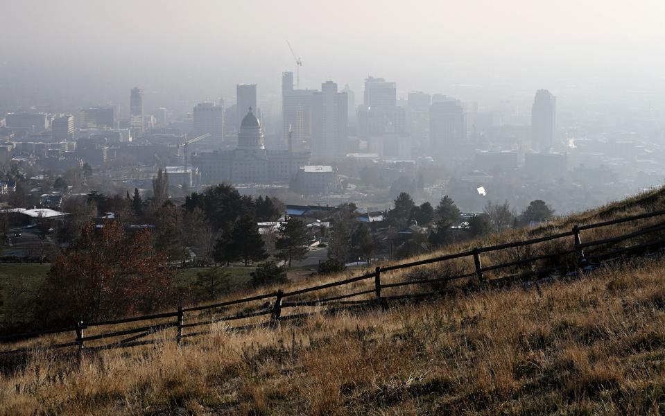
Hazy skies lingered over the Wasatch Front again on Wednesday, pushing air quality levels into ranges that are unhealthy for sensitive groups in Salt Lake County.
The particulate matter counts in Davis and Tooele counties were listed as being close to "orange" by Wednesday afternoon, as well, according to the Utah Division of Air Quality. Moderate air quality levels were reported in other parts of the Wasatch Front and northern Utah.
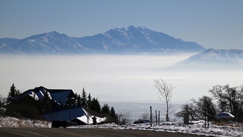
The agency points out that inversions are caused when the cold air on the ground is essentially locked into place by warmer air in the atmosphere, trapping pollution that worsens air quality. This typically happens after a high-pressure system returns after a winter storm.
State air quality officials project similar conditions will persist on Thursday, but there is relief on the horizon in the form of another winter storm headed Utah's way. KSL meteorologist Matt Johnson says the incoming storm also has the potential to bring significant snow totals to Utah's mountains this weekend.
Johnson said that low-pressure systems in Alaska are forecast to move into the Pacific Northwest on Thursday, bringing lots of precipitation with it. That system will move into Utah on Friday morning, bringing in snow potentially during the Friday morning commute.
"This is the first of many small little lows that are going to start moving through the region," he said.
Those low-pressure systems, commonly referred to as an atmospheric river, should provide cleaner air beginning on Friday.
The snow isn't expected to stop moving into the weekend, either. Johnson said 1 to 3 feet of snow are possible in Utah's mountains between Friday and Sunday, while valleys may receive 2 to 4 inches. These projections are subject to change, but the heaviest snow totals are generally expected in Utah's northern half.
"We'll likely see pretty frequent windows of snow in our mountains," he said. "We will see windows of snow for the valley, as well."
High temperatures in the Wasatch Front are also forecast to plunge into the mid-30s and low 40s again this weekend.
The National Weather Service has already issued a handful of winter weather advisories, as well as storm watches and warnings across Washington, Oregon, Idaho and Nevada ahead of the storm.
Full seven-day forecasts for areas across Utah can be found online, at the KSL Weather Center.