Topeka area anticipated Tuesday to see significant fire danger, chance for high winds and hail
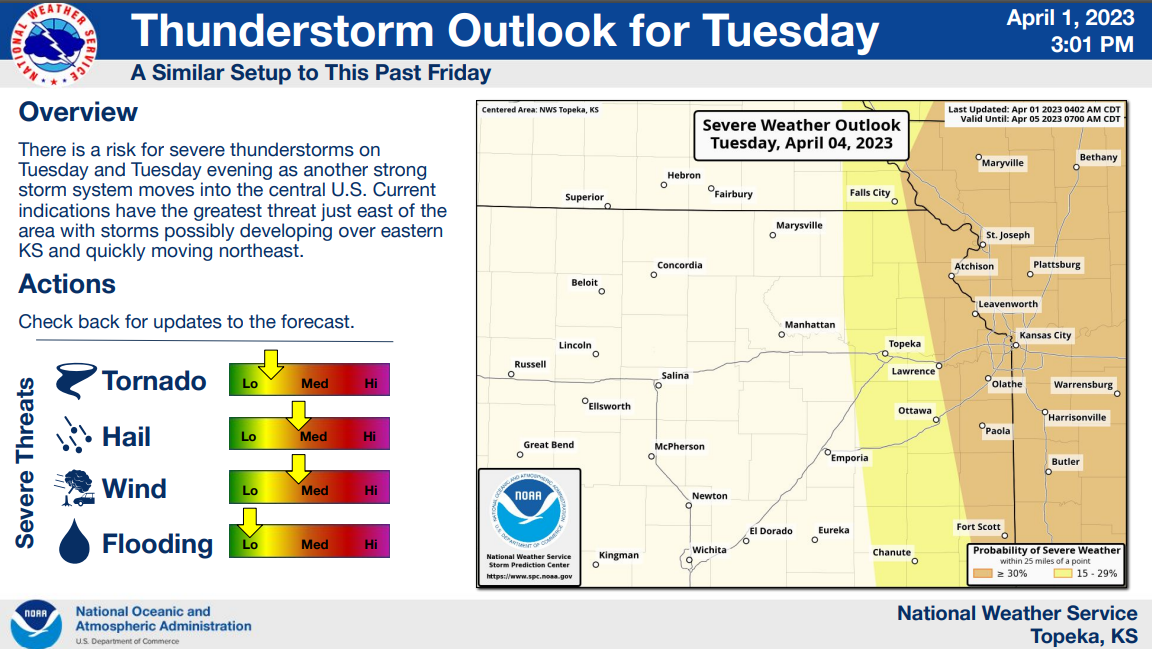
The National Weather Service expects Topeka to see high winds and a slight risk for severe thunderstorms Tuesday as a strong storm system sweeps through the central U.S., with severe weather being more likely to the east of here.
The Accuweather website suggested Saturday that Tuesday would bring the Topeka area "a damaging thunderstorm" and "potential for a significant severe weather outbreak."
Storms are anticipated to develop over eastern Kansas, then quickly move northeast, the weather service's Topeka office said in a graphic posted Saturday afternoon on its website.
More: Fire danger high for next few days in Topeka and northeast Kansas
'Very high to extreme fire danger'
Tuesday's conditions are expected to resemble those the Topeka area experienced Friday, with dry air and windy weather moving in, the weather service graphic said.
"The main concern at this time is for very high to extreme fire danger and wind gusts up to 55 mph during the afternoon on Tuesday," it said.
Still, forecasters predicted a chance for severe weather of 15% within 25 miles of any given point in an area that includes Topeka and Ottawa, and 30% within 25 miles of any given point in an area that includes Lawrence and Leavenworth.
More: Severe weather in Topeka likely Friday with storms, hail, winds and tornadoes possible
'Details could change'
The weather service anticipates "medium" threats Tuesday for hail and high winds and "low" threats for flooding and tornadoes, its graphic said.
A separate graphic on the weather service's Topeka office's website said winds are forecast to gust to a maximum Tuesday of 54 mph at Topeka, 53 mph at Emporia, 49 mph at Lawrence and 46 mph at Manhattan and Ottawa.
"This is still a developing system, so the details could change over the coming days," the weather service said.
Contact Tim Hrenchir at threnchir@gannett.com or 785-213-5934.
This article originally appeared on Topeka Capital-Journal: High winds, hail expected to be possible Tuesday in Topeka area

