Severe storms with high winds marching through southern Ontario

Severe thunderstorms are moving across southern Ontario Thursday evening as a disturbance collides with muggy air parked over the Great Lakes.
PHOTOS: Hail, damage reported as tornado-warned storms hit southern Ontario
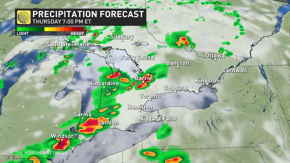
These storms will continue sweeping over southern Ontario through this evening with a risk for damaging winds, large hail, and possibly one or two tornadoes.
Numerous tornado warnings were issued through the afternoon hours. While those warnings have since expired, these storms continue to produce damaging wind gusts and large hail. Stay alert for the potential for additional tornado warnings.
"Extensive damage has been reported in Sarnia," Environment and Climate Change Canada said in a tornado warning earlier Thursday afternoon. Sarnia Airport reported a 115 km/h wind gust when this squall line moved through the area.
Ensure your safety by staying up-to-date with current weather alerts, and have a safety plan at home or while on the road.
RELATED: When extreme weather hits, trauma is the invisible damage
Thursday
Areas: Southern Ontario
Timing: This afternoon and evening
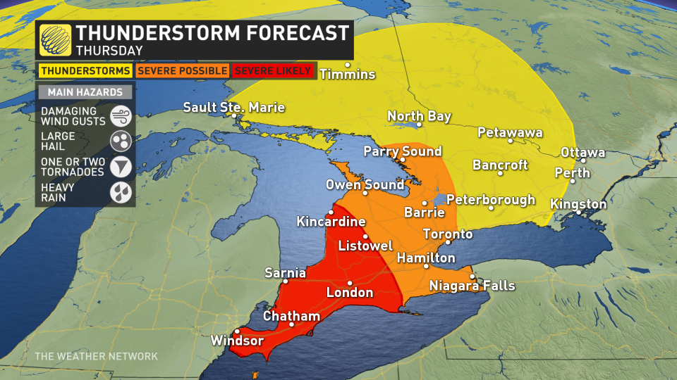
Weather: A squall line pushing through Michigan will reach southwestern Ontario by the middle of Thursday afternoon, sweeping east toward London by the start of the evening commute, and eventually reaching the Golden Horseshoe around dinnertime.
Damaging wind gusts are likely as this line of strong to severe thunderstorms moves through the region. Remain mindful of large trees and tree limbs as the storms move through, avoiding vehicles and parts of your home where falling trees may cause damage. Power outages are possible in the wake of the storms.
While damaging winds are far and away the greatest risk, the strongest storms may be capable of producing large hail up to the size of toonies or even golf balls. There’s enough wind shear in the region that one or two tornadoes are possible in southwestern Ontario within storms that form ahead of the main line, and within the squall line itself.
This squall line should begin losing some of its punch as it approaches the Greater Toronto and Hamilton Area around dinnertime, but damaging wind gusts are possible throughout the region as the storms arrive this evening.
Confidence: High confidence in storms becoming severe today, but moderate confidence on how strong the storms will be due to the potential of some storms developing earlier in the day that could hinder some later storms from becoming severe.
SEE ALSO: Four simultaneous heat domes break major records across the globe
Thursday night to Friday
Areas: Eastern Ontario and southern Quebec
Timing: Thursday overnight
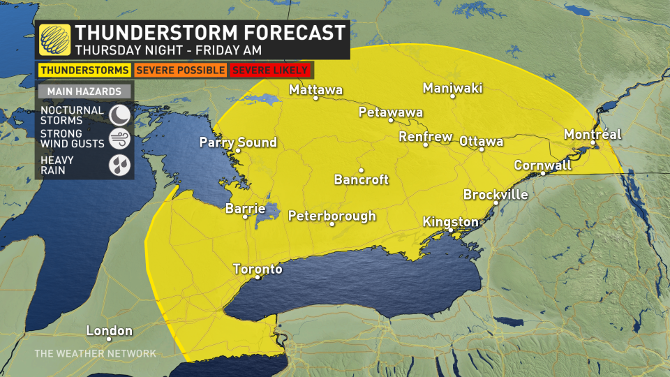
Weather: The complex of storms appear so strong that it will likely sustain thunderstorm activity through Thursday overnight. Expect periods of thunder and heavy rainfall as the low heads east into Ottawa, Ont., and southern Quebec.
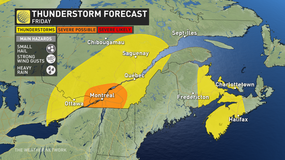
Friday
Areas: Eastern Ontario and southern Quebec
Timing: Throughout the day
Weather: The low-pressure system will then move east into Quebec, bringing the risk of heavy rain and thunderstorms. Storms will likely be much weaker than Thursday however there is a chance the system could bring strong wind gusts and small hail to the region.
Prepare
Keep The Weather Network’s app handy on your phone to peek at the radar and keep up with watches and warnings as the day progresses.
Stay close to a safe shelter in case storms threaten your location. And remember, the greatest danger in any thunderstorm is lightning. If you can hear thunder, you’re close enough to be struck by lightning.
Thumbnail courtesy of Mark Robinson.
Stay tuned to The Weather Network for the latest updates on conditions across Ontario.

