Tornado sirens blare, funnel cloud spotted in Lawrence as people told to take shelter
Douglas County emergency management was warning people to take shelter for fear of tornadoes in the area on Friday afternoon.
A tornado warning was issued at 2:38 p.m. by Douglas County Emergency Management for Lecompton and North Lawrence. Roughly 25 minutes later, the agency said the tornado warning had passed but the threat of severe thunderstorms remained in effect, bringing wind gusts as strong as 80 mph and nickel-sized hail.
Lawrence police officers also reported seeing funnel clouds near Bob Billings Parkway and Wakarusa Drive, according to the department’s Twitter account.
“These were funnel clouds, nothing on the ground,” the department said in a subsequent tweet.
Storm watchers shared photos and videos of dark clouds passing through the Lawrence area on Twitter.
[2:03pm 14 July 2023, 5 WNW Mayetta, KS]
Severe-warned storm now overhead. Wind gusts up to 50 mph have occurred. Picture is view of storm approaching taken at 1:54pm. #KSwx @NWSTopeka pic.twitter.com/bGKxLnazZ0— Jayson Prentice (@SeverePlains) July 14, 2023
2:55 PM CST Lawrence looking SE over Lawrence High. @NWSTopeka @dgcoem pic.twitter.com/uJc5J6PGlV
— Andrew F (@ghpitboss) July 14, 2023
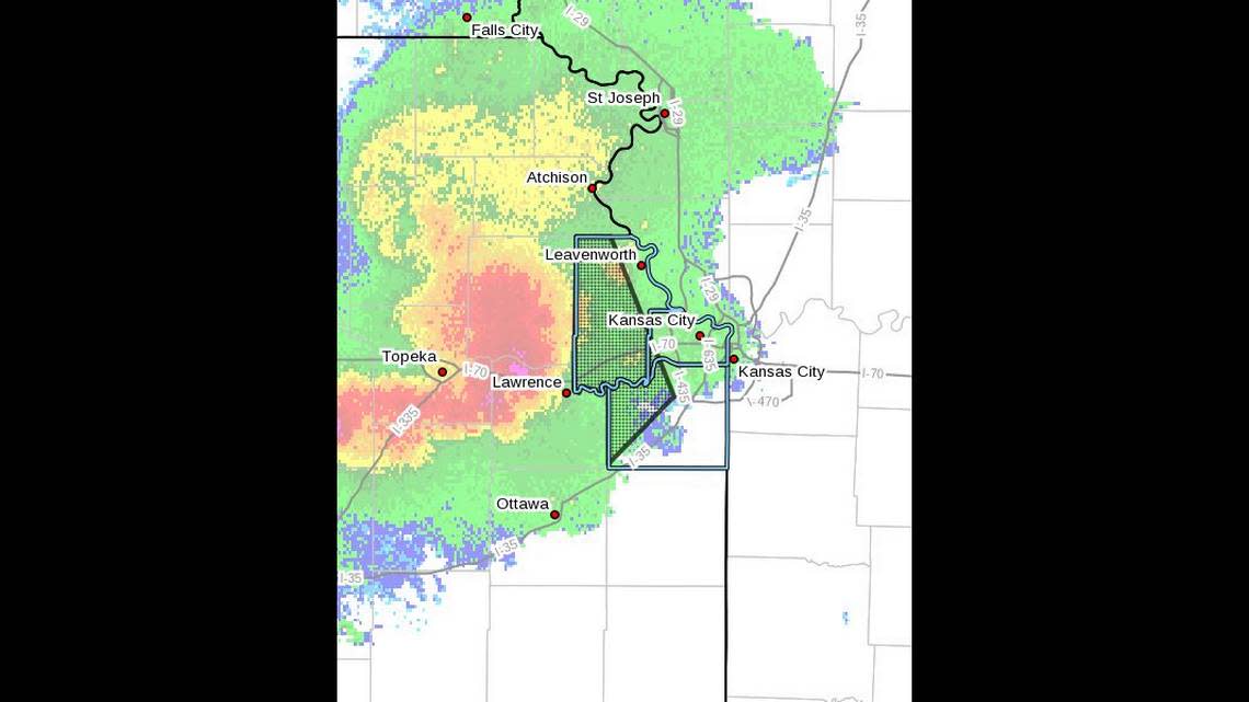
The warnings came as severe weather was headed for the Kansas City metro.
A severe thunderstorm warning was issued about 2:35 p.m. for parts of Wyandotte, Leavenworth and Johnson counties as severe thunderstorms were located along a line that stretched from Holton to near Perry Lake to near Auburn in Kansas. The storms were moving east at 40 mph.
Wind gusts of 70 mph were expected, along with quarter-sized hail, according to the weather service.
“Hail damage to vehicles is expected,” the weather service warned. “Expect considerable tree damage. Wind damage is also likely to mobile homes, roofs and outbuildings.”
Cities that could be impacted by the storms included Olathe, Shawnee, Lenexa, Bonner Springs, De Soto, Tonganoxie, Basehor, Edgerton, Linwood, and Easton.
The Star’s Robert A. Cronkleton contributed to this report.

