Tornado touches down north of Springfield, damaging homes, businesses
A strong line of storms swept through Sangamon County and central Illinois on Friday, knocking down dozens of homes and causing property damage in areas north of Springfield.
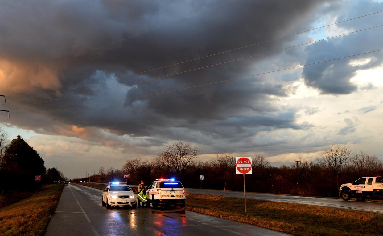
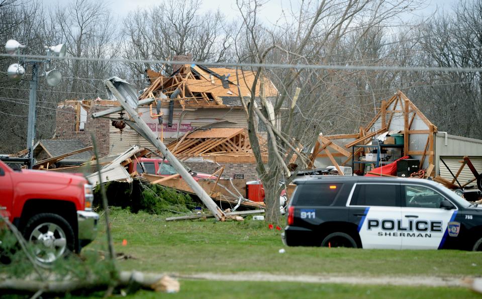
The National Weather Service in Lincoln reported that at 5:54 p.m., a tornado was spotted 20 miles west-southwest of Sherman, moving eastward from Morgan County, where tornadoes had been reported 30 minutes prior. The tornado moved through the village, causing damage to structures along the Interstate 55 Business Loop near the headquarters of the Sherman Fire Protection District.
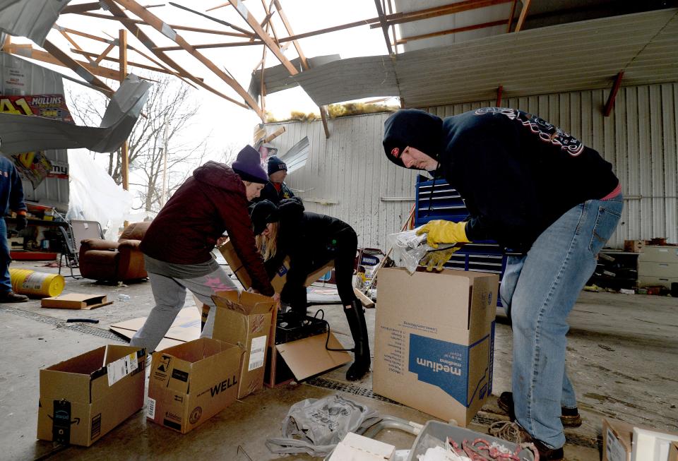
Sangamon County Sheriff Jack Campbell said that at least 30-40 homes in Sherman had been damaged as a result of the tornado; however, no injuries were reported. The storm knocked down power lines, making it difficult at night to reach areas impacted by the storm.

More: United Airlines to depart Capital Airport in June
Gas leaks, downed power lines and loose horses
"It's a little bit chaotic because of the proximity of the damage and where we're able to stage our equipment," Campbell said. "There's trees down, power lines down all through this area. There was a gas leak that took several hours to find the source of the gas leak. The Ameren (Illinois) crew was able to find that and get it stopped. We're just beginning to go house to house and check for any other residents. We think most of them have been evacuated."
After crossing into Sherman, the storm moved east towards Dawson and Riverton, knocking down the roof of Parks Place Childcare Center in Riverton. No one was injured at that scene as no one was in the building at the time, according to Campbell. In addition, the Walker Standardbreds horse stable suffered damage to several of their barns, leading to reports of 32 horses unaccounted for. Because the power lines have been down, no one has been able to approach it and crews with Ameren Illinois have not been able to go inside.
"The people that own the horses can't get to it because of the downed power lines," Campbell said. "It's a very dangerous, unstable situation. We want people to know (that) if they see horses running loose, they can call 911 because we don't want those horses to cause an accident."

Sherman homeowners react to storm damage
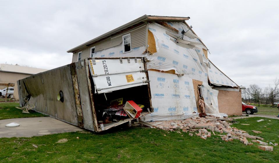
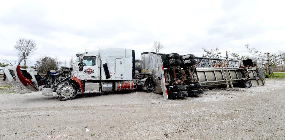
Those affected by the tornado included Jack Ealey, the owner of Ealey Transportation in Sherman. Due to the storm, his house became uninhabitable and his large garage had much of the rear torn out. He said that he rode out the storm on the floor of his pickup truck inside the garage, even as it was being knocked around.
"I saw it coming across the field, I made it into the building and I got in my pickup and laid down on the floor," Ealey said. "I saw the roof come off first, I got down on the floor of the truck and I saw the wall was coming off as I got in the pickup. It was probably 15-20 seconds of ripping and tearing."
With all the damage to his property just south of Interstate 55 — including the destruction of three of his vehicles — he felt fortunate that he, his girlfriend Brenda Books and her 96-year-old mother were able to survive.
"It almost put us out of business," Ealey said. "We lost three trucks. Last night, we were lucky we were alive. Now, we're trying to figure out what to do."
Books and her mother rode out the storm in a bathroom inside the mostly-destroyed home. She said that the force of the storm was so strong that it was able to lift the house up and she could feel it slamming down.
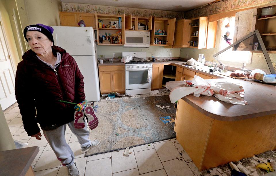
"I knew something hit the back of our house, but I had no idea it was my 52-foot container," Books said.
Even a day after the storm hit, she remains shocked that her home and everything she and her boyfriend worked for were torn apart in a matter of seconds.
"I'm still numb," Books said. "I haven't cried yet, I'm more concerned with my mom (and) we're still looking for our cat. Until I get to our new place and start unloading, I think it will finally hit me."
Cold temperatures, high winds follow storm
By 6:30 p.m., the storm had moved out of Sangamon County, heading east. NWS warning coordination meteorologist Ed Shimon said that the storm was the result of a strong low-pressure system that moved through the Midwest for much of Friday, leading to several lines of storms.
"It had a very strong wind system supporting it to the south, which is our area," Shimon said. "The jet stream aloft through the deep layer of the atmosphere was very strong and that allows for rotation to develop in the lower levels that the storms feed on. Any storm that develops rotation can produce severe weather and the amount of wind shear that was available today was very high level, causing multiple reports of tornadoes, significant wind damage and large amounts of hail."
With the storms having left the area and moving east, a cold front follows it, which will lead to colder temperatures on Saturday before a warm-up heading into next week. High temperatures will only hit into the upper 40s, with high wind gusts being a continued factor for much of the day.
More: Zoo favorite: Olive the wolverine one attraction as Henson Robinson opens for season
"It's really strong, sustained winds coming the rest of the night at least through tomorrow morning (coming) out of the west (with) 40-50 mph sustained winds, which is pretty noticeably breezy," Shimon said. "Anybody who is coming out to clean up storm damage is going to be encountering much colder air coming in and maybe make for some difficult clean-up time for some areas."
In the midst of a long, exhausting evening, Campbell gave credit to the first responders who came to the scene to help people and ensure that everyone was safe and sound despite the damage.
"(It was) just a tremendous response out here," Campbell said.
This article originally appeared on State Journal-Register: Tornado causes damage north of Springfield; damage but no injuries

