Severe weather threat dissipates as morning thunderstorms fall apart

LANSING — The threat of severe weather has waned, the National Weather Service said this afternoon, although more storms could sweep across the most southern areas of Michigan later today and a flood advisory remained in effect for most of Lower Michigan.
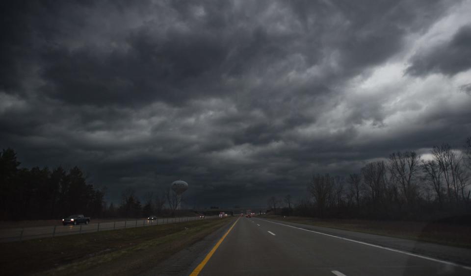
A tornado watch issued Wednesday morning was canceled as thunderstorms dissipated across southern Michigan.
"We continue to monitor storms over northern Indiana/Ohio that will clip south of I-94 through 4 p.m.," the NWS Detroit bureau said. "Gusts to 60 mph or an isolated tornado remains possible with approaching storms."
The NWS Grand Rapids office had issued a second severe thunderstorm warning for Eaton County, effective until 12:15 p.m. Wednesday, but that also expired without extreme weather.
"Thunderstorms continuing moving through the region, with the greatest risk for damaging winds and an isolated tornado near and east of I-69 through early afternoon. Still possible for an additional severe storm mid afternoon along the cold front," the NWS Detroit office said.
A previous severe thunderstorm warning for Eaton County expired at 10:45 a.m., and a similar warning for Clinton County and northern Ingham County was allowed to expire at 11:15 a.m.
A tornado watch was issued earlier in the day through 4 p.m., but the NWS did not report any warnings before the watch expired.
Consumers Energy reported about 300 customers without service with scattered outages from Portland to northeast of Lansing Wednesday morning. Other electric providers were reporting fewer than 10 outages in the Greater Lansing area as of 11:45 a.m.
RELATED: Tornado watch vs. tornado warning: Here's the difference between the two alerts
Flood advisory issued for much of Michigan
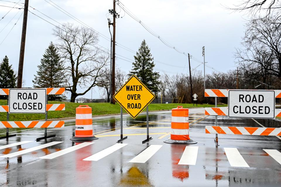
A flood advisory has been issued for much of Lower Michigan, including the Lansing area, until 3:15 p.m. Wednesday.
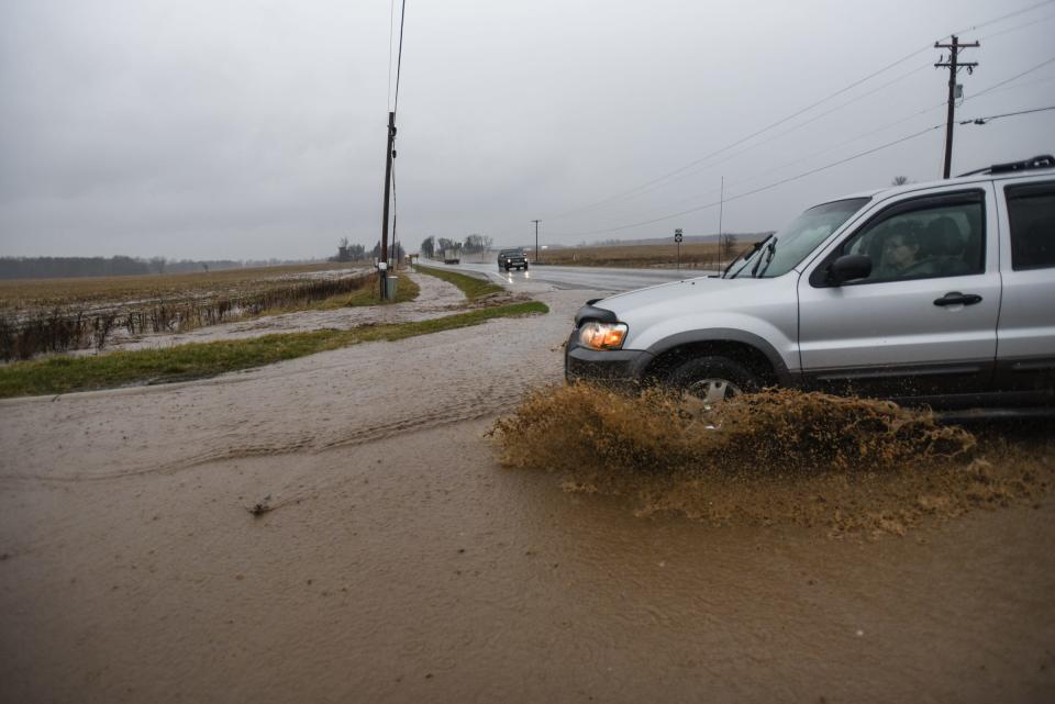
Flooding due to excessive rain is expected throughout portions of central, south central and southwest Michigan, including Gratiot, Clinton, Eaton, Ingham and Ionia counties.
"Minor flooding in low-lying and poor drainage areas" is expected, according to the National Weather Service in Grand Rapids. The NWS said people should expect water on roads and ponding.
"Repeating thunderstorms are expected over southwest Lower Michigan over the next few hours," the NWS said. "Between 1 and 1 1.5 inches of rain has fallen in some areas this morning with another 1 to 1.5 inches possible over the next several hours."
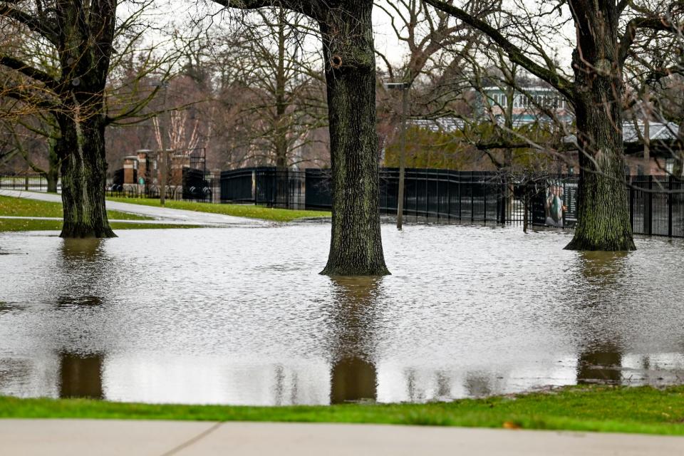
At 9:20 a.m. Wednesday, the Grand River at Lansing was at 10.46 feet, according to the NWS. The river is expected to reach 10.8 feet before receding. "Minor" flood stage is 11 feet. The Red Cedar River in East Lansing was measured at 7.15 feet and was forecast to rise to 7.4 feet Wednesday. Minor flood stage is 7.0 feet. Sycamore Creek in the Holt area was at 7.8 feet, just below flood stage of 8.0 feet.
The Meridian Township Police Department issued a noticed that several roads are closed because of high water, including: Okemos Road from Central Park Drive to Haslett Road, Hillcrest Avenue from Seminole Drive to Okemos Road, Nakoma Drive from Hamilton Road to Huron Hill Drive, and Ottawa Drive from Nakoma Drive to Woodcraft Road.
Tornado watch issued for Lower Michigan
A tornado watch was issued for much of Lower Michigan, including the Lansing area, until 4 p.m. Wednesday, although it was canceled early.
The National Weather Service said it issued the watch for portions of Michigan, Ohio and Indiana.
In Michigan, it included more than 35 counties from Holland to Detroit and as far north as Saginaw.
The weather service forecasted heavy thunderstorms with possible large hail overnight with an elevated risk of more serious storms from Wednesday morning through Wednesday evening.
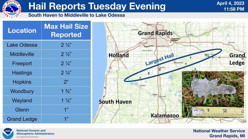
Hail about 1 inch in diameter fell overnight in Grand Ledge, and larger hail, about 2.5 inches in diameter, fell in Lake Odessa, according to the weather service.
"It would not be surprising to see wind damage and maybe even tornadoes," said Brandon Hoving, a forecaster for the weather service in Grand Rapids. "Some amount of risk is definitely something to watch. Even in early April, we've had tornadoes in the past."
Forecasters were uncertain about the timing and severity of the storms, Hoving said.
Heavy rains would exacerbate minor flooding already occurring following weeks of heavy precipitation, pushing swollen rivers over their banks and leaving park land and farm fields under water, forecasters said.
This article originally appeared on Lansing State Journal: Severe weather threat dissipates as morning thunderstorms fall apart

