Tornado watch expires in parts of eastern NC, Outer Banks after major system moves out
RALEIGH, N.C. (WNCN) — As a major storm system hit North Carolina Sunday, a tornado watch was issued for the eastern part of the state and the coast, according to the National Weather Service.
As of 12:41 a.m. Monday, that tornado watch was officially canceled by the NWS.
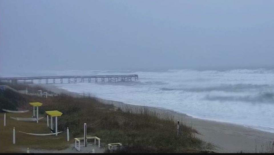
Just after 4 p.m. on Sunday, officials warned against driving on N.C. 12 as the Outer Banks and other coastal areas were under a coastal flood warning, a high wind warning and a high surf advisory.
Up to 60 mph wind gusts are forecast at Ocracoke and 20-foot waves are expected to break in the surf in the Outer Banks. Meanwhile, up to 6 feet of flooding is possible along the sounds, Inner Banks, and rivers.

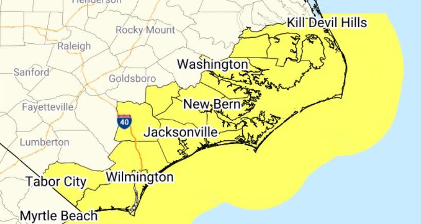
The tornado watch Sunday lasted until 10 p.m., the weather service said. The watch area was from near Kill Devil Hills and south through Morehead City, Wilmington, and to the South Carolina line.
At 10 p.m., the previous tornado watch was allowed to expire and a new one was put into effect until 2 a.m. Monday for Carteret, Dare and Hyde counties. A tornado warning was soon issued for part of Carteret County.

“A few tornadoes and a couple of intense tornadoes (are) possible,” forecasters said in the watch.
The new tornado watch area is about along and 35 statute miles east and west of a line from 70 miles north-northeast of Cape Hatteras to 70 miles southwest of Cape Hatteras.
Scattered damaging wind gusts to 65 mph are also possible, according to the National Weather Service.
Around 4:15 p.m., the NCDOT warned that “ponding rainwater and blown sand are the two big hazards now on N.C. 12.”
Officials warned that several areas of N.C. 12 could be flooded and covered by ocean waves.
They warned against travel Sunday and Monday morning in several “vulnerable” areas:
Ocracoke Island — along a 2-mile stretch of highway south of off-road vehicle ramp 59
Southern Hatteras Island — between the villages of Hatteras and Frisco
Central Hatteras Island — along the northern boundary of Buxton and along Ocean View Drive in Avon
North Hatteras Island — along N.C. 12, old N.C. 12 and several side streets in northern Rodanthe, and between the Pea Island Visitor Center and Basnight Bridge.
Weather forecasters said the potential for locally damaging winds and a couple of tornadoes will gradually increase into Sunday night.
The following counties were included in the original tornado watch: Beaufort, Brunswick, Carteret, Columbus, Craven, Dare, Duplin, Hyde, Jones, Lenoir, New Hanover, Onslow, Pamlico, Pender, Tyrrell and Washington.
Later, intense thunderstorms are expected to shift north-northeastward across the North Carolina Coastal Plain and Outer Banks area.
A tornado watch means conditions are favorable for tornadoes and severe thunderstorms in and close to the watch area.
For the latest news, weather, sports, and streaming video, head to CBS17.com.

