Tornado watch issued for parts of Ohio Monday
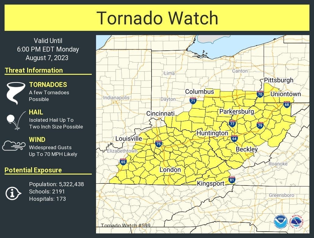
A tornado watch has been issued for parts of Ohio through 6 p.m. Monday evening.
The alert, issued by the National Weather Service, warns that a few tornadoes are possible, as well as hail and high winds.
Around 2:15 p.m., the watch was canceled for parts of Ohio including Adams, Brown, Clermont, Fairfield, Highland, Hocking, Licking, Pickaway, Pike, Ross, and Scioto counties.
[10:58 AM] A Tornado Watch has been issued for parts of our area until 6:00 PM. pic.twitter.com/nuTi9vN9aS
— NWS Wilmington OH (@NWSILN) August 7, 2023
The weather service warns residents in the affected area to consider seeking shelter inside if outdoors. If the storm becomes stronger, a tornado warning may be issued.
A hazardous weather outlook has been issued for other parts of the state on Monday, including Franklin County. The outlook includes showers and thunderstorms expected Monday afternoon through Monday night, with some storms potentially producing damaging winds. Isolated instances of large hail and tornadoes are also possible.
Farmers' Almanac The 'Farmers' Almanac' winter forecast is out. What does it mean for Ohio?
Ohio weather radar
What's the difference between a watch and a warning?
According to the National Weather Service:
A watch "is used when the risk of a hazardous weather or hydrologic event has increased significantly, but its occurrence, location or timing is still uncertain. It is intended to provide enough lead time so those who need to set their plans in motion can do so. A watch means that hazardous weather is possible."
A warning "is issued when a hazardous weather or hydrologic event is occurring, imminent or likely. A warning means weather conditions pose a threat to life or property. People in the path of the storm need to take protective action."
tmoorman@dispatch.com
@taijuannichole
This article originally appeared on The Columbus Dispatch: Tornado watch issued for parts of Ohio Monday

