Tornadoes a threat from Hurricane Idalia across west central Florida, Big Bend. What to know
Hurricane hazards are often colloquially lumped together, especially regarding damage from historic storms like Hurricane Katrina or Ian. In reality, there are a number of individual major hazards associated with hurricanes including storm surge and storm tide, heaving rainfall and inland flooding, high winds, rip currents and tornadoes.
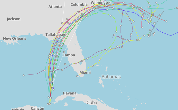
Storm surge is considered the most threatening to human life, but each hazard can cause significant and varying damage based on any number of factors. Hurricane Idalia could cause significant wind damage in Tallahassee while the chances of catastrophic surge over central and eastern Apalachee Bay increased overnight, according to meteorologist Ryan Truchelut.
In places along the Florida Big Bend like Tallahassee, Wright Dobbs, meteorologist with the National Weather Service, has told residents to make preparations today as he warns that the potential for tornadoes will increase in outer rain bands from Idalia Tuesday night and early Wednesday.
Live Idalia updates for Tallahassee: Idalia could hit city harder than Michael, Hermine
The Apalachee Bay from Gulf County to Dixie and Levy counties has never seen a Category 3 or higher hurricane, according to Dobbs, and Tallahassee hasn’t seen hurricane-force winds in the modern era.
Hurricane Michael in 2018 brought 71-mph gusts, just slightly below Category 1 strength. Hurricane Hermine in 2016 brought 64 mph gusts. Hurricane Kate in 1985 brought 68 mph gusts.
Jacksonville could see quick spin-up tornadoes from Hurricane Idalia
The latest analysis from AccuWeather shows that areas to the north and east of Idalia’s path are most likely to see not only heavy rainfall but risk of tornadoes and waterspouts.
Tornadoes produced in tropical systems can be especially dangerous as they are quick to spin up and can be obscured by darkness and rainfall, said AccuWeather.
In Florida, areas around Jacksonville are most at risk for quick spin-up tornadoes when Hurricane Idalia makes landfall on Wednesday.
Tornadoes also possible along west central Florida coast, Florida Big Bend
Hurricane Idalia could also spawn tornadoes along Florida's west central Gulf Coast and the Florida Big Bend.
The National Weather Service Melbourne office issued a statement warning that a threat of tornadoes is forecast to develop Tuesday afternoon, continuing into Wednesday.
In Collier County, the National Weather Service Miami office said it would be monitoring for the potential of isolated tornadoes as the day goes on.
Warnings of potential tornado threats were echoed in Leon and Palm Beach County where officials urged residents to make preparations and monitor Idalia as it creeps toward Florida.
Tornado warning issued in Collier County
The National Weather Service issued a tornado warning for Southwestern Collier county that expired at 2 p.m.
The storms that prompted the warning have moved out of the area.
Why do hurricanes cause tornadoes?
Tropical storms play the perfect host for all of the necessary conditions required to produce a hurricane: instability between warm and cold air, wind sheer and chaotic changes in wind speed and direction that create the column of air necessary to create a tornado.
Tropical cyclone tornadoes are major hurricane hazards, but they are weaker and dissipate faster than those spawned from thunderstorms.
What are tornadoes?
A tornado is “a violently rotating column of air, pendant from a cumuliform cloud or underneath a cumuliform cloud, and often (but not always) visible as a funnel cloud,” according to the Glossary of Meteorology. The Storm Prediction Center adds a clarifying point to the definition, saying “a tornado must must be in contact with the ground and a convective cloud at the same time.”
What is a tornado watch?
The National Weather Service (NWS) has a pretty handy way of remembering the general gist of each alert. During tornado watches, you should be prepared.
NWS says these alerts indicate that tornadoes are possible in and near the watch area. They advise individuals to take this time to discuss plans, check supplies and be ready to head toward the safest spot in your surrounding area.
These alerts are issued because taking simple precautionary steps can save lives. Alerts are sent by the Storm Prediction Center and typically include large areas covering numerous counties and even states.
Hurricane Idalia timeline: When to expect tropical-force winds, storm surges, landfall
What is a tornado warning?
Tornado warnings are just that — a warning. NWS says that during tornado warnings, you should take action.
Tornado warnings are issued when a tornado has been sighted or indicated by weather radar. There is imminent danger to life and property, and anyone receiving a tornado warning should immediately move to the safest place in their surrounding area.
Warnings typically encompass a much smaller area (around the size of a city or small county) that may be impacted by a tornado identified by a forecaster on radar or by a trained spotter/law enforcement who is watching the storm. And unlike watches, tornado warnings are issued by your local forecast office.
How do you stay safe in a tornado?
NWS provides a good list of tips to keep in mind to stay safe in a tornado.
Move to an interior room on the lowest floor of a sturdy building, a basement or safe room.
Avoid windows, skylights and glass doors.
While you shouldn’t be out and about during a hurricane, here are some tips just in case:
If in a mobile home or outdoors, move to the closest substantial shelter and protect yourself from flying debris. Sheds and storage facilities do not make safe shelter.
If you’re at work or school, follow your tornado drill and proceed to your tornado shelter location quickly and calmly. Do not go to large open rooms such as cafeterias, gymnasiums or auditoriums.
If you’re in a vehicle, drive to the nearest shelter. If you don’t think you can make it, get down in your car and cover your head, or abandon your car and seek shelter in a low0lying area such as a ditch or ravine.
How do you know when a tornado is coming?
During hurricanes, the typical signs of tornadoes can become obscured by heavy rain, darkness and the sound of hurricane-force winds. The best ways to know if a tornado is coming is to check forecasts, listen to local news or a NOAA Weather Radio.
Communities will communicate warnings, so check your local government’s online resources to learn about how they send notifications and make sure you’re signed up for any weather alerts.
A dark, often greenish, sky
Wall clouds or an approaching cloud of debris
Large hail often in the absence of rain
Before a tornado strikes, the wind may die down and the air may become very still
A loud roar similar to a freight train may be heard
An approaching cloud of debris, even if a funnel is not visible
This article originally appeared on Pensacola News Journal: Hurricane Idalia poses tornado risks for central Florida, Big Bend
