Take a tour of San Joaquin County's covered bridges
Spring offers sunny days highlighting California’s year-round scenery, with wildflower blooms adding seasonal color. Add in historic bridges over spectacular rivers, and you have the making of one or more fun road trips. Hence, pack a picnic lunch and seek some of the north state’s coolest bridge-worthy destinations.
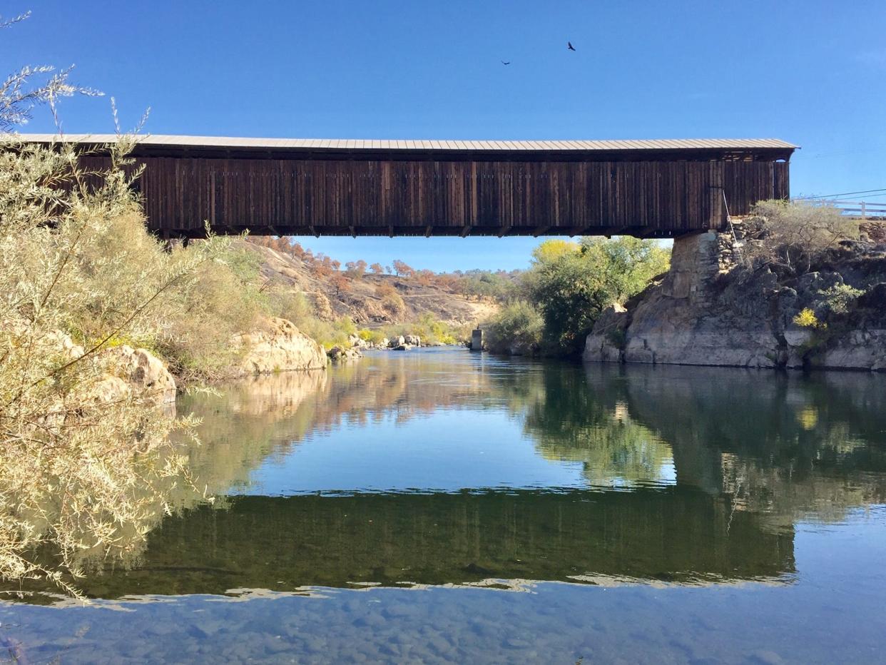
Just 40 miles east of Stockton is the historic Knights Ferry Covered Bridge across the Stanislaus River. Knights Ferry was established when gold was discovered in 1849; Dr. William Knight (a member of the 1844 Fremont party) returned and established a ferry. Within a few years, a toll bridge was built through the huge flood of 1862 washed it away. A new bridge was finished in 1864, higher and built to last, the longest covered bridge in the state at 333 feet.
The bridge anchors a beautiful state park, trails perfect for exploration in the river’s riparian plain, and a mixed bag of wildflowers, including California poppies, lupine, buttercups, and more. The park features the old Mill House, circa 1854, and the Tulloch Mill, a gristmill built after the big flood adjacent to the bridge. The town grew to include several hotels and taverns (one still stands, dating to 1856) and the International Order of Odd Fellows (IOOF) hall, circa 1870, still used today for community events. Check out the Knights Ferry General Store and Saloon, the Knights Ferry Creamery, and Rivers Edge Restaurant, all within a short walk from the old bridge.
Two others are not too far north if you are a covered bridge fan. One of the oldest and, by design, classiest old covered bridges in the state was recently renovated. The Bridgeport Covered Bridge, on Pleasant Valley Road in Penn Valley, spans the South Yuba River (about 105 miles, 2.5 hours north of San Joaquin County). Originally built in 1862, it spans 226 feet and is 16 feet wide, the only remaining single-span Howe Truss-Burr Arch-covered timber bridge of its size in the nation. In its day, it carried traffic to the nearby Sierra gold fields and later to the silver strikes in Nevada.
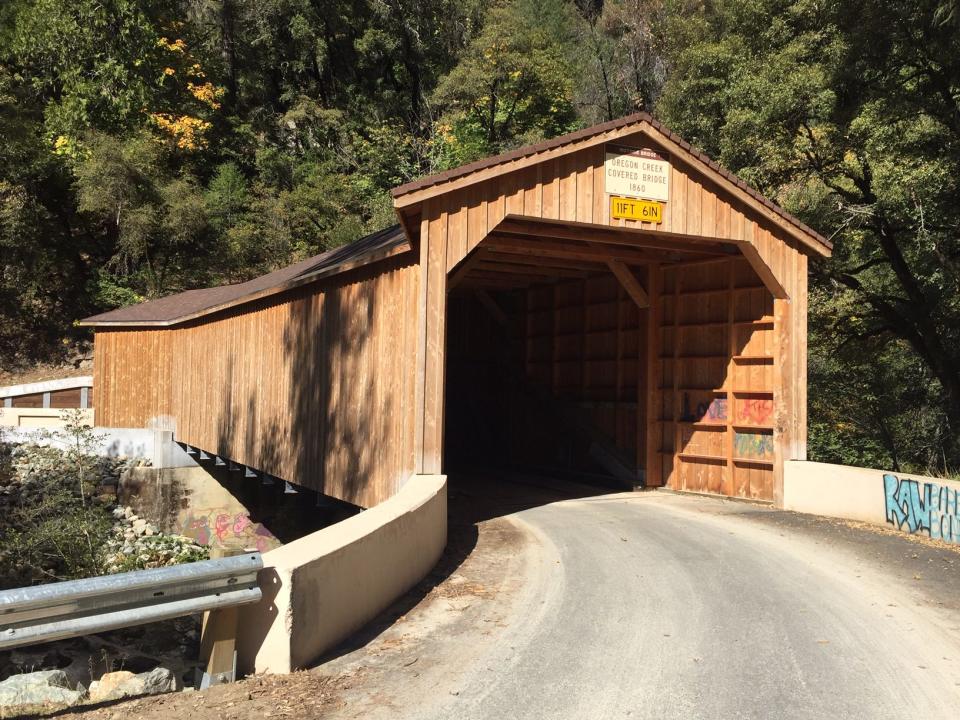
Just 30 minutes northeast, tour the Oregon Creek Covered Bridge, spanning 105 feet across the lively creek, just above its confluence with the Middle Yuba River. Located near the quaint gold rush town of North San Juan, the bridge was built in the 1860s and still carries auto traffic. An 1881 flood knocked the bridge off its moorings and spun it 180 degrees; builders moved it back into place, testimony to the solid engineering of the old span!
Our nearby San Joaquin/Sacramento River Delta is checker-boarded by historic bridges spanning both rivers and a host of sloughs that once made the Delta home to passenger travel only by riverboats. The bridges, accelerated by the development of cars and trucks, eventually made riverboats pass; today, the classic bridges offer fun destinations, with nearby towns of historical consequence, with restaurants, pubs, and wineries offering pleasant diversions.
For a road trip to old Delta towns and bridges, take the Walnut Grove Road off Interstate 5, head west to Walnut Grove, with a side trip to Locke, just north. Both towns reflect the energy of the Delta over 100 years ago, with Locke being home to a large Chinese immigrant population. In Walnut Grove, cross the historic steel truss bridge, almost 100 years old, and head south on California Highway 160 to the delightful old hotel and one-time speakeasy of the Ryde Hotel (classy restaurant, a bar that hops on the weekends). From Ryde, you can go west on Highway 220 and find additional historic bridges and access to the Grand Island Mansion, a host of wineries nestled in the Delta, and even the J Mack Ferry, one of two remaining free auto ferries in the area.
In the Sacramento area, you’ll find several famous historic bridges. Twenty miles up the American River is the old Fair Oaks Bridge, a stately steel truss bridge built in 1901, washed out by floods in 1907, and rebuilt in 1909. It carried auto traffic into the 1960s and now offers foot and bike traffic access from the lovely American River Bike Trail up the hill to the old town of Fair Oaks, lined with fine restaurants, coffee houses, bake shops, and the Fair Oaks Brew Pub – perfect for a mid-day stop.
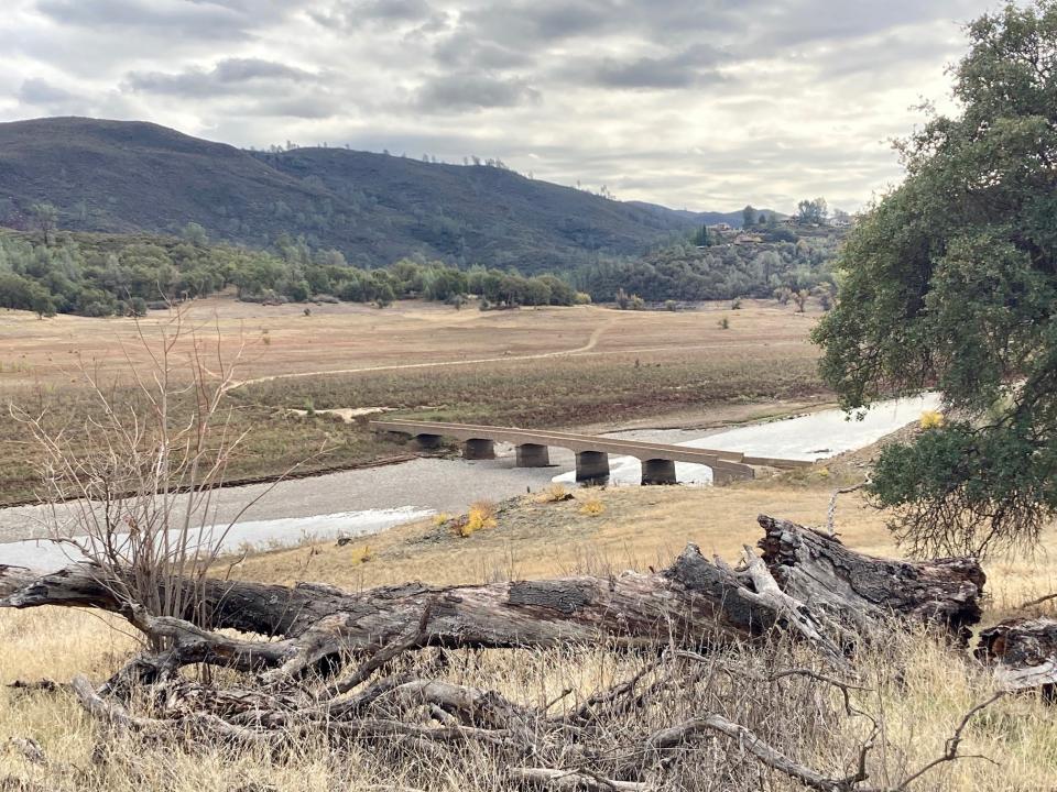
Further up the American River, take Highway 50 to El Dorado Hills, go north on El Dorado Hills Boulevard, and follow Salmon Falls Road to the South Fork American River. Here, a scenic four-mile trail from the new Salmon Falls Bridge will take you to the old Salmon Falls Bridge, now known as “Hidden Bridge,” since it is often deep underwater when the Folsom Lake reservoir is near capacity. Built in 1925 of poured concrete, the stout two-lane bridge carried locals from the now-vacated gold rush town of Salmon Falls across the river to timber and gold rush country above. We hiked there recently; heavy storms have filled the reservoir to inundate the bridge and old townsite again, but by late summer, receding lake waters will again reveal the structure.
So, pack that cooler with soft drinks and prepare to enjoy a revealing road trip!
Information
California-covered bridges, dalejtravis.com/cblist/cbca.htm; historic bridges, bridgehunter.com; for nearby hiking trails, the Alltrails app on your phone/tablet.
Contact Tim, tviall@msn.com; happy travels in the West!
This article originally appeared on The Record: Take a tour of San Joaquin County's covered bridges

