A new travel plan could close hundreds of miles of Moab’s desert roads. Is it needed conservation, or government overreach?
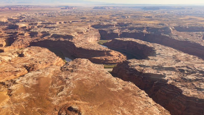
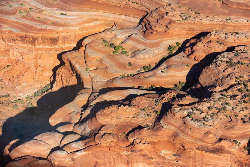
From several thousand feet above, the winding network of roads and trails that twist and divide sections of Gemini Bridges and Labyrinth Canyon in southern Utah are hard to miss. Roughly 98% of the area is within a half mile of a designated road.
But by Sept. 30, the fate of those roads, and the recreation dynamics of the area in general, will be decided by the Bureau of Land Management, which is gearing up to release a new travel plan for the Gemini Bridges-Labyrinth Canyon area.
There are several options — one would essentially manage the land the same way it’s been managed for decades, another would close hundreds of miles of roads.
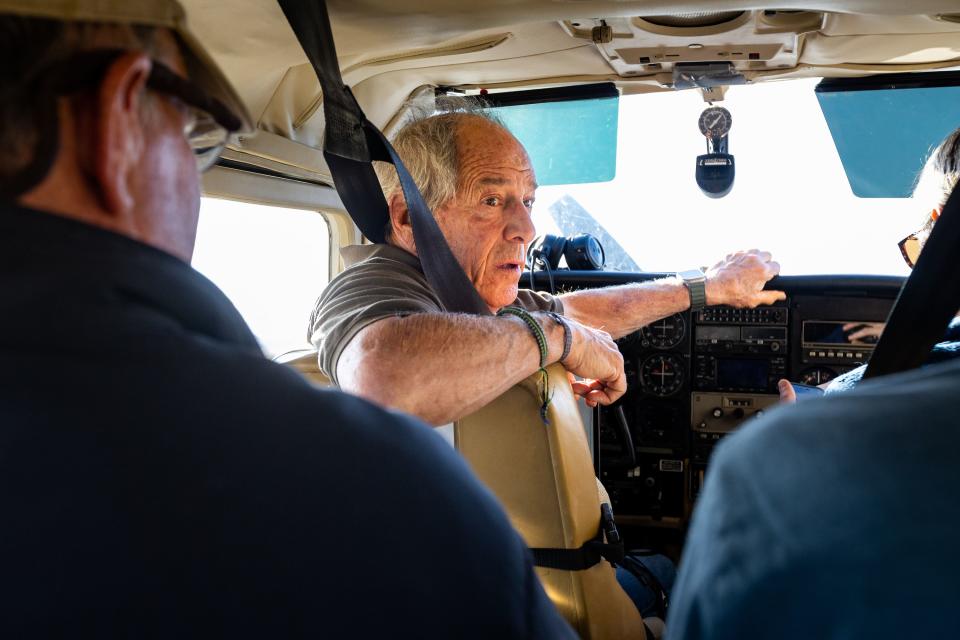
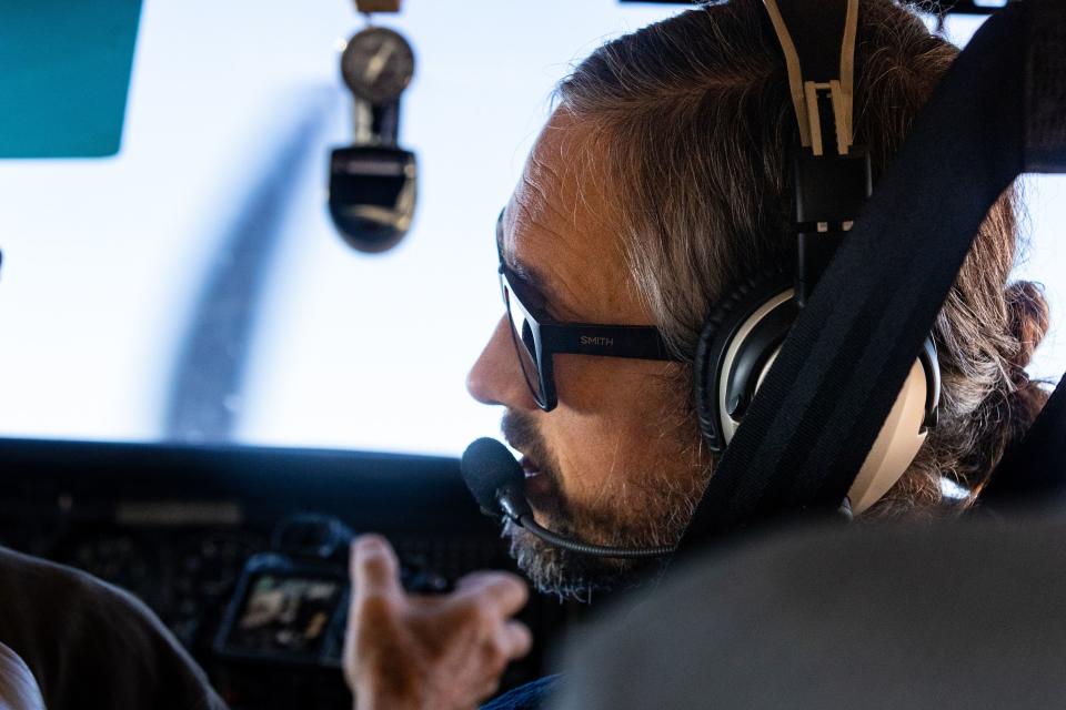
On Friday, Deseret News journalists boarded a small, six-seater Cessna to survey the region and its network of roads. The flight was hosted by the Southern Utah Wilderness Alliance, or SUWA, and Ecoflight, a nonprofit that uses small aircraft to advocate for conservation.
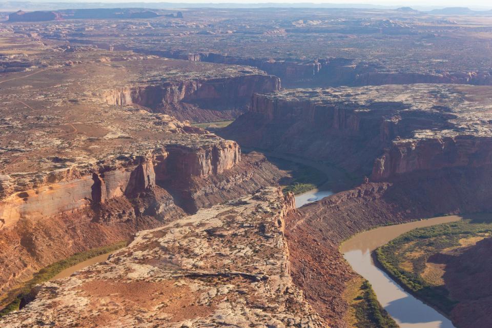
Taking off from the small Canyonlands Regional Airport outside of Moab, the plane flew West over Hell Roaring Canyon, a normally dry wash that earns its name during rainstorms when it sends a torrent of water into the Labyrinth Canyon of the Green River.
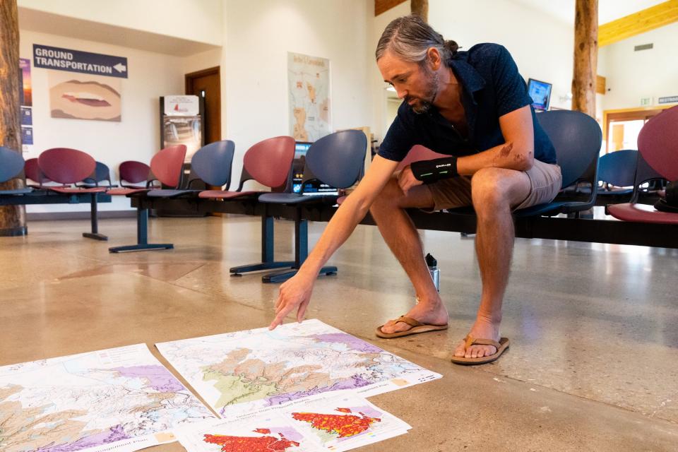
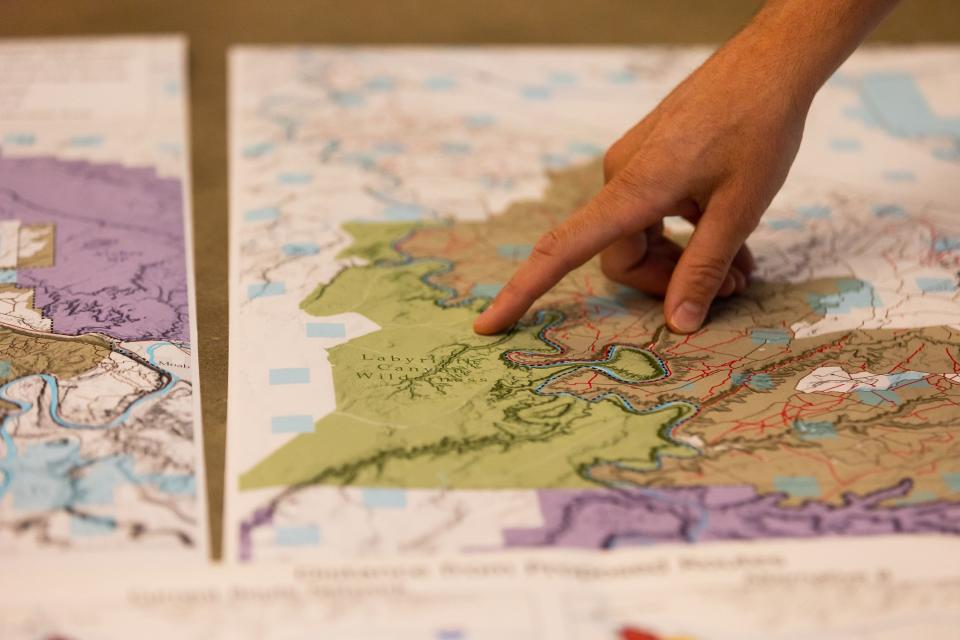
The six-seater Cessna plane continued west as the pilot, Bruce Gordon, steered over the Mineral Bottom boat launch before turning north, hugging the border of the Labyrinth Canyon Wilderness Area in Emery County. The plane banked slightly to the right, peering down into the red maze of sandstone canyons and the flat water of the Green River.
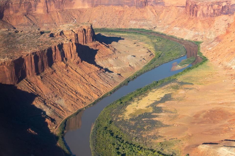
Sitting in the passenger seat, Neal Clark, SUWA wildlands director, pointed to Bowknot Bend, a peculiar meander of the Green River separated by a small mesa that, from the sky, looks like it would crumble during the spring runoff. “It’s one of the more iconic formations” in Labyrinth Canyon, Clark said.
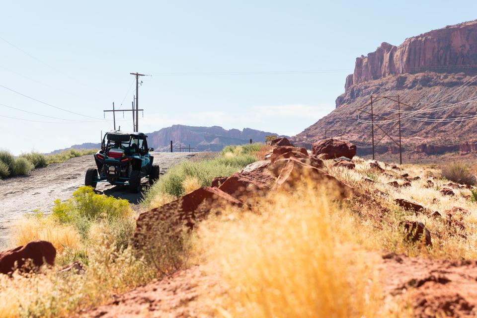
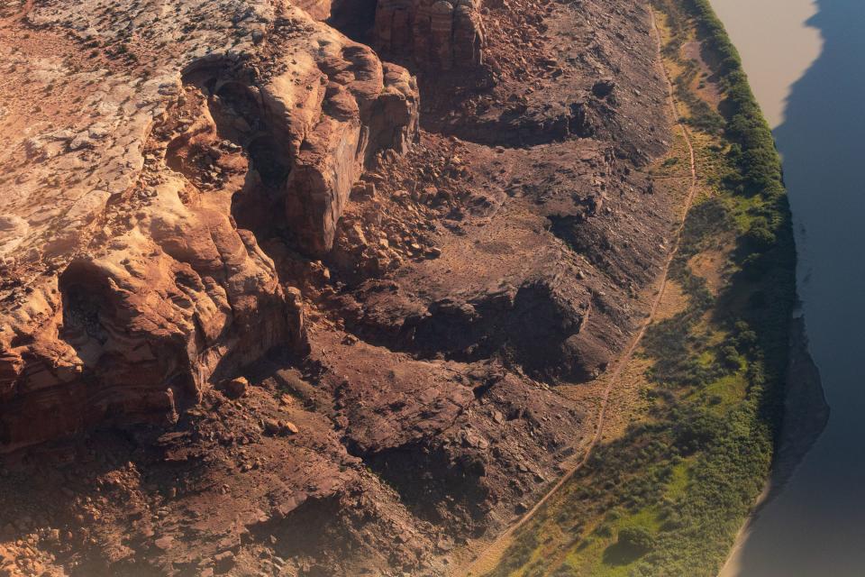
Near Bowknot Bend, a small road emerged from the red rock, veering north and cutting through the bright green riparian buffer of the Green River. An off-roading route called “Hey Joe,” it’s one of hundreds that the Bureau of Land Management could close to the public in the coming days.
Environmental advocates say the potential closures would strike a balance between motorized and nonmotorized users while protecting cultural and natural resources. Off-roading enthusiasts say more restrictions is government overreach, could threaten Moab’s economy and will unnecessarily bar users from accessing the land.
The process started in 2008 after SUWA sued the Bureau of Land Management over its resource management at the Moab, Vernal, Price, Kanab, Monticello and Richfield field offices.
SUWA argued that some of the plans didn’t look after the cultural resources in accordance with federal law — it won, starting a decade’s worth of travel plan revisions that are starting to take shape.
The BLM eventually rolled out four alternatives:
Alternative A would essentially keep the current management in place, with 1,056 miles of designated roads and about 70 miles of “limited” roads for smaller vehicles.
Alternative B would keep 606 miles open, limit 84 miles and close 437 miles of road, the most restrictive plan of the four. According to the BLM, it “prioritizes protection of wildlife habitat, natural and cultural resources, ecosystems, and landscapes.”
Alternative C would keep 838 miles open, limit 121 miles and close 167 miles, which the BLM says represents a “balanced approach to OHV access resource protection.”
Alternative D would keep 974 miles open, limit 100 miles and close 52 miles.
SUWA and the Grand County Commission want Alternative B — groups like the BlueRibbon Coalition, a motorized recreation advocacy group, and Utah Rep. Phil Lyman, R-Blanding, whose legislative district encompasses the area, want Alternative A.
Each alternative is subject to change depending on public comment, and some of the routes slated to be closed — including the popular Hey Joe, Gold Bar Rim and Ten Mile Canyon roads — could be left open. It’s also possible that either SUWA or the BlueRibbon Coalition will sue if the decision doesn’t align with their interests.
The Gemini Bridges-Labyrinth Canyon area is the third of 11 travel plans that will be revised following the settlements. Of all 11 regions, it’s one of the more high profile and controversial.
A short drive from Moab, the area has seen a proliferation of motorized use in recent years, a trend impacting much of the popular southern Utah tourist destination. And Labyrinth Canyon is one of the few consistent stretches of flat water on the Green River, doable on canoes or stand-up paddleboards.
SUWA and the BlueRibbon Coalition — two groups that struggle to find consensus — agree that the BLM’s pending decision could be indicative of what the agency does with the remaining eight travel plans.
But that’s about all the two groups can agree on in the debate over the future of Gemini Bridges-Labyrinth Canyon.
“This is an opportunity for the BLM to finally get it right, to balance management and to actually protect the river corridor and those side canyons,” said Laura Peterson, staff attorney for SUWA.
John Weisheit, an environmental activist and co-founder of Living Rivers, said the current system is a “free for all.” In his 35 years living in Moab and running the Green River, he says the riparian zone — the lush, green stretch of vegetation along the banks integral to the health of water ecosystems — has deteriorated.
“If you damage the riparian zones, you damage everything,” he said. “It’s not about restricting people’s access, it’s about managing and controlling land so that it’s here for others in the future.”
Even with the most restrictive option, the area will still have about 690 miles of designated road for motorized use, and over 3,500 miles of road in the greater area managed by the BLM Moab field office.
“It’s really modest when you look at how many miles of routes will continue to be open to motorized use, both within this travel plan area, and within the larger landscape,” said Clark. “If you look at the travel plans that are in existence, off-road vehicles are dominating the landscape.”

For Lyman, one of the more conservative members of the Utah Legislature who was found guilty of trespassing after protesting road closures in Blanding in 2015 (and was pardoned by former President Donald Trump in 2020), the idea of the BLM shutting down more routes is “frustrating.” He said the lack of pushback from other Utah politicians is another example of Utah pretending it’s “an administrative sub-unit of the federal government.”
“The fact that the state Legislature won’t pull any levers, the fact that the governor won’t pull any levers, that’s the most frustrating thing for me. Because they can, and they should, and they simply dance around the issue to not stir up the ire of the environmentalists,” Lyman said.
It’s issues like this that galvanized Lyman to run for office, and have him seriously considering a gubernatorial run. On Friday, he told the Deseret News that he’s “definitely looking at that.”
“Right now, it’s all systems go,” he said.
Most of the routes that could be closed are “Class D” roads, small double-tracks, many of them unnamed. Most were established decades ago for mining or oil exploration, cemented in the desert by off-roaders and overlanders who continued to use them. Some are visible from the air, but seem to disappear into the shrubs and soil once on the ground.
“It’s really just a historical accident from people driving around,” said Clark.
But Ben Burr, executive director of the BlueRibbon Coalition, says roads of that size have a very minimal impact.
“I just don’t think the environmental impacts are as accurate as others would claim them to be,” he said.
It’s restrictions like this, Burr said, that could harm Moab economically by creating an anti-off roading “brand.”
“A lot of people feel like they’re not welcome in Moab,” he said. “And this plan is just one more arrow in that quiver of communicating to people that this is a nature preserve, it’s not a recreation area.”
Clark says the same is true for nonmotorized recreation. By “prioritizing” off-roaders, Moab risks alienating the other public land users.
“Motorized recreation is just one component of the larger tourism ecosystem in Grand County. And I think the County Commission, local governments and citizens are understanding that you run the risk of losing nonmotorized tourism if you flood the landscape with off-road vehicles,” he said.
Back at the Canyonlands Regional Airport, Weisheit with Living Rivers stepped out of the Cessna into the warm, fall air. A hardened river guide with decades of near-misses and hair-raising mishaps, he’s unfazed by the rough landing.
From the air, the boundaries separating national park, wilderness, private land and Bureau of Land Management land of the Gemini Bridges-Labyrinth Canyon area seem arbitrary, he says.
“This concept of boundaries is very much a construct of the way we run things. But who’s really in charge is nature,” he said.

