Treasure Coast under tropical storm watch; 20-35 mph winds, 50 mph gusts possible
The National Weather Service placed the Treasure Coast, along with the entire east coast of the state from the Jupiter Inlet to Georgia, under a tropical storm watch in its latest update on Hurricane Ian.
The advisory shows tropical storm-force winds could be present in Indian River, St. Lucie and Martin counties somewhere within the next 48 hours as the storm intensifies and pushes north.
Tropical storm-force winds are classified as 39 to 73 mph, according to the National Hurricane Center in Miami.
Indian River County emergency officials report peak winds will likely be between 25 to 35 mph, with gusts up to 50 mph.
Further south, inland St. Lucie and Martin counties could see 23-30 mph wind with gusts up to 45 mph, while coastal winds across the region will likely be 5 mph greater at any point, said Jessie Smith, a meteorologist with the National Weather Service in Melbourne.
“It’s pulled it a little bit eastward," said Smith. "The newest cone brings it closer to Spring Hill (and) Citrus County ... it’s a lot slower too."
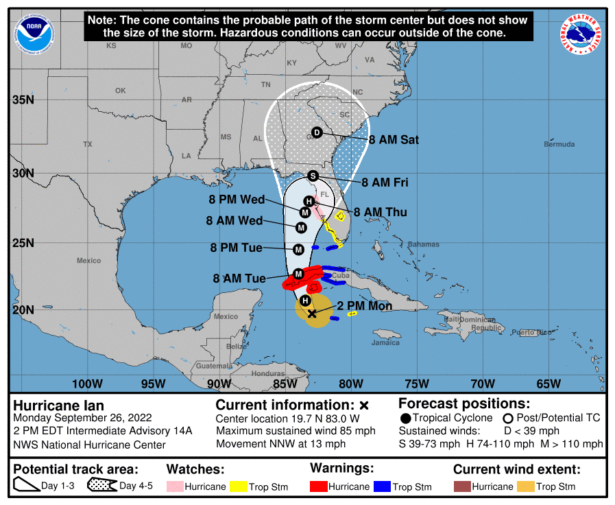
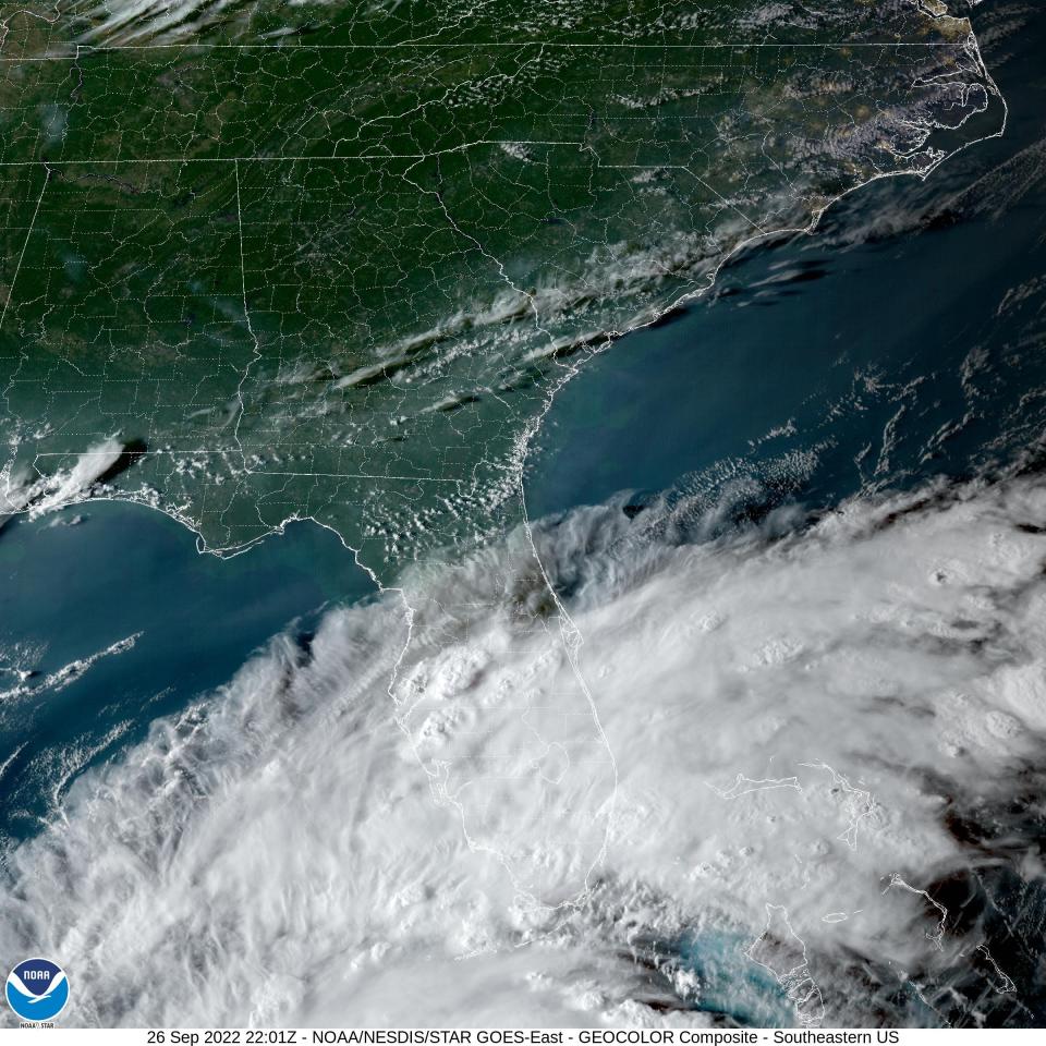
The storm is expected to slow in the Gulf, which Smith said could lead to “higher threats of flooding rainfall,” especially to the state’s west coast.
“It’s maintained the intensity,” Smith said. “It’s going to max out as a Category 4 hurricane.”
Booking on the rise: Some Treasure Coast hotels see increased bookings as hurricane approaches west coast
Keeping an eye on the storm: Treasure Coast Sheriffs keeping eye on Hurricane Ian path, plan for any impacts
Hurricane Ian: Tropical storm force winds and flooding could reach Treasure Coast
As of 5 p.m. Monday, the National Hurricane Center reported the storm had maximum sustained winds of 100 mph with higher gusts. It was forecast to strengthen and become a major storm overnight as it nears Cuba and moves into the Gulf of Mexico by Wednesday.
The latest update shows hurricane-force winds extend roughly 35 miles from its center, while tropical-storm-force winds extend outward up to 115 miles.
Indian River County emergency officials report the degree of the weather impacting the Treasure Coast could cause damage to unsecured mobile homes, or outer structures on homes, like porches or awnings.
Tree limbs and debris were also mentioned as objects that could damage homes, block roadways or cause power outages.
Corey Arwood is a breaking news reporter for TCPalm. Follow Corey on Twitter @coreyarwood, or reach him by phone at 772-978-2246.
This article originally appeared on Treasure Coast Newspapers: Treasure Coast, entire Florida east coast under tropical storm watch

