Snow starting to fall again. Winter weather advisory issued for Tri-Cities
Updated forecast:
A 70% to 80% chance of snow is forecast for the Tri-Cities on Thursday with 1 to 3 inches of new snow possible, says the National Weather Service.
The weather service has issued a hazardous weather advisory for the area, predicting a mix of snow, freezing rain and sleet until 10 a.m. Friday. Wind gusts could reach up to 18 mph.
Friday freezing rain is likely, mainly before 10 a.m. Only a slight chance of freezing rain is forecast Friday night through 10 am. Saturday.
Check for school delays or cancellations at bit.ly/SchoolClosuresDelays.
Warmer weather should bring rain rather than snow to the Tri-Cities on Sunday through Wednesday.
Highs are expected to be in the 20s for the rest of the work week, reaching the 30s for the weekend and the low 40s on Wednesday, Jan. 24.
-------------------------
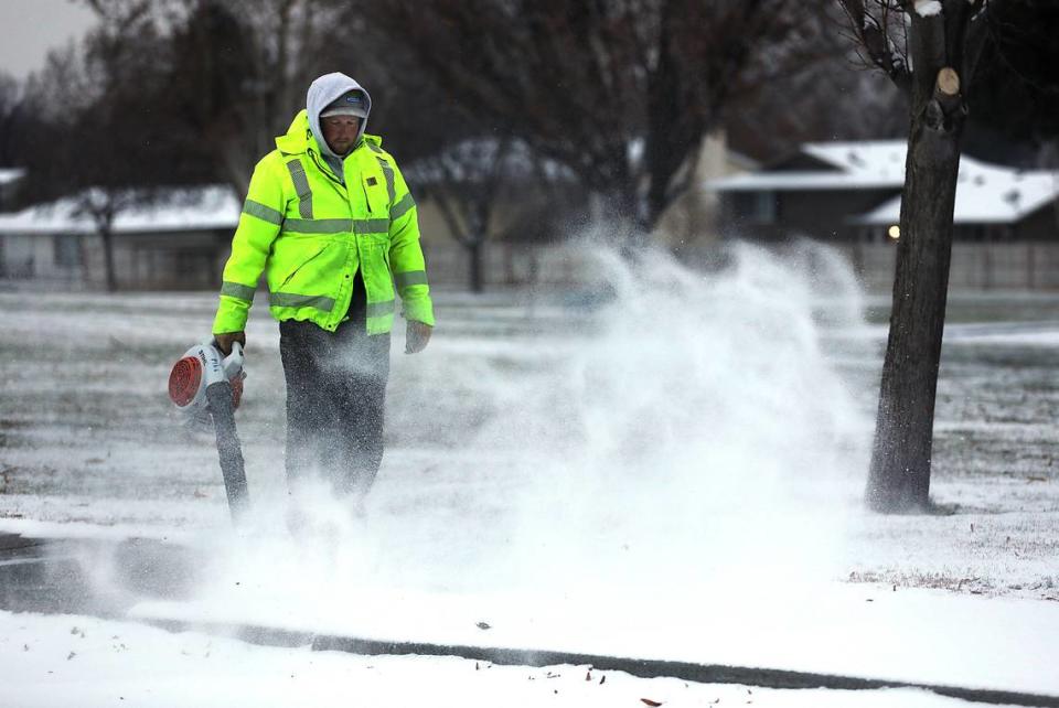
Many workers went home early in the Tri-Cities Wednesday, after a day that started with snow covering the ground followed by sporadic freezing rain.
More snow and some freezing rain are forecast for the rest of the week.
As freezing rain started to fall around 10 a.m. Wednesday Hanford nuclear reservation site workers not essential to safety and security, including those in Richland, were sent home on a staggered schedule. Swing shift was canceled, although as of early evening graveyard shift remained on its regular schedule.
Washington State University Tri-Cities closed its Richland campus at 3 p.m.
West Richland city offices closed at 10:45 a.m., city of Pasco offices closed at 3 p.m. and Franklin County workers, other than those in the courthouse, were sent home at 4 p.m.
The Kennewick School District and Ki-Be canceled all evening events and activities.
Pasco activated its 24-hour snow and ice removal Tuesday. A dozen staff are working from 12 a.m. to 8:30 a.m. to ensure continuous road maintenance.
Interstate 84 from Hood River, Ore., to Troutdale, Ore., remained closed Wednesday evening. The Oregon state Department of Transportation closed the section of the interstate about 3 p.m. Tuesday afternoon in anticipation of the ice storm.
The Washington state Department of Transportation closed Highway 14 on the other side of the Columbia River Gorge just before 5 p.m. Wednesday from near Washougal to near the Hood River Bridge Road due to icy conditions. Earlier only large trucks had been banned.
Interstate 90 in the Washington Cascade Mountains closed periodically on Wednesday due to spinouts, crashes and avalanche control work.
“Severe weather conditions today,” the Washington state Department of Transportation warned.
I-90 closed from 1 a.m. Wednesday for about 35 miles from near North Bend to Easton, with westbound lanes reopened around 6:15 a.m. and eastbound lanes reopened about an hour later.
The interstate closed again, this time from Ellensburg to Cle Elum about 9:20 a.m. until about 1:20.
Avalanche control work closed eastbound lanes at North Bend mid afternoon. The Washington state Department of Transportation reported lanes were open in both directions at about 6 p.m.
Crashes, school delays
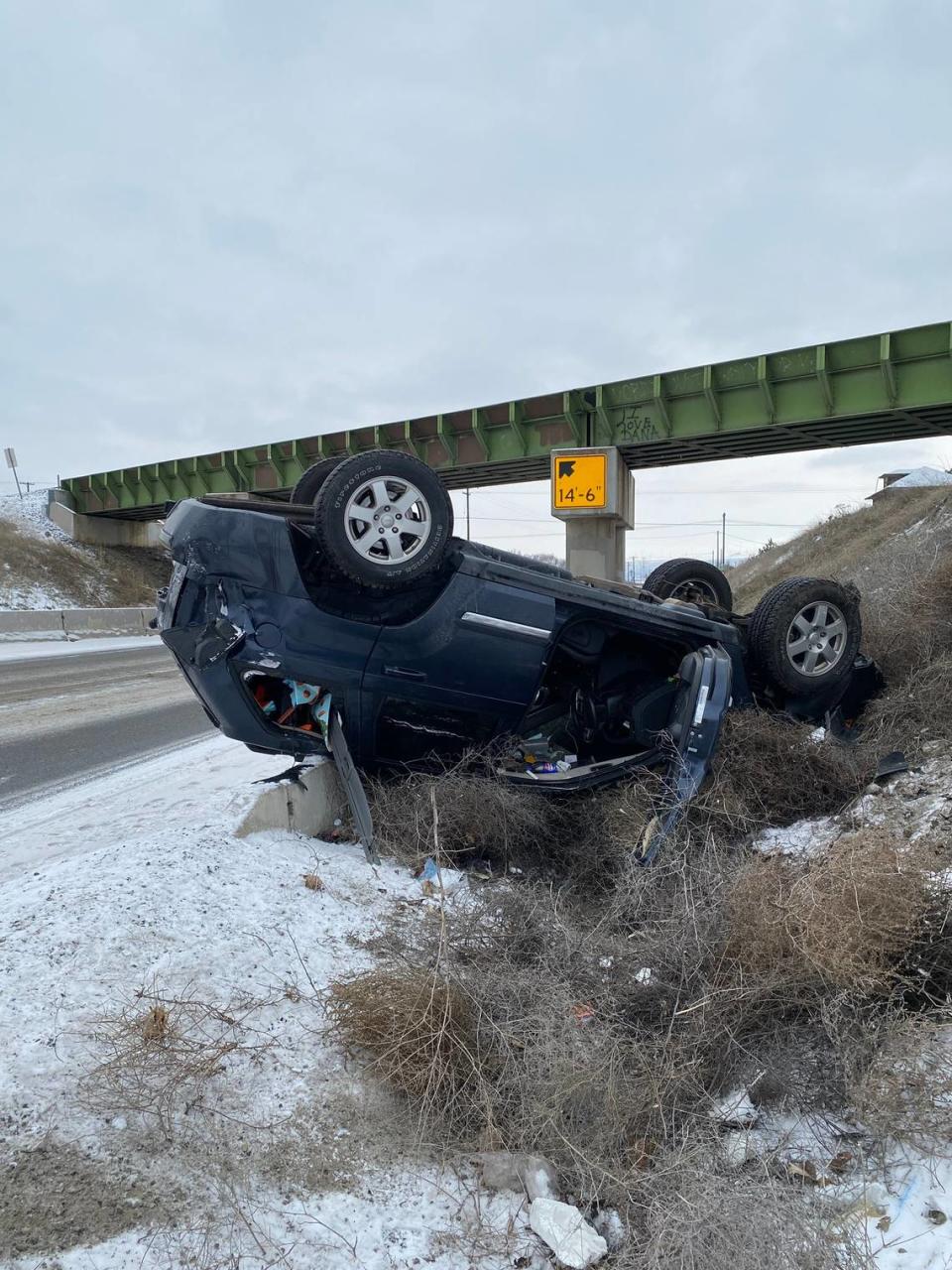
The day started with crashes across Benton and Franklin counties on icy roads.
“Road conditions in the county are snowy, icy and slick. Please drive carefully and increase your following distance,” the Franklin County Sheriff’s Office posted early Wednesday.
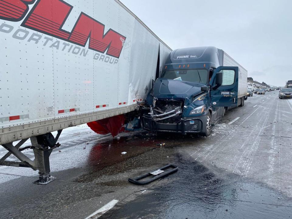
The Washington State Patrol reported they were among 37 crashes on Tri-Cities area state highways before noon. It reported 13 crashes in Yakima and the lower Yakima Valley.
“Be extra careful around on and off ramps on the highways. We are seeing a lot of cars spinning out and sliding off the roadways,” wrote state patrol Trooper Chris Thorson in a social media post.
There were reports of crashes across Benton County through Wednesday morning. County sheriff’s deputies reported seeing two cars flip on Highway 397 near East Bernath Road about 11:15 p.m.
The Washington State Patrol reported a crash with three semi trucks Wednesday afternoon on Interstate 82 at Badger Canyon that closed eastbound lanes for a time.
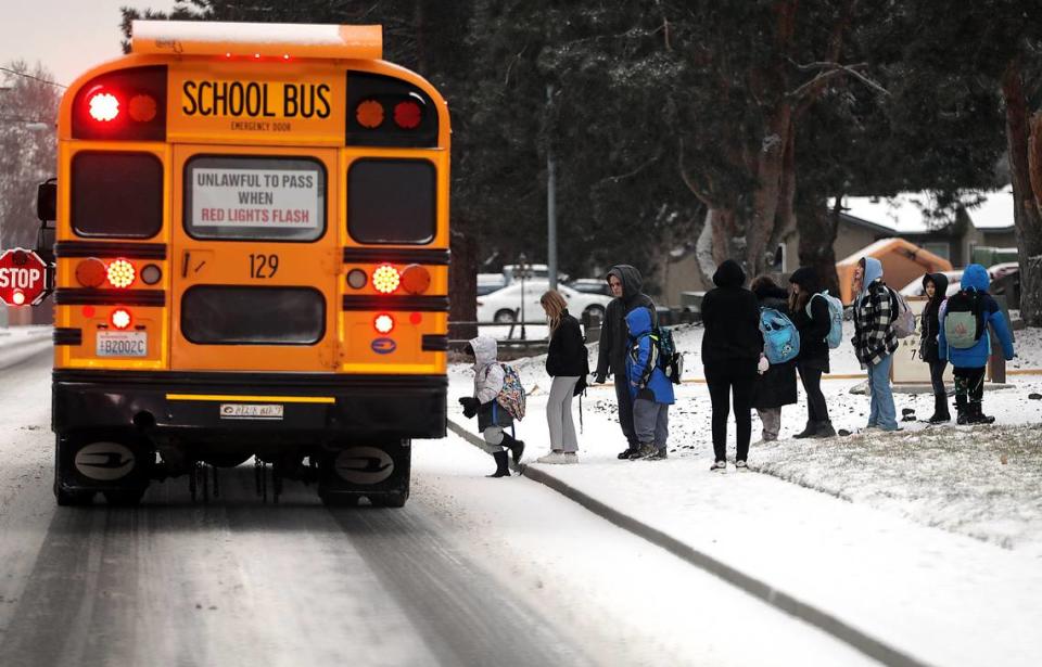
Most Tri-Cities students went to school as usual. But many outlying and rural schools were on two-hour delays.
They included Kiona-Benton City, Columbia in Burbank, Kahlotus, North Franklin, Paterson, Prosser, Sunnyside and Grandview school districts and the Benton City branch of Benton Franklin Head Start.
Meals on Wheels dining sites in Connell, Prosser and Benton City closed and no home deliveries from those locations were planned.
WA, OR travel forecast
The ice storm warning for I-84 through the lower Columbia River Gorge expired Wednesday night, but a mix of rain, snow, sleet and freezing rain was forecast at various times from Thursday night through Saturday morning at Hood River, Ore.
By the weekend rain is expected.
Interstate 90 at Snoqualmie Pass will be under a winter storm warning through Thursday afternoon. Heavy snow is forecast.
The weather service expected 10 to 16 inches of new snow Wednesday by the evening and another 2 to 4 inches Wednesday night.
Thursday new snow accumulations of 5 to 9 inches are possible.
Warming weather is expected to bring a wintry mix that could include snow, freezing rain and sleet from Thursday night through early Saturday morning. But by at least mid morning Saturday through the rest of the weekend precipitation should fall as rain.
Interstate 84 through the Blue Mountains also is under a winter storm warning through Thursday afternoon.
New snow accumulation of 2 to 4 inches Wednesday night and 1 to 3 inches Thursday is possible, according to the weather service.
Freezing rain is likely Thursday night until early Friday afternoon, possibly with more freezing rain overnight. Then precipitation should change to rain for the rest of the weekend and the start of the coming work week.
Tri-Cities overnight shelter
The Benton Franklin Health District said overnight shelter options are available in three Tri-Cities communities:
▪ Kennewick Christian Church, 1921 S. Olympia St., is open 24 hours when temperatures fall below 10 degrees.
▪ All Saints Episcopal Church, 1322 Kimball Ave., Richland, is open 5 p.m. to 9 a.m. when temperatures fall below 20 degrees.
▪ Tri-City Union Gospel Mission, 221 S. Fourth Ave., Pasco, is open 24 hours a day for men only when temperatures fall below 32 degrees or there is snow, rain or wind.


