Tribal lands in Wisconsin now visible on Apple Maps, including landmarks and places for Native cuisine
GREEN BAY - Drivers using Apple Maps for navigation will now know when they’re traveling through tribal lands in Wisconsin and across Indian Country.
Typically used on iPhones, the navigation app is being updated with information about the hundreds of sovereign Indigenous nations in the U.S. and Canada.
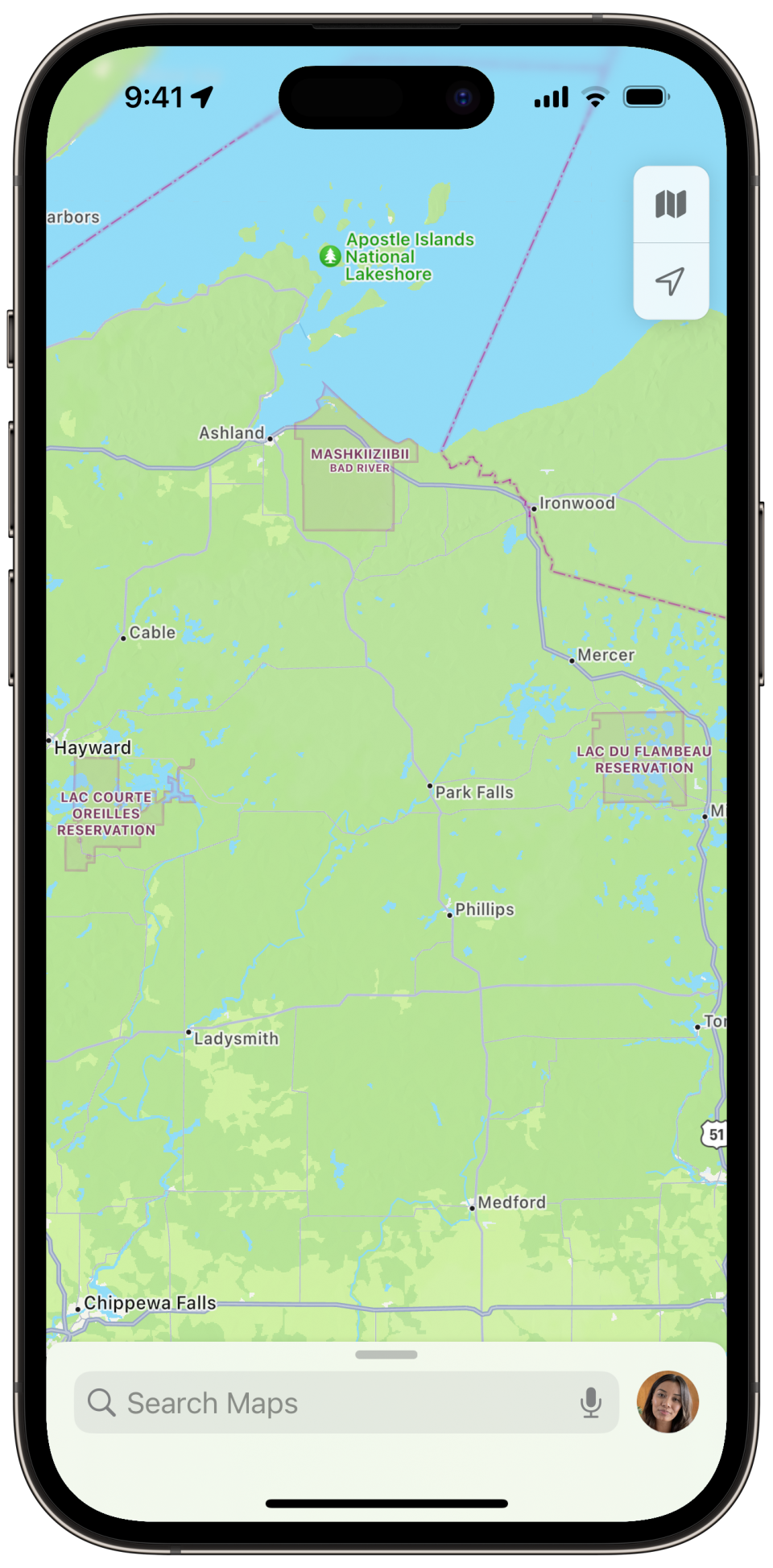
The upgraded app maps the lands of the 11 federally recognized tribes in Wisconsin.
Tribal borders within the upgraded Maps app may also help reinforce the sovereignty of these Indigenous nations for users.

Sign up for the First Nations Wisconsin newsletter Click here to get all of our Indigenous news coverage right in your inbox
Apple is using the same color for Indigenous lands and First Nations demarcations as for international and state borders.
Based on feedback from an Indigenous cartography consultancy, Apple changed the color of borders in Maps from red, which could have a negative stereotypical association, to a new “plum” color, which will now be used worldwide for all territory borders.
The upgraded Apple Maps app also incorporates the dual language names for places on reservations the Wisconsin Department of Transportation recently started recognizing with road signs.
For example, road signs were recently placed around the 65,000-acre Oneida Nation Reservation featuring the Oneida language.
One of the new signs is near the Duck Creek bridge. It features the words Taluʔkowanhné (Da-lew-go-wonh-NAY), which translates to “Place of Bountiful Ducks,” and Kawyhuhatati (Gaw-who-ha-DA-di), which means “River Flowing Along.”
Other reservations that have dual language signs in a particular tribe’s language in Wisconsin also include the Red Cliff Nation and Menominee Nation.
Although these Indigenous language place names in Wisconsin were only made official by WisDOT within the last year, they are already incorporated into Apple Maps.
The installation of the signs is part of an initiative from WisDOT to place Indigenous-language signs at the entrances for the lands of all 11 federally recognized tribal nations in Wisconsin.
The maps are also updated with the new names for dozens of water features in Wisconsin that had been recently replaced by the U.S. Department of the Interior because the previous names used a word that was offensive referring to Indigenous women.
Place names: Officials have renamed 28 places in Wisconsin that had names derogatory to Indigenous women. Here's where they are.
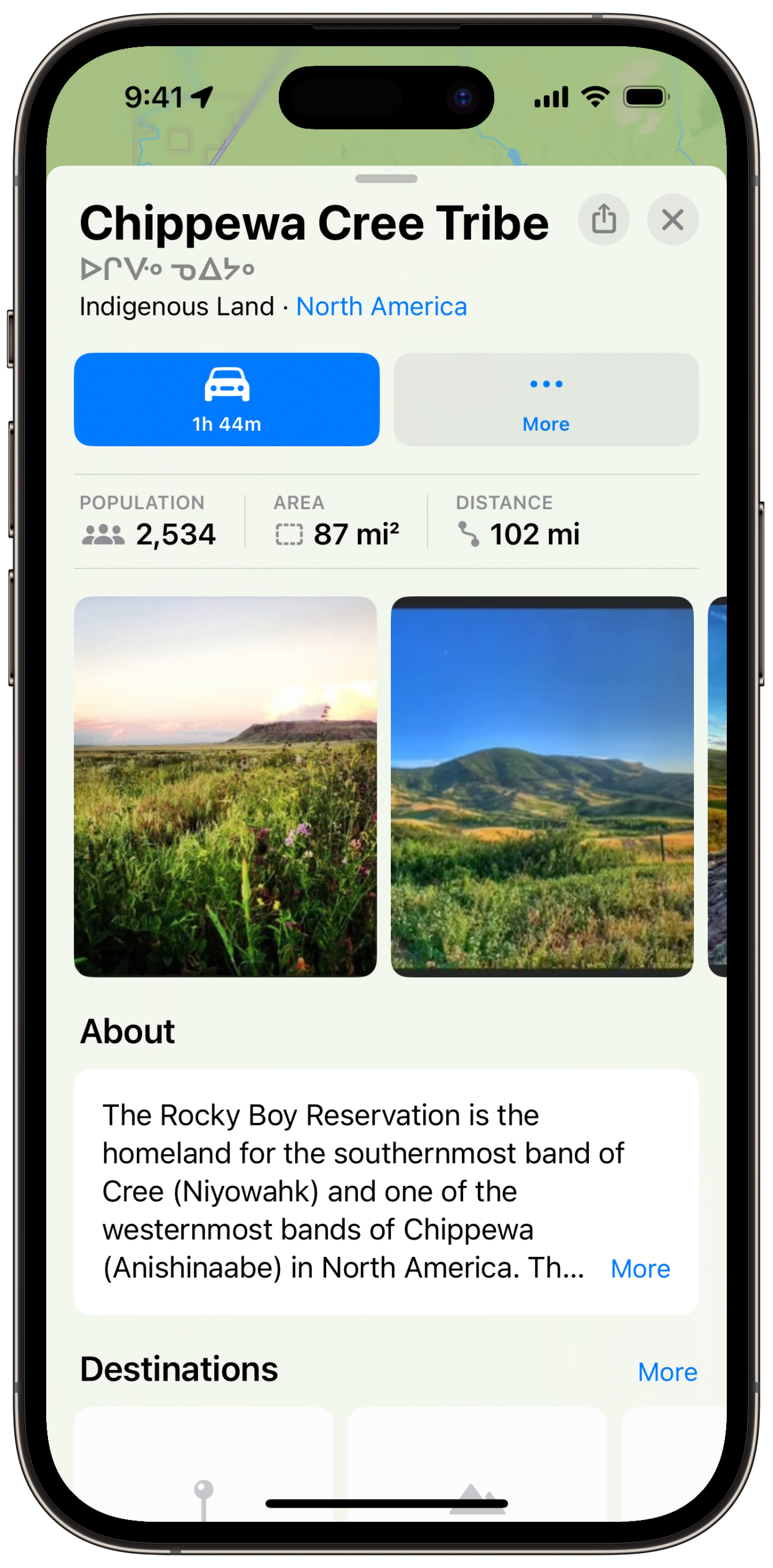
Apple engineers are also working on “place cards” for each tribal nation, which includes quick facts, such as population and area size, as it does for any other nation in the world.
Apple has collaborated with six tribes, so far, including Cherokee Nation and Chippewa Cree Tribe, to customize their place cards with images, detailed information, and destinations, and is hoping to work with even more Indigenous Communities and First Nations to help best represent their lands in Maps.
Apple is inviting tribal officials in Wisconsin to work on content for their tribe's place cards by reaching out through email at maps-outreach@apple.com.
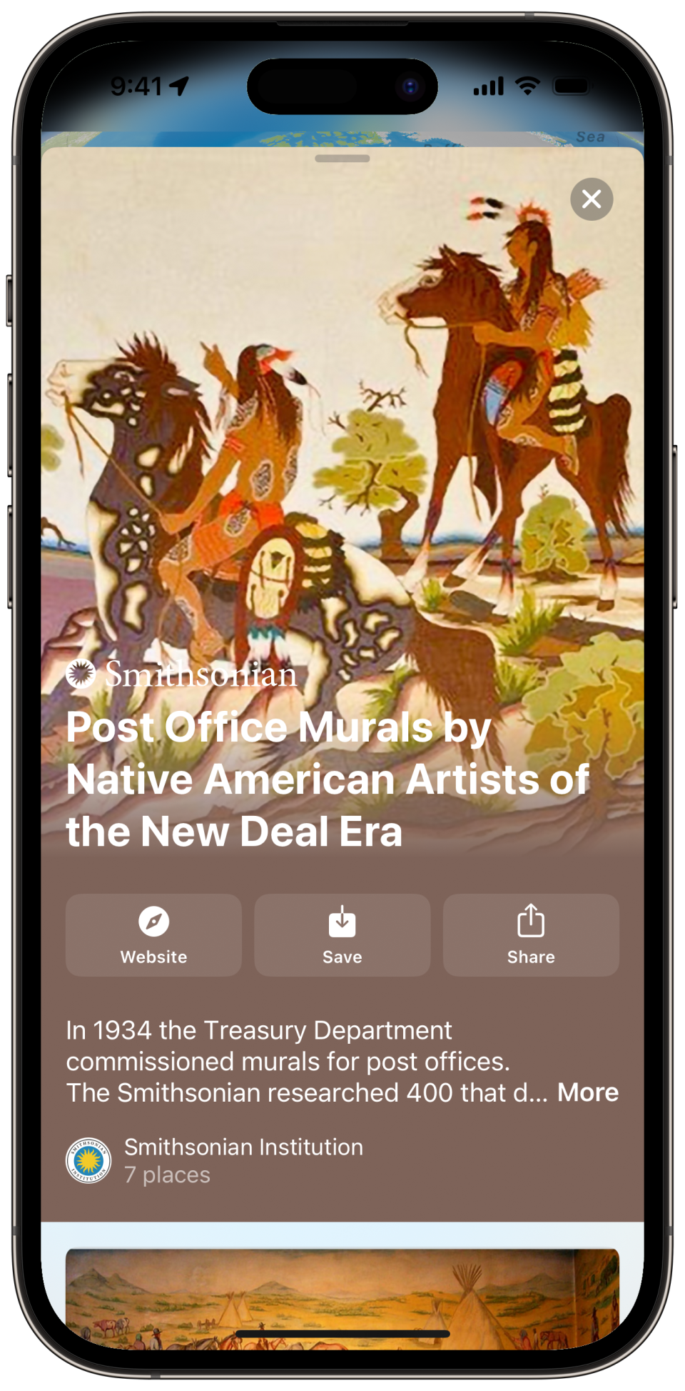
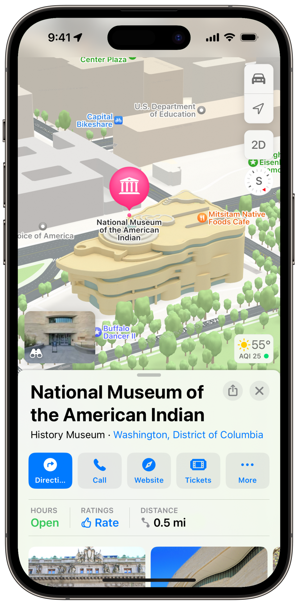
Apple Maps also highlights certain landmarks in Indian Country, such as the National Museum of the American Indian in Washington, D.C.
Apple Maps also helps users find nearby restaurants. Native American cuisine had previously been categorized with American cuisine, but now has its own category in Apple Maps for those looking for Indigenous foods, such as Three Sisters stew or prepared wild rice.
Read more:
Road closures: Can tribes close roads elsewhere in Wisconsin, like the Lac du Flambeau tribe did this winter? Here's what legal experts say.
Literary exhibit: Indigenous writers decry planned destruction of literary exhibit at Wisconsin Center in Milwaukee
Frank Vaisvilas is a Report for America corps member who covers Native American issues in Wisconsin based at the Green Bay Press-Gazette. Contact him at fvaisvilas@gannett.com or 815-260-2262. Follow him on Twitter at @vaisvilas_frank.You can directly support his work with a tax-deductible donation online at GreenBayPressGazette.com/RFA or by check made out to The GroundTruth Project with subject line Report for America Green Bay Press Gazette Campaign. Address: The GroundTruth Project, Lockbox Services, 9450 SW Gemini Drive, PMB 46837, Beaverton, Oregon 97008-7105.
This article originally appeared on Green Bay Press-Gazette: Apple Maps now shows tribal lands in Wisconsin, including landmarks

