Tropical Storm Danielle forms in Atlantic, poised to become hurricane by weekend
It didn't take long for the tropics to heat up in September, as a tropical wave in the northern Atlantic shifted quickly into a tropical depression and then into Tropical Storm Danielle.
The disturbance was a tropical wave at 2 a.m., Tropical Depression Five by 5 a.m., and strengthened into a tropical storm with winds of 40 mph by 11 a.m.
Danielle is forecast to become a strong Category 1 hurricane by the Labor Day weekend, according to the National Hurricane Center.
► Your guide to preparing for the 2022 hurricane season in Florida
The tropical storm, the fourth named storm of the 2022 hurricane season, is drifting to the east-northeast.
At this time, there is no expected direct impact to the U.S.
JUST IN: Tropical Depression 5 has strengthened into Tropical Storm #Danielle about 960 miles west of the Azores. Danielle is the first named storm in the Atlantic basin since Tropical Storm Colin dissipated on July 3: https://t.co/YXl4zh1GrK pic.twitter.com/EkEf32TUkO
— Breaking Weather by AccuWeather (@breakingweather) September 1, 2022
If it does become a named storm, it will be Danielle, the fourth named storm of the 2022 Atlantic hurricane season.
For the seventh time since 1950, the tropical Atlantic went without a hurricane in August, according to Colorado State University meteorologist Philip Klotzbach.
In fact, there were no named storms the entire month.
That may change soon, with the National Hurricane Center monitoring not only Tropical Depression Five but two other tropical waves.
Invest 91L in the central Atlantic has a high chance of becoming a tropical depression.
What's going on in the tropics? August hasn't been this devoid of tropical storms since 1997. Is hurricane season over?
Weathertiger: Baffling scot-free hurricane season thus far, but stormless streak is coming to an end
Here's the latest update from the NHC as of 8 a.m. Sept. 1:
Tropical Storm Danielle
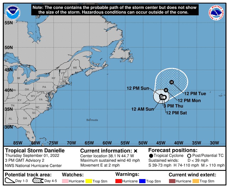
Location: 960 miles west of the Azores; 2,147 miles east of Daytona Beach
Maximum wind speed: 40 mph
Direction: east at 2 mph
Maximum sustained winds have increased to near 40 mph, with higher gusts.
Strengthening is forecast during the next few days, and Danielle is expected to become a hurricane in two days or so. Tropical-storm-force winds extend outward up to 35 miles.
What else is out there and where are they?
Invest 91L: Showers and thunderstorms associated with a broad area of low pressure located several hundred miles east of the Leeward Islands have changed little this morning.
Revised seasonal forecast: Atlantic hurricane season off to slow start. But top forecasters still expect above-normal activity
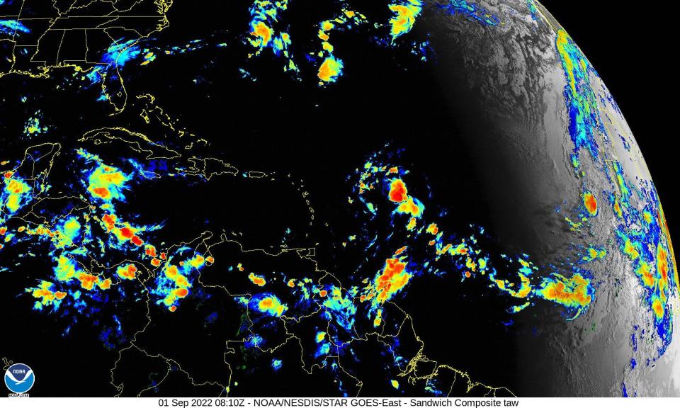
Tropical wave: Satellite imagery and surface observations show that a broad area of low pressure is located over and to the northwest of the Cabo Verde Islands.
How likely are they to strengthen?
Invest 91L: Although environmental conditions remain only marginally conducive, any additional development of the system over the next few days would lead to the formation of a tropical depression.
The disturbance is forecast to move slowly west-northwest, toward the adjacent waters of the northern Leeward Islands.
Formation chance through 48 hours: medium, 60 percent.
Formation chance through 5 days: high, 80 percent.
Tropical wave: While surface observations indicate pressures are low in this area, the associated shower activity is currently poorly organized.
There is still some chance for the system to become a short-lived tropical depression within the next day or so before environmental conditions become unfavorable for further development.
Regardless, the system could bring locally heavy rainfall to portions of the Cabo Verde Islands today and tonight.
Formation chance through 48 hours: low, 30 percent.
Formation chance through 5 days: low, 30 percent.
Who is likely to be impacted?
No impact to the U.S. is forecast from Tropical Storm Danielle.
It's too early at this time to determine if there will be any impact to the U.S. from the tropical waves.
Forecasters urge all residents to continue monitoring the tropics and to always be prepared during what's expected to be an active hurricane season.
When is the Atlantic hurricane season?
The Atlantic hurricane season runs from June 1 through Nov. 30.
When is the peak of hurricane season?

Although the season has gotten off to a quiet start, the peak of the season is Sept. 10, with the most activity happening between mid-August and mid-October, according to the Hurricane Center.
Weather watches and warnings issued for your area
If you can't see any local weather warnings here, you'll need to open this story in a web browser.
Tropical forecast for the next five days
See the National Hurricane Center's five-day graphical tropical weather outlook below.
Excessive rainfall forecast
What's out there?
Systems currently being monitored by the National Hurricane Center.
What's next?
We will continue to update our tropical weather coverage daily. Download your local site's app to ensure you're always connected to the news. And look at our special subscription offers here.
This article originally appeared on Palm Beach Post: Tropical Storm Danielle strengthens in north Atlantic, no threat to US

