Florida could face 2 storm landfalls within days: Fred may strengthen again as Tropical Storm Grace forms

Remnants of Fred, which was downgraded from a tropical depression on Saturday, are expected to redevelop Sunday as the system passes over the Gulf of Mexico, the National Hurricane Center said. It could arrive in Florida's panhandle and the coasts of Mississippi and Alabama on Monday.
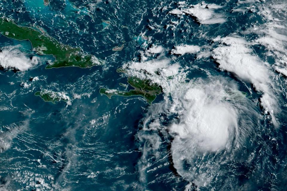
Meanwhile, Tropical Storm Grace formed in the Atlantic Ocean overnight and was moving quickly. It will be days before any possible impacts from the storm affect the Florida coast, forecasters say.
That storm is expected to bring 3 to 6 inches of rain to the Virgin Islands and Puerto Rico by Monday and could bring heavy rainfall to Florida late next week. It's also expected to bring 4 to 7 inches of rain, with up to 10 inches in isolated maximum totals, to the Dominican Republic and Haiti, which was just hit by a massive earthquake Saturday.
A tropical storm warning was discontinued for the Florida Keys on Saturday morning as Fred approached. Florida Gov. Ron DeSantis declared a state of emergency for a third of the state as Fred loomed.
Both systems are expected to bring heavy rain and flooding.
"There is a good chance for two landfalls in the U.S. with Fred ... likely in the Florida Keys early Saturday and the second likely over northern Florida by early next week," AccuWeather meteorologist Bernie Rayno said on Friday.
"Through Monday, 3 to 5 inches of rain is anticipated across the Keys and southern Florida," the National Hurricane Center said.
The National Weather Service in Miami issued a flood watch for all of South Florida due to the expected heavy rainfall.
The Hurricane Center previously cautioned to "not focus on Fred's exact forecast track as heavy rainfall, gusty winds, and a chance of tornadoes will extend far to northeast and east of the center, and those hazards are likely to still affect portions of the Florida peninsula."
As of 5 p.m. EDT Saturday, Fred was about 510 miles south-southeast of Mobile, Alabama, with maximum sustained winds of 35 mph. It was moving west-northwest at 13 mph.
After spending a brief time as a tropical storm earlier this week, Fred weakened back to a depression due to its spin over Haiti and the Dominican Republic, where it knocked out power to some 400,000 customers and caused flooding that forced officials to shut down part of the country’s aqueduct system, interrupting water service for hundreds of thousands of people.
Local officials reported hundreds of people were evacuated and some buildings were damaged. There were no immediate reports of casualties.
Fred became the sixth named storm of the Atlantic hurricane season late Tuesday as it moved past the U.S. Virgin Islands and Puerto Rico.
Contributing: Kimberly Miller, The Palm Beach Post; The Associated Press
This article originally appeared on USA TODAY: Fred may strengthen again over gulf; Tropical Storm Grace forms

