Tropical rainstorm develops in Caribbean, sets sights on southeastern US


AccuWeather forecasters say a tropical rainstorm developed over Puerto Rico on Saturday, and will continue to unleash downpours across the Caribbean through the weekend. The system is expected to encounter conducive conditions for further tropical development and it is likely to be named in the coming days as it tracks toward the southeastern United States.
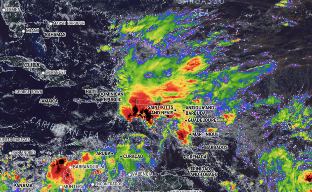
Puerto Rico was deluged with heavy rain through much of the day Saturday, threatening flooding.
 |
The above AccuWeather Enhanced RealVue™ satellite image shows a tropical rainstorm in the Caribbean Sea, just south of Puerto Rico, on Saturday afternoon, local time. (AccuWeather) |
The rainstorm is likely to be fueled by tropical moisture throughout the weekend, even as it moves northward, crossing from the Caribbean and into the southwestern Atlantic Ocean.
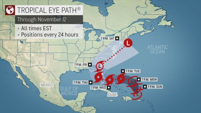
"The tropical rainstorm looks to track northward slowly through the weekend before being steered westward towards the Bahamas and the southeastern U.S," said AccuWeather Senior Meteorologist Alan Reppert.
 |
As the rainstorm moves northwestward into Monday and Tuesday, it's likely to move into a zone of low wind shear and warm ocean waters, both of which are conducive conditions for the strengthening of a tropical system.
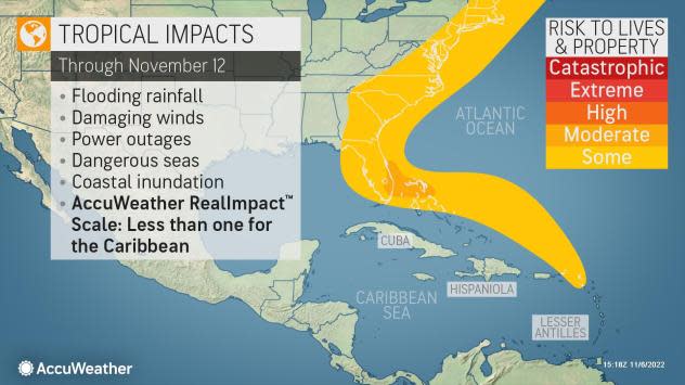
Residents in the Bahamas, Florida and others along the central Gulf and southeastern Atlantic coast should monitor this tropical rainstorm and its developments in the coming days, as AccuWeather meteorologists say that chances are increasing that a tropical storm or a subtropical storm could form by the middle of this week.
 |
A tropical storm has a warm core with a consolidated and compact area of rain and thunderstorms. A subtropical storm has some warm-core characteristics but tends to be more spread out in size with pockets of dry and cooler air intertwined in its circulation. Both systems can bring flooding rain, damaging winds and storm surge.
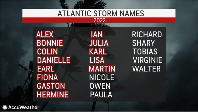
If a tropical or subtropical storm were to take shape, the next name on the list forecasters use to identify storms for the 2022 Atlantic hurricane season is Nicole.
The exact track of the tropical rainstorm early week will be determined by how strong the area of high pressure over the Northeast and Southern Canada gets into early week. The difference in pressure between this high pressure and the rainstorm is likely to create easterly, on-shore winds for communities along the Eastern Seaboard.
No matter how strong the tropical system is able to get, coastal locations, even those farther from the center of the storm, could be impacted.
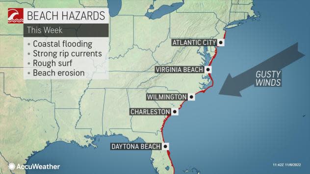
Along the Atlantic coast of the U.S., especially in areas from Florida's Space Coast, northward to Delaware and New Jersey, breezes will increase and help push water westward, bringing with it the threat for coastal flooding. The problems along the Atlantic coast this week could be made worse by the full moon, which tends to boost astronomical tide levels compared to the rest of the month. The next full moon will occur on Tuesday, Nov. 8.
 |
The stormy seas alone from the tropical rainstorm could affect cruise lines, commercial fishing vessels as well as global shipping operations from the Caribbean to the western Atlantic, said AccuWeather Senior Meteorologist Adam Douty.
Historical weather information for the month of November, as well as new forecast data, has allowed AccuWeather forecasters to deduce that the zone from the Caribbean to the western Atlantic will remain a source of potential trouble in terms of tropical activity moving forward through November.
Thus far in the 2022 Atlantic Hurricane Season, there have been 13 named storms over the Atlantic basin. Of these, seven became hurricanes, and two became major hurricanes. Both Fiona and Ian strengthened to Category 4 intensity on the Saffir-Simpson Hurricane Wind scale. Ian's maximum sustained winds peaked at 155 mph, just 2 mph below Category 5 strength, prior to a deadly and destructive landfall in southwestern Florida in late September.
 |
When both Lisa and Martin became hurricanes on Wednesday, it marked the first time there were two hurricanes spinning simultaneously in the Atlantic basin in November since 2001 when hurricanes Michelle and Noel were active at the same time, according to Colorado State University meteorologist Phillip Klotzbach. The only other year on record where there were dual hurricanes in November was 1932.
Want next-level safety, ad-free? Unlock advanced, hyperlocal severe weather alerts when you subscribe to Premium+ on the AccuWeather app. AccuWeather Alerts™ are prompted by our expert meteorologists who monitor and analyze dangerous weather risks 24/7 to keep you and your family safer.
