Tropical Storm Eta flooded South Florida, and the rain may not be stopping yet
Tropical Storm Eta moved quickly out of South Florida’s hair on Monday but left widespread flooding in its soggy wake.
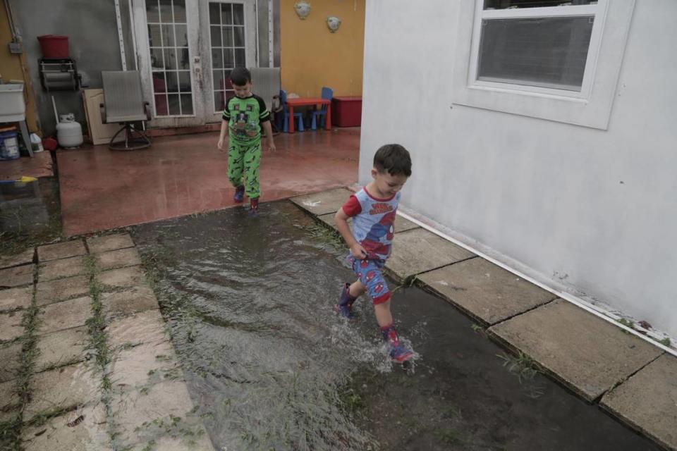
Across South Florida, residents woke up Monday to flooded roads and yards, overflowing canals and the occasional downed tree. The heaviest swath of rain hit north Miami-Dade and south Broward. According to the National Weather Service’s map, some spots have already seen more than 18 inches of rain. Parts of Miami Gardens and Miramar got 15 inches and more is possible in coming days as the storm moves north in the Gulf of Mexico.
Canals overspilled their banks, including one in Miami Gardens that flooded a nearby mobile home park. A driver was hospitalized in critical condition in Lauderhill Sunday night after driving into a flooded canal. The next morning, floodwaters in the city were so high they nearly submerged fire hydrants.

Florida Power & Light warned that power restoration to the nearly 40,000 people left without electricity might take a while because workers have to wait for the floodwaters to recede, but by midafternoon the utility announced it had restored power to 90% of its customers.
The center of Eta passed over Matecumbe Key around 11 p.m. Sunday, and residents reported little serious damage. In Key Largo, Howard Sanders, 63, was cleaning up debris left from Tropical Storm Eta, along with his niece Renita Sanders and cousin Larry Sanders.
The storm left a mess of tree branches and flooding of already flood-prone areas, but the three have definitely seen worse storm damage.
“I have trees down, and some damage to my fence and patio,” Renita Sanders, 45, said. A tree branch went into the side of a neighbor’s home, but she was not injured.

On the mainland, the picture was much wetter.
In October 2018, Miami Mayor Francis Suarez and Commissioner Ken Russell cut the ribbon on a rebuilt pump station on Brickell Avenue, a much-need upgrade to push out thousands of gallons of water during tidal flooding and heavy rainfall. It’s one of two in the Brickell area. Suarez has shown the pumps off to climate experts and foreign dignitaries as an example of Miami’s investment in mitigating the impacts of climate change.
As Eta’s wind and rain blew through Miami’s dense waterfront Sunday night, that drainage system failed to work. In Brickell, a handful of stalled cars were abandoned in intersections with more than 14 inches of standing water, although by midafternoon the streets were dry again and the cars towed away.
“I too, am frustrated, honestly,” Suarez told reporters at City Hall on Monday. “We have two permanent pumps with the capacity to remove 50,000 gallons of water per minute. The pump on Brickell Avenue, in particular, for some reason, has not worked during the last two events. This time, we were doing emergency repairs, so we used portable pumps as a temporary fix. They obviously don’t have the same capacity as the permanent pump.”
The issue, initially identified in October, had yet to be fixed when Eta blew through.
In Edgewater, Daniela Mencos, a producer at NBC News and resident of the area for three years, tried to walk her two Italian Greyhounds at Margaret Pace Park at 7:30 a.m. but opted to stay inside.
“You couldn’t see the street at all,” she said. “You would have your feet fully under water and in some areas by your shins. I didn’t venture out because the poor dogs couldn’t walk.”
Andres Althabe, president of Biscayne Neighborhood Association and president of the Quantum Master Association at Quantum on the Bay, said, “North Bayshore was completely flooded. There were several inches of water.”
Thankfully, Althabe said, he and Sue Nelson, his wife and president of the Quantum South Tower, installed metal barriers by the elevator landing on the first floor of the garage to prevent water getting into the 698-unit condominium.
“They worked,” Althabe said.
Although Brickell and other coastal parts of the county including Edgewater saw floodwaters recede by midafternoon, more inland communities still had ponds where their roads once were. And it could take a while for things to dry out completely.
“We’re going to be dealing with bouts of showers moving through the area” for the next few days, said National Weather Service Meteorologist Robert Molleda. “Any kind of additional rainfall, even if it looks like a half-inch or an inch, it could make things worse.”

Floodwater was ankle-high in the western end of Miami Beach’s Lakeview neighborhood Monday morning, as residents — and their dogs — left their homes after the worst of Eta had passed.
The neighborhood, in the city’s Mid Beach sector, had been slated for city-prescribed road-raising, but complaints from some residents led the city to postpone the plans.
Miami Beach Mayor Dan Gelber said Monday that sea level rise improvements helped prevent citywide flooding on the barrier island.
“They’re working. The areas that we’ve been trying to address look really inundated with water,” he said. “The good news is this is a surmountable challenge.”
As of 4 a.m. Tuesday, Tropical Storm Eta is stationary about 80 miles north-northwest of Cuba, lingering near the Yucatan Channel. Its sustained winds are 50 mph, but forecasters expect it will strengthen slightly in a warm and favorable pocket of the Gulf by Tuesday afternoon.

The trough that shoved Eta into such a hard left turn and kept its center south, in the Keys, is expected to steer the storm west for the next few days before collapsing. That could leave Eta hovering in one spot (or doing a loop) through nearly Wednesday, potentially dumping even more rain on Florida.
“While it’s hanging around over the Gulf, we’ll still have periods of higher than normal rain chances,” Molleda said. “We’re not expecting total, complete washouts like we’ve seen the last few days.”
From there, the models don’t agree on Eta’s next step, so the hurricane center said it has “low confidence” in its predictions for later in the week. For now, it expects Eta to head north to menace the Panhandle.
Forecasters said Eta’s best chance to strengthen is in the next 36 hours, after which some wind shear might eat away at it.
“Although occasional intrusions of very dry air will prevent rapid intensification from occurring, some gradual strengthening seems to be in order given the other favorable environmental conditions and the cyclone’s new smaller size,” forecasters wrote.

The National Hurricane Center is also tracking two other disturbances. One in the Atlantic became Subtropical Storm Theta as of 10 p.m. Monday, becoming the 29th storm. It poses no threat to land. Another one in the central Caribbean could become the 30th storm, breaking the 2005 record of 28 named storms.
That one has a 50% chance of forming in the next five days, is in the central Caribbean, near where Eta formed last week. The hurricane center said this tropical wave could form a tropical depression later this week as it moves west toward Central America.
Miami Herald staff writers Yadira Lopez, Charles Rabin, Antonio Maria Delgado, Martin Vassolo, Joey Flechas, Rebecca San Juan, Carli Teproff and David Goodhue contributed to this report.

