Tropical Storm Franklin will miss New Jersey, but watch for rip currents
The Dominican Republic and Haiti were hit hard by Tropical Storm Franklin on Wednesday leaving two known deaths and a trail of destruction. While the region is beginning its recovery, Franklin now has its eyes on the U.S. East Coast.
The National Hurricane Center predicts the storm will upgrade to a Category 2 hurricane over the weekend and peak in intensity early next week. It is not projected to hit New Jersey soil directly but could cause inclement weather effects.
Franklin's pathway is expected to curve along the East Coast border and continue northeast based on AccuWeather mapping. Forecaster Sarah Johnson at New Jersey's National Weather Service office said Franklin looks to stay hundreds of miles away from the Jersey Shore.
"Even when you have a storm well off coast, it can still bring impact in terms of increased risk of rip currents. That's something we're gonna be watching since it tends to storm in the area Franklin is forecasted to be in," Johnson said.
National Weather Service reports show on-again off-again showers for the New Jersey region over the next couple days. Friday evening and parts of early next week see the most likely rainfall, but Johnson said these conditions are due to other factors.
Riptides could be an adverse effect of Franklin that Johnson said is an area of concern for the National Weather Service. There is also potential for high wind gusts during the height of thunderstorms that will hit the area.
New Jersey: What would you ask Phil Murphy? Now you can send NJ governor a text
New Jersey courts: Will NJ's judicial vacancy crisis extend beyond the fall election? It looks like it
Extending from Cape May Point to Raritan Bay, risk level for rip currents are "moderate" as of Friday according to the National Weather Service. This level means life threatening rip currents "are possible."
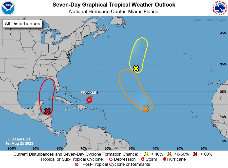
"This is just a good reminder that we are in the peak of the Atlantic tropical season," Johnson said. "There are other areas of interest in the Atlantic that the National Hurricane Center is watching, so we'll be keeping our eyes on that."
Tropical Storm Franklin is currently right above Puerto Rico and a clearer outlook will be determined as it moves north.
This article originally appeared on NorthJersey.com: Tropical Storm Franklin path to avoid NJ, East Coast

