Fred weakens to tropical wave as Florida braces for two storm landfalls: What we know
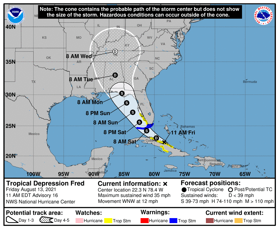
A tropical storm warning for the Florida Keys was discontinued Saturday as Tropical Depression Fred weakened to a tropical wave, the National Hurricane Center said. Florida could see two storm landfalls within days as Tropical Storm Grace picks up speed.
Fred is expected to reform Sunday as it passes over the Gulf of Mexico. It could arrive in Florida's panhandle and the coasts of Mississippi and Alabama on Monday.
The storm, which soaked parts of Cuba on Friday, was on track to redevelop to a tropical depression and ultimately strengthen to a tropical storm, it wasn't expected to reach hurricane strength, the Hurricane Center said.
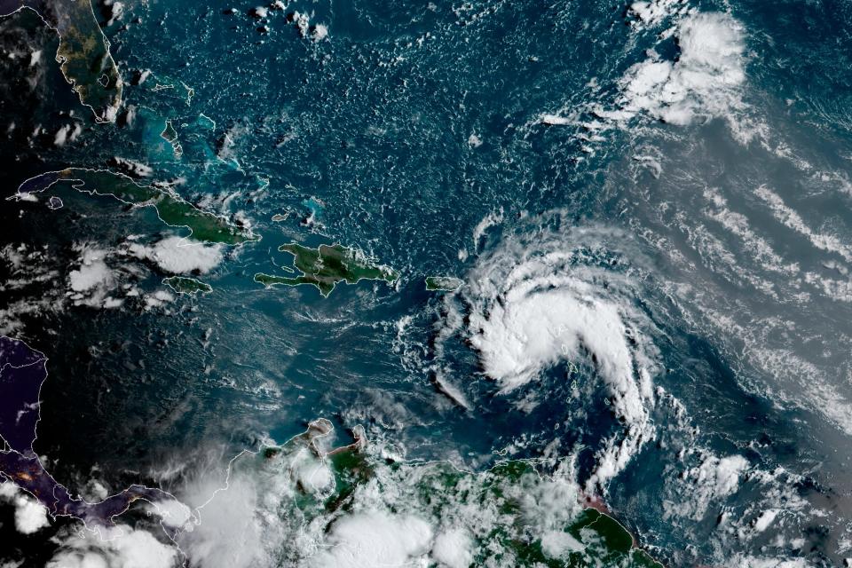
Fred reached tropical storm strength late Tuesday and drenched the U.S. Virgin Islands and Puerto Rico before continuing its downpour on the Dominican Republic and Haiti.
Hurricane season is upon us during a pandemic. Here's what you need to protect yourself.
The storm weakened, as expected, but forecasters say it could gain momentum en route to Florida. While there is still uncertainty about its track, Fred could make landfall in the state in multiple locations, forecasters said.
Fred is the sixth named storm of the 2021 hurricane season and first in August, breaking a monthlong lull after Hurricane Elsa.
Where are the remnants of Tropical Depression Fred?
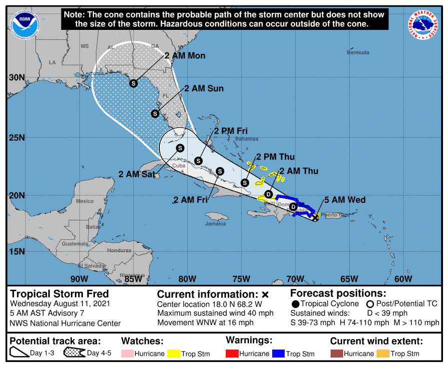
The storm was about 125 miles southeast of Key West as of 11 a.m. EDT Saturday. It was moving west-northwest at 12 mph with maximum sustained winds of 35 mph.
What do the spaghetti models forecast for Fred?
After Fred moves past Cuba later Friday, it's expected to be west of the lower Florida Keys on Saturday afternoon.
The National Hurricane Center said its official track shows Fred over the eastern Gulf Saturday night through Monday, which could lead to more strengthening, before a final landfall is forecast along the Big Bend region or the panhandleearly next week.
When is Fred expected to make landfall?
Fred made landfall in the Dominican Republic on Wednesday. It was scraping the coast of Cuba on Friday. A Monday landfall in the Keys is likely, forecasters say.
Irreversible changes, warmer temperatures sooner: 5 alarming findings from the UN climate change report
How strong is Fred?
Maximum sustained winds reached 40 mph Wednesday before Fred was downgraded to a tropical depression, then a tropical wave, with winds of 35 mph.
In the Dominican Republic, about 300,000 customers were without power, and forecasters warned there was a risk of dangerous flooding and mudslides after heavy rain. Puerto Rico had 13,000 customers without power after Fred roared through.
The National Weather Service said the Keys and southern Florida could also expect to see 3 to 5 inches of rain; some areas could get up to 10 inches through Monday. That raises the possibility of flash flooding, the Weather Service said.
Track Fred's path
Contributing: Megan Kearney, Naples Daily News; Charles Ventura, Joel Shannon and Steve Kiggins, USA TODAY; The Associated Press
This article originally appeared on USA TODAY: Fred path: Storm forecast to arrive in Florida panhandle Monday

