Heavy rains knock out power in south Charlotte, with more wet weather in the forecast
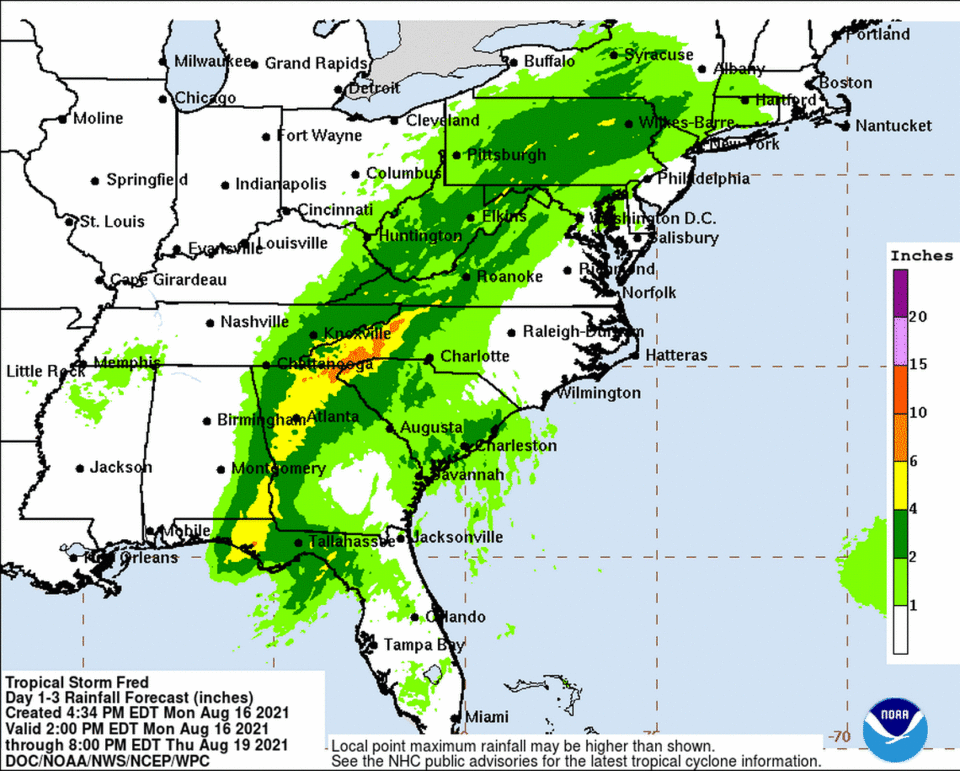
Heavy rains fueled by Tropical Storm Fred will continue in the Charlotte area Tuesday, while parts of the Carolinas could see isolated tornadoes.
Showers and thunderstorms that hit the area Monday afternoon were expected to continue into the evening, with a low around 72, according to the National Weather Service.
Drivers can also expect patchy fog after midnight, the NWS said.
A quick storm Monday afternoon knocked out power for thousands in the Charlotte area.
At 5:30 p.m., Duke Energy’s outage map showed over 3,000 customers without power, primarily in south Charlotte neighborhoods that included Madison Park, Myers Park and Barclay Downs. Power was expected to be restored in these areas by 10 p.m.
About 400 more outages were reported in west Charlotte, near Charlotte Douglas International Airport.
More than 80 flights were delayed at the airport as of 5:50 p.m., according to FlightAware.com.
Over the weekend, severe storms in the Charlotte area left about 20,000 Duke Energy customers without power. Service was restored to most customers by Sunday morning.
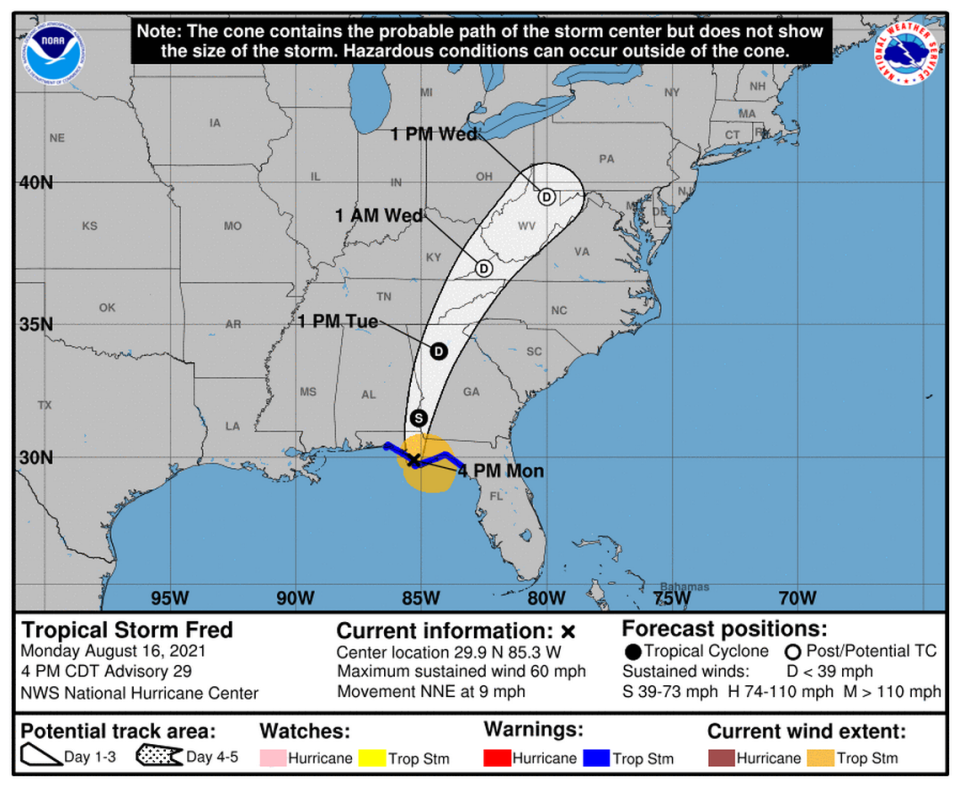
Meanwhile, Tropical Storm Fred made landfall Monday afternoon near Cape San Blas in Florida’s Panhandle. As of 5:45 p.m., the storm’s maximum sustained winds were 60 mph as it moved north-northeast at 9 mph, The Associated Press reported.
The remnants of Fred “will interact with an old front and the mountains” and cause heavy rain and possible flooding on Tuesday, the NWS said.
Along with heavy rain, the weather service said isolated tornadoes are possible across Western North and South Carolina.
Meanwhile, Tropical Depression Grace was centered about 85 miles southeast of Port Au Prince, the earthquake-stricken capital of Haiti, the National Hurricane Center reported Monday. The storm had maximum sustained winds of 35 mph. The storm was moving west/northwest at 13 mph, and it could regain tropical storm status on Tuesday, the center said.
Grace is expected to head west toward the south of Cuba, pushing into the Gulf of Mexico and eventually hitting Mexico or southern Texas this weekend, according to the hurricane center.
A third system, Tropical Storm Henri, developed Monday afternoon about 145 miles southeast of Bermuda, with maximum sustained winds of 40 mph, the hurricane center said.

